Saint-Étienne-de-Tinée
Saint-Étienne-de-Tinée (Italian: Santo Stefano di Tinea) is a commune in the Alpes-Maritimes department in southeastern France.
Saint-Étienne-de-Tinée | |
|---|---|
 A view of the village from the hillside to the east | |
.svg.png) Coat of arms | |
Location of Saint-Étienne-de-Tinée 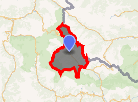
| |
 Saint-Étienne-de-Tinée  Saint-Étienne-de-Tinée | |
| Coordinates: 44°15′28″N 6°55′31″E | |
| Country | France |
| Region | Provence-Alpes-Côte d'Azur |
| Department | Alpes-Maritimes |
| Arrondissement | Nice |
| Canton | Tourrette-Levens |
| Intercommunality | Métropole Nice Côte d'Azur |
| Government | |
| • Mayor (2008–2014) | Thérèse Fabron |
| Area 1 | 173.81 km2 (67.11 sq mi) |
| Population (2017-01-01)[1] | 1,531 |
| • Density | 8.8/km2 (23/sq mi) |
| Time zone | UTC+01:00 (CET) |
| • Summer (DST) | UTC+02:00 (CEST) |
| INSEE/Postal code | 06120 /06660 |
| Elevation | 949–3,027 m (3,114–9,931 ft) (avg. 1,142 m or 3,747 ft) |
| 1 French Land Register data, which excludes lakes, ponds, glaciers > 1 km2 (0.386 sq mi or 247 acres) and river estuaries. | |
It was part of the historic County of Nice until 1860.
The ski resort of Auron is located on the territory of the commune, and linked to the village of Saint-Étienne-de-Tinée directly by a gondola lift.
Population
| Historical population | ||
|---|---|---|
| Year | Pop. | ±% |
| 1962 | 1,505 | — |
| 1968 | 1,549 | +2.9% |
| 1975 | 1,700 | +9.7% |
| 1982 | 1,780 | +4.7% |
| 1990 | 1,783 | +0.2% |
| 1999 | 1,528 | −14.3% |
| 2008 | 1,324 | −13.4% |
External links
| Wikimedia Commons has media related to Saint-Étienne-de-Tinée. |
| Authority control |
|
|---|
This article is issued from Wikipedia. The text is licensed under Creative Commons - Attribution - Sharealike. Additional terms may apply for the media files.