Rucphen
Rucphen (pronounced [ˈrɵkfən] (![]()
Rucphen | |
|---|---|
 Street through Rucphen | |
 Flag  Coat of arms | |
.svg.png) Location in North Brabant | |
| Coordinates: 51°32′N 4°35′E | |
| Country | Netherlands |
| Province | North Brabant |
| Government | |
| • Body | Municipal council |
| • Mayor | Marjolein van der Meer-Mohr (VVD) |
| Area | |
| • Total | 64.47 km2 (24.89 sq mi) |
| • Land | 64.41 km2 (24.87 sq mi) |
| • Water | 0.06 km2 (0.02 sq mi) |
| Elevation | 10 m (30 ft) |
| Population (January 2019)[4] | |
| • Total | 22,572 |
| • Density | 350/km2 (900/sq mi) |
| Demonym(s) | Rucphenaar |
| Time zone | UTC+1 (CET) |
| • Summer (DST) | UTC+2 (CEST) |
| Postcode | 4710–4722, 4735 |
| Area code | 0165 |
| Website | www |
Population centres
- Sint Willebrord ('t Heike) (pop.: 9,320)
- Sprundel (5,090)
- Rucphen (4,580)
- Zegge (2,210)
- Schijf (1,430)
Topography
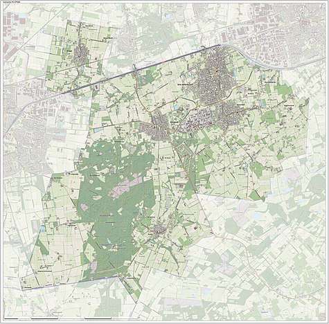
Dutch Topographic map of the municipality of Rucphen, June 2015
Notable people
- Hendrik Detmers (1761 in Sprundel – 1825) a Dutch general in the Battle of Waterloo
- Dick Jaspers (born 1965 in Sint Willebrord) a Dutch professional carom billiards player
- John Kerstens (born 1965 in Zegge) a Dutch politician and former trade union leader
- Donny Gorter (born 1988) a Dutch professional footballer with over 200 club caps
- Tessa ter Sluis (born 1995 in Sint Willebrord) a Dutch professional squash player
Gallery
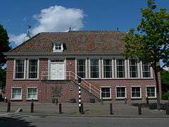 Oude Raadhuis van Rucphen
 Heilig Hartbeeld aan de zijkant van de Martinuskerk in Rucphen
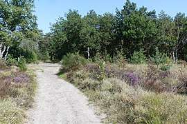 Rucphense Heide
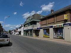 Dorpsstraat in Sint Willebrord
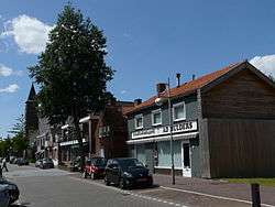
See also
References
- "mr. Marjolein van der Meer Mohr" (in Dutch). Gemeente Rucphen. Archived from the original on 6 June 2014. Retrieved 3 June 2014.
- "Kerncijfers wijken en buurten" [Key figures for neighbourhoods]. CBS Statline (in Dutch). CBS. 2 July 2013. Retrieved 12 March 2014.
- "Postcodetool for 4715RK". Actueel Hoogtebestand Nederland (in Dutch). Het Waterschapshuis. Retrieved 3 June 2014.
- "Bevolkingsontwikkeling; regio per maand" [Population growth; regions per month]. CBS Statline (in Dutch). CBS. 1 January 2019. Retrieved 1 January 2019.
External links

- Official website
Places adjacent to Rucphen | ||||||||||
|---|---|---|---|---|---|---|---|---|---|---|
| ||||||||||

This article is issued from Wikipedia. The text is licensed under Creative Commons - Attribution - Sharealike. Additional terms may apply for the media files.