Goirle
Goirle (pronounced [ˈɣoːrlə] (![]()
Goirle | |
|---|---|
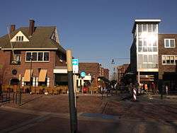 Goirle town centre | |
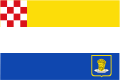 Flag  Coat of arms | |
.svg.png) Location in North Brabant | |
| Coordinates: 51°31′N 5°4′E | |
| Country | Netherlands |
| Province | North Brabant |
| Government | |
| • Body | Municipal council |
| • Mayor | Mark van Stappershoef (CDA) |
| Area | |
| • Total | 42.34 km2 (16.35 sq mi) |
| • Land | 42.07 km2 (16.24 sq mi) |
| • Water | 0.27 km2 (0.10 sq mi) |
| Elevation | 16 m (52 ft) |
| Population (January 2019)[4] | |
| • Total | 23,793 |
| • Density | 566/km2 (1,470/sq mi) |
| Demonym(s) | Goirlenaar |
| Time zone | UTC+1 (CET) |
| • Summer (DST) | UTC+2 (CEST) |
| Postcode | 5050–5053, 5133 |
| Area code | 013 |
| Website | www |
The municipality also includes the villages of Breehees and Riel.
Topography

Dutch Topographic map of the municipality of Goirle, June 2015
Notable people
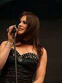
Floor Jansen, 2013

Ireen Wüst, 2013
- Max Steenberghe (1899–1972) a Dutch politician and Govt. minister
- John Boxtel (born 1930) a Dutch sculptor of woodcarvings and an art teacher
- Pepijn van Erp (born 1972) a Dutch mathematician, skeptical activist and chess player
- Jan Taminiau (born 1975) a Dutch clothes designer
- Floor Jansen (born 1981) a Dutch singer, songwriter and lead vocalist of Finnish symphonic metal band Nightwish
Sport
- Tiest van Gestel (1881–1969) an archer and team gold medallist at the 1920 Summer Olympics
- Huub Zilverberg (born 1939) a Dutch former professional road bicycle racer
- Martin van Geel (born 1960) a retired Dutch footballer with over 430 club caps
- Mathieu Hermans (born 1963) a former Dutch professional road bicycle racer
- Roy Hendriksen (born 1969) a Dutch professional football manager, coach and former player with 438 club caps
- Edwin Hermans (born 1974) a Dutch former footballer with over 360 club caps
- Amanda Hopmans (born 1976) a former professional tennis player
- Björn van der Doelen (born 1976) a retired football midfielder with 249 club caps and a singer/songwriter
- Marcel Meeuwis (born 1980) is a Dutch former footballer with 300 club caps
- Joris Mathijsen (born 1980) a Dutch former footballer with 409 club caps
- Ireen Wüst (born 1986) a Dutch long track allround speed skater, winner of eleven Olympic medals
- Eefje Muskens (born 1989) a Dutch badminton player, competed in the 2016 Summer Olympics
- Michael Kuiper (born 1989 in Riel) a Dutch mixed martial artist
- Virgil Misidjan (born 1993) a Dutch footballer
Gallery
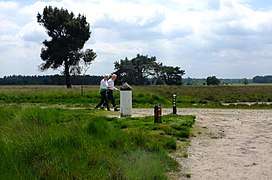 Regte Heide
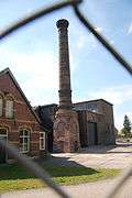 Schoorsteen HAVEP
- De Hovel
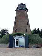 Molenromp Rielvoor
References
- "Mevr. M.G. Rijsdorp" (in Dutch). Gemeente Goirle. Archived from the original on 22 April 2014. Retrieved 21 April 2014.
- "Kerncijfers wijken en buurten" [Key figures for neighbourhoods]. CBS Statline (in Dutch). CBS. 2 July 2013. Retrieved 12 March 2014.
- "Postcodetool for 5051LT". Actueel Hoogtebestand Nederland (in Dutch). Het Waterschapshuis. Archived from the original on 21 September 2013. Retrieved 21 April 2014.
- "Bevolkingsontwikkeling; regio per maand" [Population growth; regions per month]. CBS Statline (in Dutch). CBS. 1 January 2019. Retrieved 1 January 2019.
See also
- Van Gool, a Dutch surname meaning "from Goirle".
External links

- Official website
Places adjacent to Goirle | ||||||||||
|---|---|---|---|---|---|---|---|---|---|---|
| ||||||||||

| Authority control |
|
|---|
This article is issued from Wikipedia. The text is licensed under Creative Commons - Attribution - Sharealike. Additional terms may apply for the media files.