Une
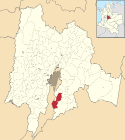
Une is a municipality and town of Colombia in the Eastern Province, part of the department of Cundinamarca. The urban centre is located at an altitude of 2,376 metres (7,795 ft) at a distance of 43 kilometres (27 mi) from the capital Bogotá. The municipality borders Chipaque in the north, Cáqueza and Fosca in the east, Fosca and Gutiérrez in the south and Bogotá in the west.[1]
Une | |
|---|---|
Municipality and town | |
.svg.png) Flag .svg.png) Seal | |
 Location of the municipality and town of Gómez Plata in the Antioquia Department of Colombia | |
| Country | |
| Department | |
| Province | Eastern Province |
| Founded | 23 February 1538 |
| Founded by | Diego Romero de Aguilar |
| Government | |
| • Mayor | Yecith Efren Angel Romero (2016-2019) |
| Area | |
| • Municipality and town | 221 km2 (85 sq mi) |
| • Urban | 2.33 km2 (0.90 sq mi) |
| Elevation | 2,376 m (7,795 ft) |
| Population (2015) | |
| • Municipality and town | 9,196 |
| • Density | 42/km2 (110/sq mi) |
| • Urban | 4,566 |
| Time zone | UTC-5 (Colombia Standard Time) |
| Website | Official website |
Geology and geography
Une is situated in the Eastern Ranges of the Colombian Andes. In the municipality outcrops the Une Formation, a marine quartz-rich sandstone, an important oil-bearing formation of Colombia.[3]
History
Une in the times before the Spanish conquest was inhabited by the Muisca.
Modern Une was founded on February 23, 1538 by Diego Romero de Aguilar.[1]
Economy
Main economical activities of Une are agriculture and livestock farming. Important agricultural products cultivated are potatoes, onions, carrots, peas and coriander.[1]
References
- (in Spanish) Official website Une
- (in Spanish) une - Muysccubun Dictionary
- (in Spanish) Une Formation - ANH