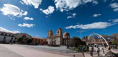
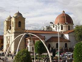
Huancayo
Huancayo (Spanish pronunciation: [waŋˈkaʝo]; in Wanka Quechua: Wankayuq [wɐŋˈkæjuː], '(place) with a (sacred) rock') is the capital of Junín Region, in the central highlands of Peru.
Huancayo | |
|---|---|
| Santísima Trinidad de Huancayo Holy Trinity of Huancayo | |
      | |
 Flag  Coat of arms | |
| Nickname(s): "La Ciudad Incontrastable" (The Uncontrastable City) | |
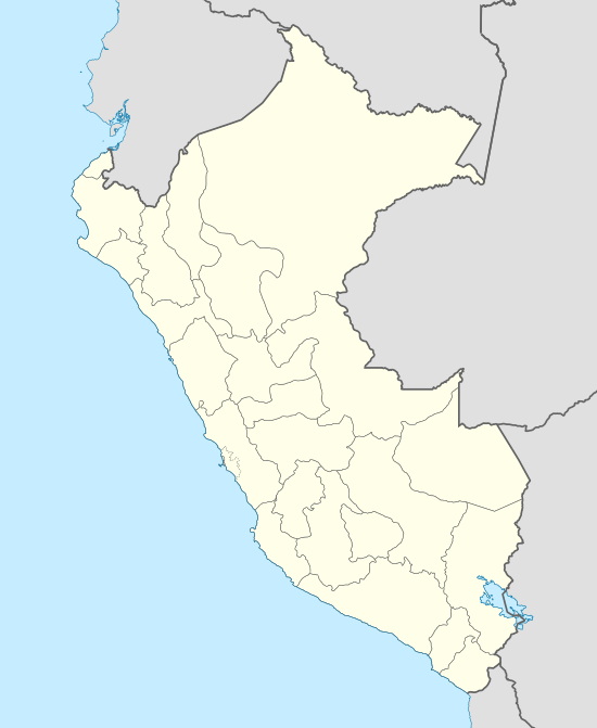 Huancayo Location in Peru | |
| Coordinates: 12°4′S 75°13′W | |
| Country | Peru |
| Region | Junin |
| Province | Huancayo |
| District | Huancayo |
| Founded | 1 June 1572 |
| Government | |
| • Type | Municipal government |
| • Mayor | Henry López Cantorín |
| Area | |
| • Total | 319.41 km2 (123.32 sq mi) |
| Elevation | 3,259 m (10,692 ft) |
| Population (2017) | |
| • Total | 456,250 |
| • Estimate (2015)[1] | 364,725 |
| • Density | 1,400/km2 (3,700/sq mi) |
| Time zone | UTC-5 (PET) |
| • Summer (DST) | UTC-5 (PET) |
| Area code(s) | 64 |
| Website | www.munihuancayo.gob.pe |
Location


Huancayo is located in Huancayo Province, of which it is also the capital. Situated in the Mantaro Valley at an altitude of 3,271 meters, it belongs to the Quechua region. Depending on delimitation, the agglomeration has a population between 340,000 and 380,000[2] and is the fifth most populous city of the country. Huancayo is the cultural and commercial center of the whole central Peruvian Andes area. Huancayo Metropolitano is made up of seven districts that form the urban center of Junin's region. This region is considered Central Peru's economic and social hub.[3]
Historical overview
Pre-Columbian era
The area was originally inhabited by the Huancas. At around 500 BC, they were incorporated into the Wari Empire. Despite efforts to defend its independence, the Huancas were eventually subdued by the Inca leader Pachacutec in 1460 and the region was incorporated into the Inca empire. It subsequently became a notable stopping point along the Inca Camino Real.
Colonial era
After the Spanish colonization in 1534, Huancayo was overshadowed by Jauja, a provisional capital of Peru, until Lima took over that role, as established by the conquistador Francisco Pizarro. In 1570, the viceroy Francisco de Toledo established the site as the center of his encomienda Guancayo. The town was officially established on 1 June 1572 with the title of Santísima Trinidad de Huancayo. In 1813, Huancayo celebrated the promulgation of the Constitution of Cadiz, changing the name of "Plaza del Comercio" to "Plaza de la Constitución".
Republican era
During the war for independence, Huancayo was liberated on 20 November 1820. Construction on the cathedral commenced in 1831. The accord was made law in Huancayo in 1854, when Peru officially ended slavery. There is a statue in the Plaza Constitución commemorating this.
Recent situation
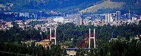
Today, in addition to its importance as a center of commerce, Huancayo is known for the crafts and the many festivals of the surrounding towns. Having rapidly expanded in recent decades, it has few remaining colonial buildings. Currently, the cityscape is dominated by modern construction.
The city's rise began with the construction of a central railway Callao-La Oroya in 1908 and later extended from Lima to Huancayo in the early 1930s. The railway connection between Lima and Huancayo, introduced new ways of transporting goods. The railway's new avenues for transport contributed to the city's economic and population growth. Population growth was mostly present in Tambo and Chilica, two suburban districts near the highways.[3] Furthermore, population growth between 1981 and 2007 was a result of in-migration due to terrorist attacks of Sendero Luminoso. People from highlands and amazonian lowlands sought refugee in Andean cities such as Huancayo.
Demographics
According to the National Census of 2007,[4] the three main districts of Huancayo have a total population of about 340,000. However, the continuous settlement area have already reached periurban districts, resulting in the agglomeration's population to be at least 380,000 people. Amerindian and Mestizos (Amerindian and Spanish ancestry) are the two largest ethnic groups in the city. Asian (mainly descendants of Japanese and Chinese immigrants) and European descendants are important minority groups.
| Municipalities of the city |
Area km2 |
Population censo 2007(hab) |
Population under 1 year-old Census 2007(hab) |
Households (2007) |
Density (inhabitants/km2) |
Elevation msnm | |
|---|---|---|---|---|---|---|---|
| Chilca | 8,3 km2 | 77.392* | 1.358* | 17.509 | 9.324,33 | 3.275 msnm | |
| El Tambo | 73,56 km2 | 146.847* | 2.365* | 36.982 | 1.996,28 | 3.260 msnm | |
| Huancayo | 237,55 km2 | 112.054* | 1,789* | 27.552 | 471,70 | 3.249 msnm | |
| Total | 319,41 km2 | 336.293* | 5.512* | 82.043 | 1.052,85 | — | |
| *Data from the census taken by the INEI[5] | |||||||
Transport
Huancayo has transportation connections by road and rail. The Francisco Carle Airport at Jauja offers daily connections to Lima and is located 45 minutes via car from Huancayo. Current airlines include LATAM Peru, LC Peru, and Peruvian Airlines. To travel by road, the Carretera Central links Huancayo with La Oroya and Lima, which generally takes 7 to 8 hours. Multiple bus carriers operate between Lima and Huancayo daily. The Ferrocarril Central Andino enables transport by rail. Huancayo was a break-of-gauge from 914 mm (3 ft) gauge to 1,435 mm (4 ft 8 1⁄2 in) gauge for the 147 km (91 mi) extension to Huancavelica. In 2009, this line was being standardised.[6] There was a plan Metro Wanka to use the railway line as a local metro however this never came to fruition.[7]
Education
Local universities
- Universidad Nacional del Centro del Peru (UNCP)
- Universidad Peruana Los Andes (UPLA)
- Universidad Continental (UC)
- Universidad Franklin Roosevelt (UFR)
Branches of other Peruvian universities
- Universidad Alas Peruanas (UAP)
- Universidad Los Angeles de Chimbote (ULADECH)
- Universidad Nacional Mayor de San Marcos (UNMSM)
- Universidad Nacional Daniel Alcides Carrión (UNDAC)
- Universidad de Huanuco (UDH)
Language institutes
- Instituto Cultural Peruano Británico
- Instituto Cultural Peruano Norteamericano - Región Centro (ICPNA)
- Alianza Francesa de Huancayo (French Alliance, AF)
Notable people
- Damaris Mallma Porras (1986- ), Peruvian folk singer
- Josué Sánchez (1945- ), painter
- Rodolfo Cerrón Palomino (1940- ), linguist
- Víctor Alberto Gil Mallma (1930–1975), musician
- Juan Parra del Riego (1894–1925), poet
See also
- Wanka (disambiguation)
- Plaza El Coliseo, bullfighting stadium
- Papa a la Huancaína (literally, Huancayo style potatoes), a Peruvian dish
References
- Perú: Población estimada al 30 de junio y tasa de crecimiento de las ciudades capitales, por departamento, 2011 y 2015. Perú: Estimaciones y proyecciones de población total por sexo de las principales ciudades, 2012-2015 (Report). Instituto Nacional de Estadística e Informática. March 2012. Retrieved 3 June 2015.
- "Huancayo Statistics, Information, Weather", TravelsRadiate, 3 Aug 2011, accessed 3 Aug 2011.
- Haller, Andreas; Borsdorf, Axel (2013). "Huancayo Metropolitano". CITIES. 31: 553–562. doi:10.1016/j.cities.2012.04.004.
- Instituto Nacional de Estadística e Informática, Perfil Sociodemográfico del Perú Archived 14 November 2012 at the Wayback Machine pp. 29–30, 32, 34.
- Censo 2005 INEI Archived 23 April 2008 at the Wayback Machine
- Trains, March 2009, p68
- "Proyecto del Metro Wanka se queda sin vagones". Diario Correo (in Spanish). Retrieved 19 October 2017.
External links
| Wikimedia Commons has media related to Huancayo. |
| Wikivoyage has a travel guide for Huancayo. |
- (in Spanish) Official Portal Huancayo
- (in Spanish) Official Municipal website
| Authority control |
|
|---|