Peto Municipality
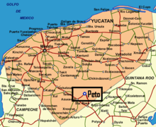
Peto Municipality is one of 106 municipalities in Yucatán State, Mexico. It has a municipal seat of the same name and is located in the centre-south portion of the Yucatán, 135 km to the south-east of state capital Mérida.
Peto | |
|---|---|
Municipality | |
 | |
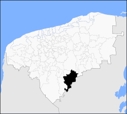 Location of Peto in Yucatán | |
Peto Location of Peto in Yucatán | |
| Coordinates: 20°07′N 89°55′W | |
| Country | |
| State | |
| Government | |
| • Type | PRI |
| • Municipal President | Jose Vicente Dominguez Canto[1] |
| Area | |
| • Total | 3,136 km2 (1,211 sq mi) |
| [1] | |
| Elevation | 35 m (115 ft) |
| Population | |
| • Total | 22,386 |
| Time zone | UTC-6 (Central Standard Time) |
| • Summer (DST) | UTC-5 (Central Daylight Time) |
| INEGI Code | 058 |
| Major Airport | Merida (Manuel Crescencio Rejón) International Airport |
| IATA Code | MID |
| ICAO Code | MMMD |
Communities
The municipality is made up of 74 communities, the most important include the following:
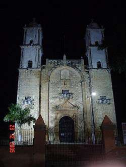
- Peto (Municipal Seat)
- Xoy
- Yaxcopil
- Tixhualatun
- Progresito
Additional Data
- City population (2005): 18,177
- City Founded: 1549
- Annual fairs: 29 April to 3 May; 26 December to 2 January
- Media: XEPET-AM, a government-run indigenous community radio station.
References
- "Nuestros municipios - Peto". Archived from the original on 1 December 2009. Retrieved 12 November 2009.
- "Encyclopedia of the Municipalities of Mexico: Yucatan". Archived from the original on 20 November 2008. Retrieved 1 November 2009.
- Census Results by Locality, 2005 Archived 22 July 2011 at the Wayback Machine INEGI.
Location of Peto in Yucatán
Mérida (capital) | |||||||||||||||
| Topics | 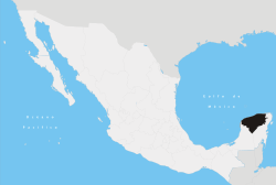 | ||||||||||||||
| Metros | |||||||||||||||
| Larger cities | |||||||||||||||
| Smaller cities |
| ||||||||||||||
| Municipalities |
| ||||||||||||||
This article is issued from Wikipedia. The text is licensed under Creative Commons - Attribution - Sharealike. Additional terms may apply for the media files.