Cansahcab Municipality
Cansahcab Municipality (In the Yucatec Maya Language: "Place of the four white caves") is a small (146.90 km²) municipalities in the Mexican state of Yucatán located roughly 50 km southeast of the state capital of Mérida.[2]
Cansahcab | |
|---|---|
Municipality | |
.jpg) Principal Church of Cansahcab, Yucatán | |
 Region 4 Litoral centro #009 | |
Cansahcab Location of the Municipality in Mexico | |
| Coordinates: 21°10′N 89°06′W | |
| Country | |
| State | |
| Government | |
| • Type | |
| • Municipal President | Felipe Chan May[2] |
| Area | |
| • Total | 146.9 km2 (56.7 sq mi) |
| [2] | |
| Elevation | 6 m (20 ft) |
| Population (2010[3]) | |
| • Total | 4,696 |
| Time zone | UTC-6 (Central Standard Time) |
| • Summer (DST) | UTC-5 (Central Daylight Time) |
| INEGI Code | 009 |
| Major Airport | Merida (Manuel Crescencio Rejón) International Airport |
| IATA Code | MID |
| ICAO Code | MMMD |
History
Before the arrival of the Spanish, the area belonged to the chieftainship of Ah Kin Chel. After the conquest the area became part of the encomienda system. One of the encomenderas was Bantulia Sosa de Rivero, who in 1700 had responsibility entrusted for the care of 250 indigenous inhabitants.[2]
Yucatán declared its independence from the Spanish Crown in 1821 and in 1825, the area was assigned to the Izamal Municipality. In 1913 it was designated as its own municipality.[2]
Governance
The municipal president is elected for a three-year term. The town council has four councilpersons, who serve as Secretary and councilors of ecology, public services and public security.[4]
Communities
The head of the municipality is Cansahcab, Yucatán. The other populated areas of the municipality include Ayala, Ekbalám, Kancabchén, San Antonio Xíat, San Isidro, San Pedro, Santa María, and Uchanchá. The significant populations are shown below:[2]
| Community | Population |
|---|---|
| Entire Municipality (2010) | 4,696[3] |
| Cansahcab | 4325 in 2005[5] |
| San Antonio Xíat | 171 in 2005[6] |
| Santa María | 224 in 2005[7] |
Local festivals
Every year from 14 – 16 September, Cansahcab holds an annual fair or "fiesta del pueblo" during which an impromptu bullfighting ring is set up to host much of the festivities which include a charrería, bullfighting and folkloric dancing.[8] On 4 October, a feast is held in honor of St. Francis of Assisi, patron saint of the town.[2]
Notables
Notable locals include General Teodosio Canto who was governor of the state of Yucatán from 1882-1886.[2]
Tourist attractions
References
- "Presidentes Municipales" (in Spanish). Mérida, Mexico: PRI yucatan. 23 January 2014. Archived from the original on 3 July 2015. Retrieved 5 July 2015.
- "Municipios de Yucatán »Cansahcab" (in Spanish). Retrieved 5 July 2015.
- "Mexico In Figures:Cansahcab, Yucatán". INEGI (in Spanish and English). Aguascalientes, México: Instituto Nacional de Estadística y Geografía (INEGI). Archived from the original on 6 May 2015. Retrieved 5 July 2015.
- "Cansahcab". inafed (in Spanish). Mérida, Mexico: Enciclopedia de Los Municipios y Delegaciones de México. Retrieved 5 July 2015.
- "Cansahcab (2005)". PueblosAmerica (in Spanish). PueblosAmerica. 2005. Retrieved 4 July 2015.
- "San Antonio Xíat (2005)". PueblosAmerica (in Spanish). PueblosAmerica. 2005. Retrieved 4 July 2015.
- "Santa María (2005)". PueblosAmerica (in Spanish). PueblosAmerica. 2005. Retrieved 4 July 2015.
- "Independence day".
Mérida (capital) | |||||||||||||||
| Topics | 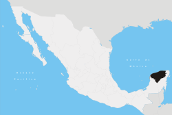 | ||||||||||||||
| Metros | |||||||||||||||
| Larger cities | |||||||||||||||
| Smaller cities |
| ||||||||||||||
| Municipalities |
| ||||||||||||||