Dzán Municipality
Dzán Municipality (In the Yucatec Maya Language: “plunge or sunken") is one of the 106 municipalities in the Mexican state of Yucatán containing (61.31 km2) of land and is located roughly 95 km south of the city of Mérida.[2]
Dzán | |
|---|---|
Municipality | |
 Region 7 Sur #025 | |
Dzán Location of the Municipality in Mexico | |
| Coordinates: 20°25′42″N 89°18′04″W | |
| Country | |
| State | |
| Mexico Ind. | 1821 |
| Yucatán Est. | 1824 |
| Government | |
| • Type | |
| • Municipal President | Luis Manuel Novelo Ku[2] |
| Area | |
| • Total | 61.31 km2 (23.67 sq mi) |
| [2] | |
| Elevation | 17 m (56 ft) |
| Population (2010[3]) | |
| • Total | 4,941 |
| • Density | 81/km2 (210/sq mi) |
| • Demonym | Umanense |
| Time zone | UTC-6 (Central Standard Time) |
| • Summer (DST) | UTC-5 (Central Daylight Time) |
| INEGI Code | 025 |
| Major Airport | Merida (Manuel Crescencio Rejón) International Airport |
| IATA Code | MID |
| ICAO Code | MMMD |
| Municipalities of Yucatán | |
History
There is no accurate data on when the town was founded, though it existed before the conquest. At colonization, Dzán became part of the encomienda system.[2] The area encompassing Dzán and Muna Municipality were joined at the time of encomienda. The first encomendero was Castilla in 1549 and it then passed to Alonso Rosado and Diego Rosado. By 1607 the encomendero was Pedro Rosado.[4]
Yucatán declared its independence from the Spanish Crown in 1821, and in 1825 the area was assigned to the high sierra partition of Ticul Municipality. In 1932 it was designated as its own municipality.[2]
Governance
The municipal president is elected for a three-year term. The town council has five councilpersons, who serve as Secretary and councilors of public works, public security, cemeteries and nomenclature.[5]
Communities
The head of the municipality is Dzán, Yucatán. There are 4 populated areas of the municipality.[5] The significant populations are shown below:[2]
| Community | Population |
|---|---|
| Entire Municipality (2010) | 4,941[3] |
| Dzán | 4587 in 2005[6] |
Local festivals
Every year from 6 to 14 September is the Festival of Cristo de San Román.[2]
Tourist attractions
- Church of Santiago Apóstol, built in the seventeenth century
- Chapel of the Holy Cross
- Archaeological sites in the area around Dzán
References
- "Presidentes Municipales" (in Spanish). Mérida, Mexico: gentepractika. 2012. Archived from the original on 5 March 2016. Retrieved 2 August 2015.
- "Municipios de Yucatán »Dzan" (in Spanish). Retrieved 2 August 2015.
- "Mexico In Figures:Dzan, Yucatán". INEGI (in Spanish and English). Aguascalientes, México: Instituto Nacional de Estadística y Geografía (INEGI). Archived from the original on 6 May 2015. Retrieved 1 August 2015.
- García Bernal, Manuela Cristina (1978). Población y encomienda en Yucatán bajo los Austrias (in Spanish). Sevilla: Escuela de Estudios Hispano-Americanos. p. 496. ISBN 978-8-400-04399-5. Retrieved 1 August 2015.
- "Dzan". inafed (in Spanish). Mérida, Mexico: Enciclopedia de Los Municipios y Delegaciones de México. Retrieved 2 August 2015.
- "Dzán". PueblosAmerica (in Spanish). PueblosAmerica. 2005. Retrieved 2 August 2015.
Mérida (capital) | |||||||||||||||
| Topics | 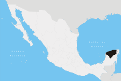 | ||||||||||||||
| Metros | |||||||||||||||
| Larger cities | |||||||||||||||
| Smaller cities |
| ||||||||||||||
| Municipalities |
| ||||||||||||||