Peregian Beach, Queensland
Peregian Beach is a beach and small coastal town on the Sunshine Coast, Queensland, Australia.[3][4] It is a suburb split between two local government areas with the eastern coastal in the Shire of Noosa and the western hinterland part in the Sunshine Coast Region.[5][6] (Between 2008 and 2013 Peregian Beach was entirely within Sunshine Coast Region). In the 2016 census, Peregian Beach had a population of 3,791 people.[1]
| Peregian Beach Noosa, Queensland | |||||||||||||||
|---|---|---|---|---|---|---|---|---|---|---|---|---|---|---|---|
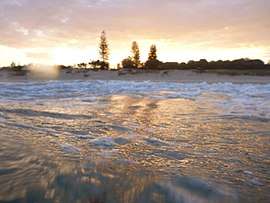 Peregian Beach, 2012 | |||||||||||||||
 Peregian Beach | |||||||||||||||
| Coordinates | 26.4663°S 153.0636°E | ||||||||||||||
| Population | 3,791 (2016 census)[1] | ||||||||||||||
| • Density | 451.3/km2 (1,169/sq mi) | ||||||||||||||
| Established | 1960[2] | ||||||||||||||
| Postcode(s) | 4573 | ||||||||||||||
| Area | 8.4 km2 (3.2 sq mi) | ||||||||||||||
| Location | |||||||||||||||
| LGA(s) | |||||||||||||||
| State electorate(s) | |||||||||||||||
| Federal Division(s) | Wide Bay | ||||||||||||||
| |||||||||||||||
History
Peregian is an Aboriginal word for emu.[2][7]
During World War II, Peregian Beach, Sunshine Beach and surrounding areas were used for artillery training. Current residents occasionally discover artillery shells and unexploded ordnance on their land.[8]
In the 2011 census, Peregian Beach had a population of 3,531 people.[9] In the 2016 census, Peregian Beach had a population of 3,791 people.[10]
In 2015, there was a competition for local residents to choose one of four pieces of artwork to decorate the concrete walls of the Peregian Beach Reservoir.[11] The winning artwork was "Peregian Stand" by Peregian artist Colin Passmore which depicted a stand of melaleuca trees.[12]
Geography
Peregian Beach within the Sunshine Coast Region comprises continual residential development along the eastern coastal strip of sandy beaches. The David Low Way passes north to south through this area. Development to the west is constrained by Noosa National Park.[13]
Peregian Beach within the Shire of Noosa is further west, bounded on the north by Lake Weyba and to the east by Noosa National Park and Murdering Creek. Its south-western boundary roughly follows Emu Mountain Road. This area is only sparsely settled.[13]
Amenities
There is a village style shopping precinct, a surf club and hotel. The local skate park is popular amongst skaters in the region, but can be prone to short periods of flash flooding in the wet season.
The town of Peregian Beach has recently been given an upgrade, with a new shopping precinct including several new restaurants, a medical centre, and assorted shops. Several other shops have recently been renovated.
The Shire of Noosa operates a weekly mobile library service on a weekly schedule located on Woodland Drive.[14]
Events
Peregian Originals is a popular community event held on the second Sunday of each month in the park beside the Surf Club showcasing original live music.
Peregian Markets is a popular community event held on the first and third Sunday of each month in the park on the beachside of the Surf Club which helps raise money for the local club.
References
- Australian Bureau of Statistics (27 June 2017). "Peregian Beach (SSC)". 2016 Census QuickStats. Retrieved 19 March 2018.

- Noosa Shire Historical Cultural Heritage - Marcus & Peregian Beach, July 2002 19 December 2006
- "Peregian Beach - beach (entry 26445)". Queensland Place Names. Queensland Government. Retrieved 22 December 2015.
- "Peregian Beach - town (entry 26446)". Queensland Place Names. Queensland Government. Retrieved 22 December 2015.
- "Peregian Beach - suburb (Shire of Noosa) (entry 48836)". Queensland Place Names. Queensland Government. Retrieved 22 December 2015.
- "Peregian Beach - suburb (Sunshine Coast Region) (entry 49429)". Queensland Place Names. Queensland Government. Retrieved 22 December 2015.
- South East Queensland - Place Names Archived 22 August 2006 at the Wayback Machine 19 December 2006
- Joyce, Nikkii (27 November 2008). "Don't touch that bomb!". Sunshine Coast Daily. Archived from the original on 11 August 2014. Retrieved 26 June 2014.
- Australian Bureau of Statistics (31 October 2012). "Peregian Beach (SSC)". 2011 Census QuickStats. Retrieved 26 June 2014.
- Australian Bureau of Statistics (27 June 2017). "Peregian Beach (SSC)". 2016 Census QuickStats. Retrieved 21 September 2019.
- "Facelift for a Peregian eyesore paints brighter future". Noosa News. 19 October 2015. Archived from the original on 11 October 2016. Retrieved 5 September 2016.
- "Announcing the winning artwork for the Peregian Beach Reservoir". UnityWater. 9 November 2015. Archived from the original on 3 October 2016. Retrieved 5 September 2016.
- "Queensland Globe". State of Queensland. Retrieved 18 March 2019.
- "Noosa Mobile Library - Mobile Stops - Noosa Mobile Hours". Shire of Noosa. Archived from the original on 30 January 2018. Retrieved 19 January 2018.
Further reading
- Sharpe, Peter R. (Peter Robert) (2009), Up rose an emu : the development of Noosa's Peregian Beach, Marcus Beach, Sunrise Beach : a book of recollections, Peter Sharpe, ISBN 978-0-646-50831-3
External links
| Wikimedia Commons has media related to Peregian Beach, Queensland. |
- "Peregian Beach". Queensland Places. Centre for the Government of Queensland, University of Queensland.