Woombye, Queensland
Woombye is a town and locality in the Sunshine Coast Region, Queensland, Australia.[2][3] In the 2016 census, Woombye had a population of 3,246 people.[1]
| Woombye Sunshine Coast, Queensland | |||||||||||||||
|---|---|---|---|---|---|---|---|---|---|---|---|---|---|---|---|
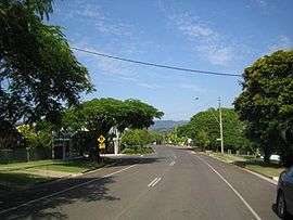 Eastern end of the main street | |||||||||||||||
 Woombye | |||||||||||||||
| Coordinates | 26.6602°S 152.9658°E | ||||||||||||||
| Population | 3,246 (2016 census)[1] | ||||||||||||||
| • Density | 235.2/km2 (609.2/sq mi) | ||||||||||||||
| Postcode(s) | 4559 | ||||||||||||||
| Area | 13.8 km2 (5.3 sq mi) | ||||||||||||||
| Time zone | AEST (UTC+10:00) | ||||||||||||||
| Location | |||||||||||||||
| LGA(s) | Sunshine Coast Region | ||||||||||||||
| State electorate(s) | Nicklin | ||||||||||||||
| Federal Division(s) | Fairfax | ||||||||||||||
| |||||||||||||||
Geography
Woombye is located on the Sunshine Coast hinterland in Queensland, Australia, approximately 100 kilometres (62 mi) north of the Brisbane CBD. The name is derived from words from the local Aboriginal language - a place (wumbai) of black snake, or (wambai) black myrtle or axe handle made from black myrtle.[4]

The Bruce Highway forms the eastern boundary of the locality. The North Coast railway line runs from north to south through the western part of the locality,; the town is centred around the Woombye railway station in the west of the locality.[5][6]
Woombye is accessible by Translink trains and buses. There are numerous rail services departing for Brisbane daily.
The small township of Woombye is surrounded by what were once pineapple farms, which today are acreage properties and gated communities. The first pineapple farm was owned and operated by Hugh and Alice Moorhouse, located on Moorhouse Road, which overlooks the township. The Woombye Light Horse Memorial is also named after MAJ Hugh Vardy Moorhouse (2 Feb 1903 - 11 Oct 1993).
History
The town has its roots in a settlement first known as Middle Camp, and later Cobb's Camp. It was established in 1868 as a staging depot and hotel for Cobb & Co stagecoaches at the halfway point on the road between Brisbane and Gympie, after the discovery of gold at Gympie.[7]
Cobbs Camp Provisional School opened on 17 August 1885.[8]
The town was renamed as Woombye in the 1880s.[9] The name of Woombye is thought to be derived from an Aboriginal word "wombai", which means black myrtle tree[2] or black snake. The school was renamed Woombye State School in 1892.[8]
In 1891 the North Coast railway from Landsborough to Yandina was opened, and it became a rail centre until 1914.[10]
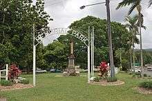
The Woombye War Memorial was unveiled on 18 June 1925 by the Queensland Governor, Matthew Nathan.[11][12]
In 1977, a preschool was added to Woombye State School.[8]
On 5 February 1979 the Christian Outreach College (Sunshine Coast) was established by the Nambour Christian Outreach Centre on a 26-acre (11 ha) pineapple farm. The church and school were later renamed Suncoast Church and Suncoast Christian College respectively. In 2004, an adjoining 16-acre (6.5 ha) pineapple farm was purchased to expand the school.[8][13]
On 29 January 1980, Nambour Christian College was established with 36 students by the families of the New Life Assembly of God Nambour church.[8] The name was changed to Nambour Christian College in 1992.[14]
In the 2006 census, Woombye had a population of 2,094.[15]
Education
Woombye State School is a government primary (Prep-6) school for boys and girls at 95 Pine Grove Road (26.6677°S 152.9738°E).[16][17] In 2017, the school had an enrolment of 506 students with 41 teachers (32 full-time equivalent) and 21 non-teaching staff (14 full-time equivalent).[18] The school includes a special education program.[16]
Suncoast Christian College is a private primary and secondary (Prep-12) school for boys and girls at the corner of Schubert & Kiel Mountain Roads (26.6658°S 152.9777°E).[16][19] In 2017, the school had an enrolment of 803 students with 67 teachers (57 full-time equivalent) and 70 non-teaching staff (42 full-time equivalent).[18]
Nambour Christian College is a private primary and secondary (Prep-12) school for boys and girls at McKenzie Road (26.6439°S 152.9616°E).[16][20] In 2017, the school had an enrolment of 1,131 students with 87 teachers (80 full-time equivalent) and 95 non-teaching staff (59 full-time equivalent).[18]
There are no government secondary schools in Woombye, but there are government secondary schools in neighbouring Nambour and Burnside.[5]
Amenities
Woombye is home to one of the longest established soccer clubs on the Sunshine Coast, the Woombye Snakes.[21]
Visitor attractions
Woombye is home to The Big Pineapple, a tourist attraction which is one of Australia's big things.[22]
Heritage listings
Woombye has a number of heritage-listed sites, including:
- Nambour Connection Road: North Coast Roadside Rest Areas[23]
- Nambour Connection Road: The Big Pineapple (former Sunshine Plantation)[24]
References
- Australian Bureau of Statistics (27 June 2017). "Woombye (SSC)". 2016 Census QuickStats. Retrieved 19 October 2018.

- "Woombye - town (entry 38087)". Queensland Place Names. Queensland Government. Retrieved 13 April 2017.
- "Woombye - locality (entry 48940)". Queensland Place Names. Queensland Government. Retrieved 13 April 2017.
- "Place Name Origins - Maroochy Shire Council". Maroochy Shire. 2006. Archived from the original on 10 December 2006. Retrieved 30 November 2006.
- "Queensland Globe". State of Queensland. Retrieved 17 July 2019.
- Woombye on the North Coast Line. Milne, Rod. Australian Railway Historical Society Bulletin. December 1997. pp435-441.
- "Woombye". Queensland Places. Centre for the Government of Queensland, University of Queensland. Retrieved 17 July 2019.
- Queensland Family History Society (2010), Queensland schools past and present (Version 1.01 ed.), Queensland Family History Society, ISBN 978-1-921171-26-0
- "Official Items". The Telegraph (4, 800). Queensland, Australia. 29 February 1888. p. 4. Retrieved 17 July 2019 – via National Library of Australia.
- "Sunshine Coast Libraries - Woombye". Sunshine Coast Regional Council. 2007. Archived from the original on 19 July 2008.
- "Woombye War Memorial". Monument Australia. Archived from the original on 6 October 2014. Retrieved 3 April 2014.
- "Dedication Service". Nambour Chronicle and North Coast Advertiser (Qld. : 1922 - 1954). Qld.: National Library of Australia. 10 July 1925. p. 8. Retrieved 4 April 2014.
- "College History". Suncoast Christian College. Archived from the original on 17 July 2019. Retrieved 17 July 2019.
- "History". Nambour Christian College. Archived from the original on 17 July 2019. Retrieved 17 July 2019.
- Australian Bureau of Statistics (25 October 2007). "Woombye (State Suburb)". 2006 Census QuickStats. Retrieved 16 March 2008.
- "State and non-state school details". Queensland Government. 9 July 2018. Archived from the original on 21 November 2018. Retrieved 21 November 2018.
- "Woombye State School". Retrieved 21 November 2018.
- "ACARA School Profile 2017". Archived from the original on 22 November 2018. Retrieved 22 November 2018.
- "Suncoast Christian College". Retrieved 21 November 2018.
- "Nambour Christian College". Retrieved 21 November 2018.
- "About". Woombye Snakes. Archived from the original on 17 July 2019. Retrieved 17 July 2019.
- "Big Things in Queensland Bucket List". Queensland Uncovered. Tourism and Events Queensland. 1 May 2015. Archived from the original on 17 July 2019. Retrieved 17 July 2019.
- "North Coast Roadside Rest Areas (entry 602698)". Queensland Heritage Register. Queensland Heritage Council. Retrieved 14 July 2013.
- "The Big Pineapple (former Sunshine Plantation) (entry 602694)". Queensland Heritage Register. Queensland Heritage Council. Retrieved 14 July 2013.
External links
| Wikimedia Commons has media related to Woombye, Queensland. |
- "Woombye". Queensland Places. Centre for the Government of Queensland, University of Queensland.
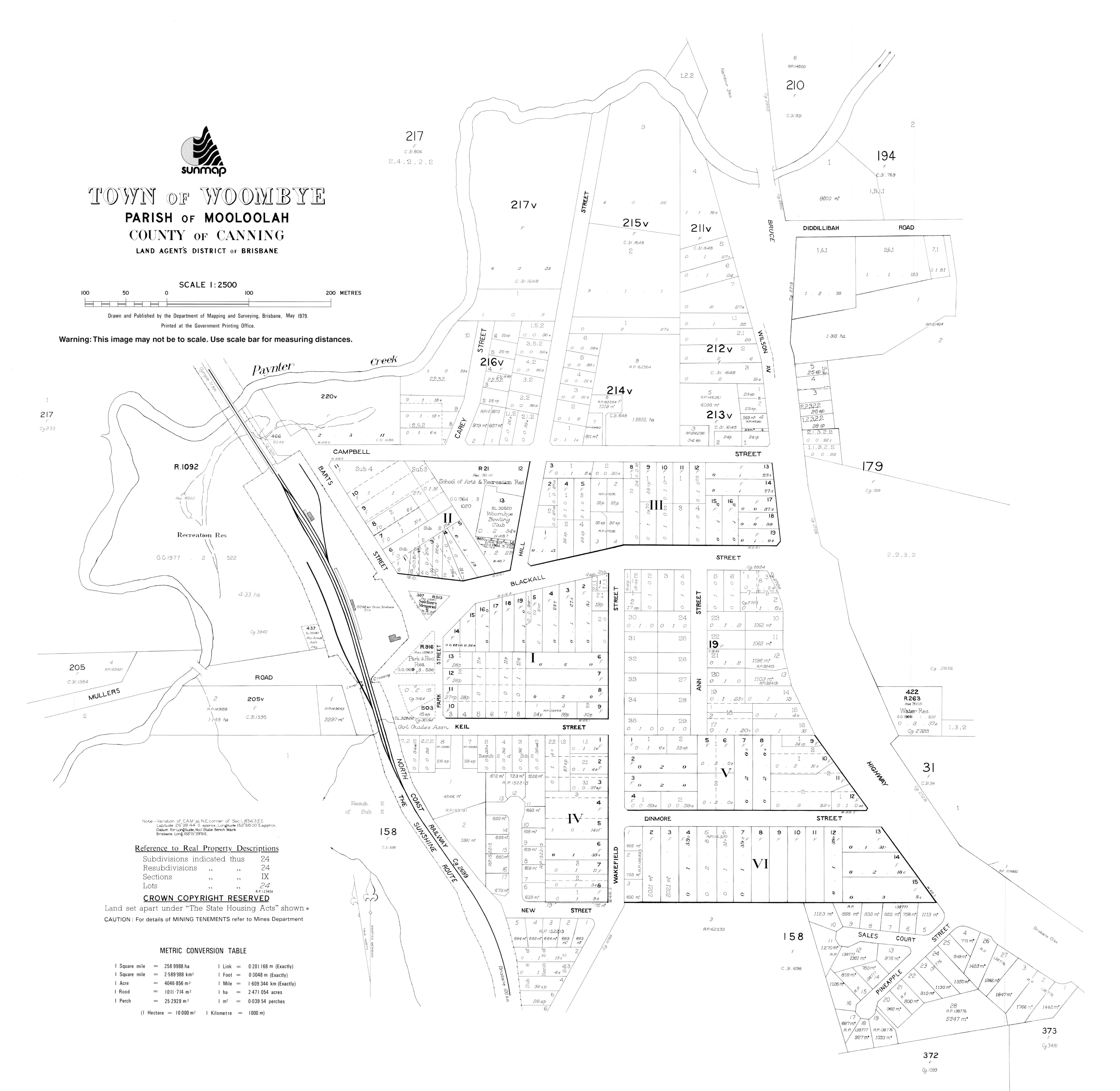
- Town map of Woombye, 1979