Pepillo Salcedo, Dominican Republic
Pepillo Salcedo is a municipality in the Monte Cristi Province of the Dominican Republic. It is one of the closest shores to Haiti. Pepillo Salcedo is frequently named Manzanillo due to the bay of manzanillo Bahia De Manzanillo which is approximately 2 miles from playa el coquito coquito beach. the city received its name from José Antonio Salcedo Ramírez who was a combatant in the long war days of the consolidation of national independence day in the Dominican Republic. General Salcedo Ramírez was also an outstanding military leader in the intense restorative war from 1863 to 1865. Pepillo Salcedo is a coastal town. It is built on the shores of the Bay of Manzanillo. In the westernmost part of the Dominican Northwest.
Pepillo Salcedo | |
|---|---|
 Pepillo Salcedo | |
| Coordinates: 19°42′0″N 71°45′0″W | |
| Country | |
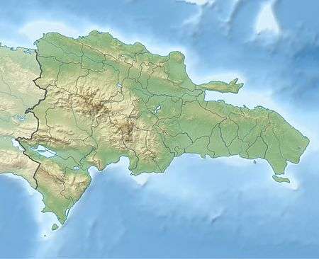
| Province | Monte Cristi |
| Municipality since | 1948 |
| Area | |
| • Total | 149.32 km2 (57.65 sq mi) |
| Population (2012)[2] | |
| • Total | 11,588 |
| • Density | 78/km2 (200/sq mi) |
| Municipal Districts | 0 |
Its official name is Pepillo Salcedo, in accordance with Law 2089, of August 25, 1949, whose literature highlights the historical figure of that character who knew how to defend the concept of Dominicanness by first confronting the Haitians and then the Spanish.
This almost bucolic looking town is also popularly known by the names of Manzanillo and Puerto Libertador. This triple toponymy is not a unique case in the world. One is tempted to remember that the architectural jewel of the Bosphorus Strait, the current Turkish city of Istanbul, has also been known through the centuries as Constantinople and Byzantium.
The Municipality of Pepillo Salcedo on the Dominican side and the Meillac hamlet, on the other side, are the starting points of the border of some four hundred kilometers that divides our country from Haiti. The other end of the border line is at Pedernales and Anse-a-Pitre.
Climate
| Climate data for Pepillo Salcedo, Dominican Republic (1961–1990) | |||||||||||||
|---|---|---|---|---|---|---|---|---|---|---|---|---|---|
| Month | Jan | Feb | Mar | Apr | May | Jun | Jul | Aug | Sep | Oct | Nov | Dec | Year |
| Record high °C (°F) | 37.0 (98.6) |
39.4 (102.9) |
40.4 (104.7) |
38.4 (101.1) |
40.5 (104.9) |
39.4 (102.9) |
41.2 (106.2) |
41.4 (106.5) |
40.4 (104.7) |
40.3 (104.5) |
38.4 (101.1) |
37.2 (99.0) |
41.4 (106.5) |
| Average high °C (°F) | 29.4 (84.9) |
29.7 (85.5) |
30.6 (87.1) |
31.0 (87.8) |
31.7 (89.1) |
33.0 (91.4) |
34.1 (93.4) |
34.1 (93.4) |
33.2 (91.8) |
32.2 (90.0) |
30.8 (87.4) |
29.4 (84.9) |
31.6 (88.9) |
| Average low °C (°F) | 19.3 (66.7) |
19.5 (67.1) |
20.5 (68.9) |
21.3 (70.3) |
22.3 (72.1) |
22.9 (73.2) |
23.2 (73.8) |
23.1 (73.6) |
22.7 (72.9) |
22.4 (72.3) |
21.1 (70.0) |
19.7 (67.5) |
21.5 (70.7) |
| Record low °C (°F) | 13.1 (55.6) |
14.2 (57.6) |
14.0 (57.2) |
15.0 (59.0) |
16.0 (60.8) |
19.1 (66.4) |
17.0 (62.6) |
17.5 (63.5) |
18.0 (64.4) |
19.0 (66.2) |
15.3 (59.5) |
14.3 (57.7) |
13.1 (55.6) |
| Average rainfall mm (inches) | 42.7 (1.68) |
36.6 (1.44) |
38.8 (1.53) |
53.3 (2.10) |
90.7 (3.57) |
90.9 (3.58) |
59.6 (2.35) |
60.0 (2.36) |
81.6 (3.21) |
92.2 (3.63) |
76.3 (3.00) |
55.2 (2.17) |
777.9 (30.63) |
| Average rainy days (≥ 1.0 mm) | 3.0 | 2.7 | 2.7 | 4.0 | 6.7 | 6.3 | 4.1 | 5.2 | 5.8 | 6.1 | 4.5 | 3.8 | 54.9 |
| Source: NOAA[3] | |||||||||||||
Sources
- World Gazeteer: Dominican Republic at Archive.today (archived 2012-12-04) – World-Gazetteer.com
T. (2010, March). PEPILLO SALCEDO: PATRIOTA EXCEPCIONAL. Retrieved June 14, 2020, from https://diariodominicano.com/cultura/2018/03/17/262686/pepillo-salcedo-patriota-excepcional-
References
- Superficies a nivel de municipios, Oficina Nacional de Estadistica Archived 2009-04-17 at the Wayback Machine
- Censo 2012 de Población y Vivienda,Oficina Nacional de Estadistica Archived 2009-09-19 at the Wayback Machine
- "P. Salcedo Climate Normals 1961-1990". National Oceanic and Atmospheric Administration. Retrieved September 18, 2016.