Monte Plata
Monte Plata is a municipality (municipio) and the capital of the Monte Plata province in the Dominican Republic. It includes the municipal districts (distritos municipal) of Boyá, Chirino, and Don Juan.[3]
Monte Plata | |
|---|---|
 Seal | |
 Monte Plata | |
| Coordinates: 18°48′36″N 69°47′24″W | |
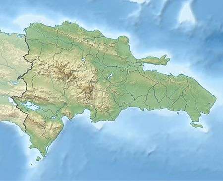
| Country | |
| Province | Monte Plata |
| Founded | 1606 |
| Area | |
| • Total | 623.55 km2 (240.75 sq mi) |
| Elevation | 56 m (184 ft) |
| Population (2012) | |
| • Total | 57,553 |
| • Density | 92/km2 (240/sq mi) |
| Municipal Districts | 3 |
| Distance to – Santo Domingo | 153 km |
| Climate | Af |
History
Monte Plata was founded by residents of the towns of Monte Cristi and Puerto Plata, whose destruction was ordered by the king of Spain and carried-out by Antonio Ozorio, Governor of the Island. The name is a portmanteau of the names of the two cities MONTE Cristi and Puerto PLATA. The founders of Monte Plata were 87 families from the two previously mentioned cities.
Climate
| Climate data for Monte Plata (1961–1990) | |||||||||||||
|---|---|---|---|---|---|---|---|---|---|---|---|---|---|
| Month | Jan | Feb | Mar | Apr | May | Jun | Jul | Aug | Sep | Oct | Nov | Dec | Year |
| Record high °C (°F) | 33.7 (92.7) |
33.7 (92.7) |
35.8 (96.4) |
36.9 (98.4) |
37.9 (100.2) |
36.7 (98.1) |
36.6 (97.9) |
37.8 (100.0) |
37.9 (100.2) |
36.6 (97.9) |
35.8 (96.4) |
33.7 (92.7) |
37.9 (100.2) |
| Average high °C (°F) | 29.5 (85.1) |
30.1 (86.2) |
31.3 (88.3) |
32.3 (90.1) |
32.6 (90.7) |
33.0 (91.4) |
33.1 (91.6) |
33.0 (91.4) |
32.9 (91.2) |
32.2 (90.0) |
31.0 (87.8) |
29.5 (85.1) |
31.7 (89.1) |
| Average low °C (°F) | 18.8 (65.8) |
19.1 (66.4) |
20.0 (68.0) |
20.7 (69.3) |
21.8 (71.2) |
22.3 (72.1) |
22.4 (72.3) |
22.3 (72.1) |
22.1 (71.8) |
21.8 (71.2) |
20.6 (69.1) |
19.4 (66.9) |
20.9 (69.6) |
| Record low °C (°F) | 12.9 (55.2) |
14.8 (58.6) |
14.7 (58.5) |
14.9 (58.8) |
16.4 (61.5) |
15.4 (59.7) |
19.4 (66.9) |
17.3 (63.1) |
18.9 (66.0) |
18.6 (65.5) |
15.7 (60.3) |
13.9 (57.0) |
12.9 (55.2) |
| Average rainfall mm (inches) | 60.9 (2.40) |
78.1 (3.07) |
102.3 (4.03) |
120.1 (4.73) |
256.1 (10.08) |
232.3 (9.15) |
232.0 (9.13) |
327.6 (12.90) |
252.4 (9.94) |
211.7 (8.33) |
118.1 (4.65) |
67.2 (2.65) |
2,058.8 (81.06) |
| Average rainy days (≥ 1.0 mm) | 6.4 | 6.4 | 7.1 | 8.0 | 14.0 | 14.5 | 14.6 | 16.1 | 14.4 | 13.6 | 9.6 | 8.2 | 132.9 |
| Source: NOAA[4] | |||||||||||||
Hydrology
In the municipality the main rivers are the Ozama and the Yabacao. Other rivers are the tributaries, Yamasá, Mijo, Sabita and Guanuma.
Culture
Monte Plata possesses a wealth of folkloric elements and rich culture. Some of its best-known cultural elements are its folk songs, folk dances, oral and written traditions, historic monuments, and popular folk beliefs.
References
- Superficies a nivel de municipios, Oficina Nacional de Estadistica Archived 2009-04-17 at the Wayback Machine
- De la Fuente, Santiago (1976). Geografía Dominicana (in Spanish). Santo Domingo, Dominican Republic: Editora Colegial Quisqueyana.
- "Listado de Codigos de Provincias, Municipio y Distritos Municipales, Actualizada a Junio 20 del 2006" (in Spanish). Oficina Nacional de Estadistica, Departamento de Cartografia, Division de Limites y Linderos. 20 June 2006. Archived from the original on 14 March 2007. Retrieved 12 August 2011.
- "Monte Plata Climate Normals 1961-1990". National Oceanic and Atmospheric Administration. Retrieved September 18, 2016.
| ||