Bayaguana
Bayaguana is a municipality (municipio) of the Monte Plata province in the Dominican Republic.[3]
Bayaguana | |
|---|---|
 Church | |
 Seal | |
 Bayaguana | |
| Coordinates: 18°45′N 69°38′W | |
| Country | |
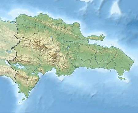
| Province | Monte Plata |
| Founded | 1606 |
| Area | |
| • Total | 877.99 km2 (338.99 sq mi) |
| Elevation | 61 m (200 ft) |
| Population (2012) | |
| • Total | 34,786 |
| • Density | 40/km2 (100/sq mi) |
| • Urban | 19,001 |
| • Rural | 15,785 |
| Municipal Districts | 0 |
| Distance to – Monte Plata | 21 km |
As of the Dominican Republic's 2002 census, the municipality had a total population of 34,786 inhabitants, of which 19,001 resided in urban areas and 15,785 in rural areas.
Bayaguana was founded in 1606, when Spain resettled colonists from the northern and western part of Hispaniola closer to Santo Domingo, under the government eviction programme known as the devastations of Osorio. Spanish colonists from La Yaguana and Bayajá (present-day Léogâne and Fort-Liberté, Haiti) were resettled in the town. The economy is centered on cattle-ranching and pineapple and rice farming.
Climate
| Climate data for Bayaguana (1961–1990) | |||||||||||||
|---|---|---|---|---|---|---|---|---|---|---|---|---|---|
| Month | Jan | Feb | Mar | Apr | May | Jun | Jul | Aug | Sep | Oct | Nov | Dec | Year |
| Record high °C (°F) | 36.0 (96.8) |
35.5 (95.9) |
36.5 (97.7) |
36.5 (97.7) |
37.0 (98.6) |
37.5 (99.5) |
37.5 (99.5) |
39.5 (103.1) |
37.5 (99.5) |
37.0 (98.6) |
36.0 (96.8) |
37.8 (100.0) |
39.5 (103.1) |
| Average high °C (°F) | 30.1 (86.2) |
30.6 (87.1) |
31.5 (88.7) |
31.8 (89.2) |
32.2 (90.0) |
32.6 (90.7) |
32.7 (90.9) |
32.7 (90.9) |
32.7 (90.9) |
32.4 (90.3) |
31.5 (88.7) |
30.1 (86.2) |
31.7 (89.1) |
| Daily mean °C (°F) | 24.7 (76.5) |
24.9 (76.8) |
25.6 (78.1) |
26.2 (79.2) |
27.0 (80.6) |
27.5 (81.5) |
27.6 (81.7) |
27.6 (81.7) |
27.6 (81.7) |
27.2 (81.0) |
26.4 (79.5) |
25.0 (77.0) |
26.4 (79.5) |
| Average low °C (°F) | 19.3 (66.7) |
19.3 (66.7) |
19.7 (67.5) |
20.6 (69.1) |
21.8 (71.2) |
22.5 (72.5) |
22.6 (72.7) |
22.5 (72.5) |
22.5 (72.5) |
22.1 (71.8) |
21.3 (70.3) |
19.9 (67.8) |
21.2 (70.2) |
| Record low °C (°F) | 14.0 (57.2) |
12.5 (54.5) |
13.2 (55.8) |
14.0 (57.2) |
14.6 (58.3) |
19.0 (66.2) |
18.0 (64.4) |
18.0 (64.4) |
18.8 (65.8) |
17.7 (63.9) |
16.1 (61.0) |
13.4 (56.1) |
12.5 (54.5) |
| Average rainfall mm (inches) | 45.4 (1.79) |
61.1 (2.41) |
78.8 (3.10) |
126.8 (4.99) |
232.0 (9.13) |
229.6 (9.04) |
227.3 (8.95) |
281.4 (11.08) |
217.6 (8.57) |
200.8 (7.91) |
117.0 (4.61) |
58.3 (2.30) |
1,876.1 (73.86) |
| Average rainy days (≥ 1.0 mm) | 6.1 | 6.0 | 6.3 | 8.1 | 13.5 | 14.2 | 14.2 | 16.2 | 15.5 | 15.4 | 9.7 | 7.2 | 132.4 |
| Average relative humidity (%) | 77.5 | 74.6 | 73.2 | 74.9 | 78.8 | 79.3 | 79.4 | 81.3 | 82.3 | 82.8 | 81.1 | 79.2 | 78.7 |
| Source: NOAA[4] | |||||||||||||
References
- Superficies a nivel de municipios, Oficina Nacional de Estadistica Archived April 17, 2009, at the Wayback Machine
- De la Fuente, Santiago (1976). Geografía Dominicana (in Spanish). Santo Domingo, Dominican Republic: Editora Colegial Quisqueyana.
- "Listado de Codigos de Provincias, Municipio y Distritos Municipales, Actualizada a Junio 20 del 2006" (in Spanish). Oficina Nacional de Estadistica, Departamento de Cartografia, Division de Limites y Linderos. 20 June 2006. Archived from the original on 14 March 2007. Retrieved 12 August 2011.
- "Bayaguana Climate Normals 1961-1990". National Oceanic and Atmospheric Administration. Retrieved September 21, 2016.
This article is issued from Wikipedia. The text is licensed under Creative Commons - Attribution - Sharealike. Additional terms may apply for the media files.