Ogasawara Subprefecture
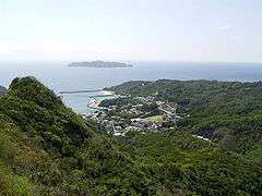
Ogasawara Subprefecture (小笠原支庁, Ogasawara-shichō) is a subprefecture of Tokyo Metropolis, Japan. The subprefecture covers the Bonin Islands and is coterminous with the village of Ogasawara; and the prefectural government maintains a main office on Chichijima and a branch office on Hahajima.
The subprefecture covers 104.41 square km and 2,415 people.
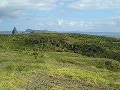
The Ogasawara Islands refer to a scattered group of islands in the Northwest Pacific south of the Japanese main island of Honshū. They consist of the Bonin Islands (Ogasawara Archipelago), the Volcano Islands (Kazan Islands) and several isolated islands.[1]
History
Until 1830, the Ogasawara Islands were uninhabited and thus called Muninjima (meaning "uninhabited island"). This Japanese name was transliterated or transformed into the more widely known English name—the Bonin Islands.[1]
These Bonin Islands (the Ogasawara archipelago) are composed of the three island groups:
|
|
|
|
These main island clusters are encompassed within the Tokyo prefectural administrative area known as the Ogasawara Subprefecture; but only the islands of the Ogasawara archipelago are traditionally considered to be the Bonin Islands.[2] These geologically older and larger islands are traditionally considered distinct from the administratively-related but geologically newer and smaller island clusters and other isolated outcroppings in this part of the Pacific.[1]
Okinotorishima was added to the subprefecture in 1930.[3]
The current Japanese administrative structure has its historical organizational roots in the post-war occupation of these strategically positioned Pacific islands. In the 23 years that UN Trust Territory was administered by the Americans, the region was known as the Bonin-Volcano Islands.[4] Prior to repatriation in 1968, this military strategic area remained under the control of U.S. military occupation forces.[5]
Geography
The three main groups which comprise the Bonin Islands are at the northern end of the archipelago. All the islands together comprise only 61 square kilometers;[4] and they are:
- Groom Islands (group) (聟島列島, Muko-jima rettō)—the northern-most cluster.[4]
- Bride Island (嫁島, Yome-jima)
- Groom Island (聟島, Muko-jima)
- "Go-Between" Island (媒島, Nakōdo-jima or Nakadachi-jima)
- ... plus a few outcrops, the most remote northerly one is North Island (北島, Kitano-jima or Kitanoshima)

- Father Islands (group) (父島列島, Chichi-jima rettō)—the middle cluster.[4]
- Father Island (父島, Chichi-jima)
- Elder Brother Island (兄島, Ani-jima)
- Younger Brother Island (弟島, Otōto-jima)
- Grandchild Island (孫島, Mago-jima)
- ... plus islets known only as
- East Island (東島, Higashi-jima)
- West Island (西島, Nishi-jima)
- South Island (南島, Minami-jima)
- the Mother Islands (group) (母島列島, Haha-jima rettō)—the southern-most cluster.[4]
- Mother Island (母島, Hahajima)
- Elder Sister Island (姉島, Ane-jima)
- Younger Sister Island (妹島, Imōto-jima)
- Niece Island (姪島, Mei-jima)
- ... plus a few other small and miscellaneous islands known as
- "Flat" Island (平島, Hira-shima)
- "Over There" Island (向島, Muko-jima)
- Nishinoshima (西之島, lit. "west island"), west of the Bonin Islands
- Volcano Islands (火山列島, Kazan rettō), to the south:
- North Iwo Jima (北硫黄島, Kitaiōjima/Kitaiōtō, lit. "north sulfur island")
- Iwo Jima (硫黄島, Iōjima/Iōtō, lit. "sulfur island")
- South Iwo Jima (南硫黄島, Minamiiōjima/Minamiiōtō, lit. "south sulfur island")
- and two isolated islands to the south:
- Okinotorishima (沖ノ鳥島, lit. "distant bird island"), far to the west
- Minami-Tori-shima (南鳥島, lit. "south bird island"), far to the east
Development
Lessons learned the hard way from the experience of the Galapagos Islands are potentially paradoxical.[4] The ecosystem fragility is well documented;[5] and it suggests comparisons with the cautious development history of the Galapagos.
The islanders also stress the uniquely multicultural roots of the Ogasawara life, where roughly one-tenth of the Japanese population is descended from early European and American settlers, with some families going back up to seven generations.[4]
See also
- Kita Iwo Jima (北硫黄島, Kitaiōjima or Kitaiōtō)
- Iwo Jima (硫黄島, Iōjima or Iōtō)
- Minami Iwo Jima (南硫黄島, Minamiiōjima or Minamiiōtō)
Notes
- UNESCO World Heritage, Tentative List: "Ogasawara Islands" (Ref. 5095), proposed by the Ministry of the Environment (Japan). January 30, 2007.
- Freeman, Otis W. (1951). Geography of the Pacific, pp. 229-235.
- Yong Hong, Seoung. (2009). Maritime Boundary Disputes, Settlement Processes, and the Law of the Sea, p. 148.
- McCormack, Gavan. "Dilemmas of Development on The Ogasawara Islands," JPRI Occasional Paper, No. 15 (August 1999).
- Zicus, Sandra. (2001) "Ogasawara Subtropical Moist Forests". Terrestrial Ecoregions. World Wildlife Fund.
References
- Freeman, Otis Willard. (1951). Geography of the Pacific. New York: Wiley. OCLC 415089
- McCormack, Gavan. "Dilemmas of Development on The Ogasawara Islands," JPRI Occasional Paper, No. 15 (August 1999). Japan Policy Research Institute (University of San Francisco).
External links
- Ogasawara Island Branch Office Official Website (in Japanese)
| |||||||
| Special Wards of Tokyo | |||||||
| Western (Tama area) |
| ||||||
| Subprefectures | |||||||
| |||||||