South Iwo Jima
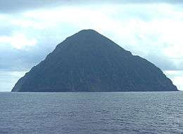
South Iwo Jima (南硫黄島, officially Minami-Iōtō, also frequently Minami-Iwō-jima,[1] Minami-Iōjima: “South Sulfur Island”) is the southernmost island of the Volcano Islands group of the Ogasawara Islands, 60 km south of Iwo Jima. It is 1300 km south of Tokyo, 330 km SSW of Chichi-jima. Its area is 3.4 km² and the shore length, 7.5 km. Along the shoreline there are few bays and inlets, and it is covered with mostly rocks and little sand. To the rear are sea cliffs that rise to 200 m in height. The peak on South Iwo Jima is the largest in the Ogasawara Islands at 913 m and its average slope angle is 45 degrees. The northwest side of this volcano, which has a relatively stable shape and is not eroding much, rises at a gentler incline of 30 degrees. Another defining feature of the island is that it does not have rivers, lakes, marshes or a freshwater system of any kind.
| Native name: Japanese: 南硫黄島 | |
|---|---|
 Minami-Iōtō | |
 South Iwo Jima | |
| Geography | |
| Location | Pacific Ocean |
| Coordinates | 24°14′2″N 141°27′49″E |
| Archipelago | Volcano Islands |
| Area | 3.54 km2 (1.37 sq mi) |
| Coastline | 7.5 km (4.66 mi) |
| Highest elevation | 916 m (3,005 ft) |
| Administration | |
Japan | |
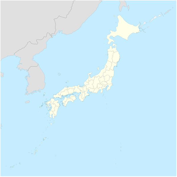
| Prefecture | Tokyo |
| Subprefecture | Ogasawara Subprefecture |
| Village | Ogasawara |
| Demographics | |
| Population | 0 |
| Pop. density | 0/km2 (0/sq mi) |
South Iwo Jima is part of a volcanic front which has been active for 2,588,000 years beginning in the Quaternary period and started to form as a result of volcanic activity in that period. Though it is not clear when it emerged as an island, rocks which have been gathered and analyzed show no signs of geomagnetic reversal, so it is believed that the island is no more than a few hundred thousands years old. It was discovered in October 1543 by Spanish sailor Bernardo de la Torre on board of carrack San Juan de Letrán when trying to return from Sarangani to New Spain.[2][3]
The island is now administered as part of the Ogasawara-mura of Tokyo and is unpopulated. Its pronounced Japanese name was changed on June 18, 2007 to Minami-Iōtō, the kanji unchanged. The next southern island (geologically), located 541 km (336 mi) away, is Farallon de Pajaros of the Northern Mariana Islands while Iwo Jima is roughly 60 km to the north.
In popular culture
Minami Iwo Jima is the location of Mahoutokoro, the Japanese school of witchcraft and wizardry in the fictional universe of Harry Potter. Mahoutokoro, the shiro or castle is located on the peak of extinct volcano and is constructed of pure white jade and described as having surrounded by stormy seas, without any Muggle inhabitants, and very close to a Japanese Air Force base.[4]
See also
- Iwo Jima
- Desert island
- List of islands
References
- Teikoku's Complete Atlas of Japan, Teikoku-Shoin Co., Ltd, Tokyo, ISBN 4-8071-0004-1
- Brand, Donald D. The Pacific Basin: A History of its Geographical Explorations The American Geographical Society (New York, 1967) p.123.
- Welsch, Bernard (Jun 2004). "Was Marcus Island Discovered by Bernardo de la Torre in 1543?". The Journal of Pacific History. Taylor & Francis. Ltd. 39 (1): 109–122. doi:10.1080/00223340410001684886.
- "Mahoutokoro". Pottermore. Retrieved 2019-08-06.
External links
| Authority control |
|
|---|