Nerang, Queensland
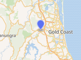
Nerang is a town and a suburb in the City of Gold Coast, Queensland, Australia.[2][3] At the 2011 Census, Nerang had a population of 16,256.[4]
| Nerang Gold Coast, Queensland | |||||||||||||||
|---|---|---|---|---|---|---|---|---|---|---|---|---|---|---|---|
 Nerang railway station | |||||||||||||||
 Nerang | |||||||||||||||
| |||||||||||||||
| Coordinates | 27.9902°S 153.3358°E | ||||||||||||||
| Population | 16,864 (2016 census)[1] | ||||||||||||||
| • Density | 413.3/km2 (1,070.5/sq mi) | ||||||||||||||
| Postcode(s) | 4211 | ||||||||||||||
| Area | 40.8 km2 (15.8 sq mi) | ||||||||||||||
| LGA(s) | Gold Coast City | ||||||||||||||
| State electorate(s) | Gaven | ||||||||||||||
| Federal Division(s) | |||||||||||||||
| |||||||||||||||
Geography
The Nerang River flows through the locality from south to east, passing through the town. The river ultimately flows into the most southern part of Moreton Bay.[5]
Nerang has a small town centre in which banking and a range of other commercial and retail services are available. Of more prominence within the Division, is the development of a series of light industrial parks which house a diverse range of small and large business operations providing services such as panel beating, motor vehicle wrecking, a wide range of trades, printing and equipment hire services. Administration offices of the Gold Coast City Council are also located at Nerang including Council functions such as finance, town planning and building services.[6]
History

The town takes its name from the river which, in turn, is reportedly a word from the Bundjalung language, Ngaraangbal variant, meaning either small river, or shovel nosed shark.[2]
The township of Nerang was surveyed by Martin Lavelle in June 1865.[6] Lavelle named a street after himself and others after local pioneers like William White the local squatter, and Edmund Price the local planter. Nerang has focused very much on the river crossing and the head of navigation. Land was first sold here in 1871. Daily Cobb & Co coach services from Brisbane began the same year[7] and river transport to the settlement became more regular. Benjamin Cockerill erected the first hotel, The Nerang, in early 1872. The population of the 'town' of Nerang in the 1871 census was too small even to be included in the list of towns in the region. A thrice weekly Cobb & Co coach service provided the incentive for the opening of a second hotel called the Southern Cross, followed by the Royal Mail in 1873. With an abundant supply of red cedar amongst other tree species, the first industry to flourish in the area was timber cutting. In 1875, Nerang State School opened. With the establishment of a telegraph office, two stores, a butcher, a saddler, a baker and a boot maker it was clear that a township was forming. By 1881 the population reached 95.
On 30 September 1885 J. Howard Maynard auctioned 34 allotments on the bank of Mooyumbin Creek, bound by Martin Street, Tibbing Street and Price Street. At the time the amenities advertised included the Commercial Hotel, agricultural and saw-milling district and a railway station was promised.[8][9]
By 1888 there were three schools in Nerang The area and the population had grown to 343 by 1901. By 1905 Nerang was becoming a centre for dairying. Maize was the main industry with arrowroot and potato crops also becoming more important. Nerang boomed in the 1970s and 1980s as the Gold Coast expanded westward and urban development surrounded the district. This boom saw the establishment of Railway Station at Nerang and forms part of the Gold Coast rail link to Brisbane.
Although the economic focus of the Gold Coast today is tourism, in the 19th century the South Coast (as it was then known) was an agricultural area. Sugar and maize were grown by farmers along the upper reaches of the Nerang River. At that time, Nerang was the one of those townships in the Gold Coast hinterland that reflected that the economic focus of the area was agriculture. The South Coast railway arrived in Nerang in 1887 with the town being serviced by the old Nerang railway station. The railway linked these rural towns together and gave impetus to their development. Subdivision was conventional and buildings were traditional rural or rural commercial.
In 1927, a timber building was the first built specifically for use as the Nerang Council Chambers.[10] During World War II the Australian Army's 4th Armoured Brigade operated a tank training centre at Nerang.[11]
The Shire of Nerang became part of the Shire of Albert in 1950 and the Nerang Council Chambers became a post office.[10]
It was not until the mid 20th century that the beaches of the South Coast attracted significant interest as a holiday destination, which led to the coining of the name Gold Coast where tourism became the dominant sector of the economy.
The Gaven Way, a highway connecting the Pacific Highway to Nerang, opened to traffic on 10 December 1960. It was the first stage of the Pacific Motorway in Queensland and the first initiative to diverting the major highway traffic travelling between Queensland and New South Wales to bypass the coastal recreational areas of the Gold Coast.
The South Coast railway and the Nerang railway station closed in 1964, partly reflecting the rising use of automobiles and partly reflecting the declining importance of agriculture. The Pacific Motorway development through the Gold Coast hinterland mostly followed the route of the reserved land corridor of the South Coast railway. The highway shifted development in the town in a manner which extended and perhaps dominated the early township. Nonetheless the early township still retains its connection to the river and its early subdivisions and commercial centre survives. The Nerang town centre was bypassed by the Pacific Motorway in 1979.[12]
In the 1990s, it was realised that the Gold Coast needed a railway leading to the construction of the Gold Coast railway line which reached Nerang in 1997, although the new railway line had to follow a different route and the new Nerang railway station was in a different location to the former station on the South Coast line. This railway line was not to service agriculture but for workers and tourists to commute between the Gold Coast and Brisbane (including connection to Brisbane Airport for business and leisure travellers).
Like other Gold Coast hinterland towns, Nerang began to change from being a service centre for agriculture to becoming increasingly residential suburbs for workers in the coastal tourism industries. This was officially recognised in 2003 when Nerang was re-designated a suburb rather than a locality.[3] Recent years have seen the early Nerang flourish as an administrative centre for the growing Gold Coast.
The Nerang public library was opened in 2003.[13]
Transport
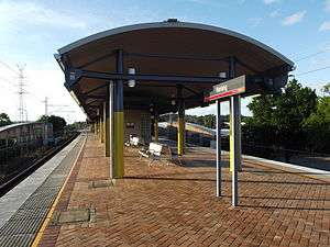
Nerang is a regional and transportation hub, containing several shopping centres and Nerang railway station.
Education
The Nerang State School was Nerang's first school which opened in 1875. Due to increasing growth of the area in the 1980s, Nerang State High School and William Duncan State School were opened in 1986 and 1987 respectively. There are numerous child care centres in the area, with four (4) state primary schools, two state high schools and a number of private schools. The Gold Coast College of TAFE is located at Ashmore which is only a few kilometres away.[6]
Community amenities
The Nerang Branch Library is located on the corner of White & Price Streets.[14] The Nerang Branch Library also holds the Special Needs Library Collection which contains specialist materials for developmental and disability needs.[15]
The Nerang branch of the Queensland Country Women's Association meets at the Girl Guide Hut at 40 Ferry Street.[16]
Sport and recreation
A number of well-known sporting teams represent the local area, including the Nerang Roosters is the local rugby league club and Nerang Bulls RUC are the local Rugby Union club who play home games at Robert Dalley Park. The Carrara Sports Ground is located a short distance away from the Nerang Train Station with Metricon Stadium being the home for of the Gold Coast Suns AFL football team. The area surrounding the Carrara Sports Ground has undertaken significant development in anticipation for the 2018 Commonwealth Games. Nerang also boasts a velodrome and a public swimming pool complex that has 3 pools owned and operated by the Gold Coast City Council. The Mudgeeraba/Nerang Cricket Club also has its home ground at Carrara with turf wicket, practice nets and club house facilities. It has teams in all grades from juniors through to first grade in the Gold Coast District Cricket competition. There are also a number of world class golf courses within easy reach from Nerang. The Nerang Division takes in areas such as Springbrook, Natural Arch, the Rock Pools and Lower Beechmont; all great places to take the family for picnics, horse riding and bush walking.[6]
Notable residents
- Sara Carrigan - Athens 2004 Olympic gold medalist in road bicycle racing
- Billy Drumley, Indigenous community leader
- Sydney Barber Josiah Skertchly (1850 – 1926), botanist and geologist, buried in the cemetery.
References
- Australian Bureau of Statistics (27 June 2017). "Nerang (State Suburb)". 2016 Census QuickStats. Retrieved 6 February 2018.

- "Nerang - town in City of Gold Coast (entry 24047)". Queensland Place Names. Queensland Government. Retrieved 22 October 2017.
- "Nerang - suburb in City of Gold Coast (entry 48134)". Queensland Place Names. Queensland Government. Retrieved 22 October 2017.
- "Nerang (State Suburb)". Archived from the original on 24 September 2015. Retrieved 10 September 2012.
- "Queensland Globe". State of Queensland. Retrieved 21 October 2017.
- Queensland Police Service - Nerang Archived 22 October 2017 at the Wayback Machine. Centre for the Government of Queensland, Queensland Police Service. Retrieved on 24 April 2018.
- Roberts, Beryl (1991). Stories of the Southside. Archerfield, Queensland: Aussie Books. p. 14. ISBN 0-947336-01-X.
- "Mooyumbin Estate, Town of Nerang". 1885. hdl:10462/deriv/18477. Cite journal requires
|journal=(help) - "Advertising". Queensland Figaro And Punch. VI (142). Queensland, Australia. 26 September 1885. p. 22. Retrieved 26 March 2019 – via National Library of Australia.
- Environmental Protection Agency (Queensland) (2000). Heritage Trails of the Great South East. State of Queensland. p. 24. ISBN 0-7345-1008-X.
- Hopkins, R.N.L. (1978). Australian Armour: A History of the Royal Australian Armoured Corps 1927–1972. Canberra: Australian Government Publishing Service. p. 140. ISBN 0-642-99407-2.
- Department of Main Roads Annual Report 1978-1979
- "Public Libraries Statistical Bulletin 2016-17" (PDF). Public Libraries Connect. State Library of Queensland. November 2017. Archived (PDF) from the original on 30 January 2018. Retrieved 29 January 2018.
- "Nerang Branch Library". Public Libraries Connect. State Library of Queensland. 16 October 2014. Archived from the original on 29 January 2018. Retrieved 29 January 2018.
- "Special Needs Library". Gold Coast City Council. Retrieved 30 January 2018.
- "Branch Locations". Queensland Country Women's Association. Retrieved 26 December 2018.
External links
| Wikimedia Commons has media related to Nerang, Queensland. |
- "Nerang and Nerang Shire". Queensland Places. Centre for the Government of Queensland, University of Queensland.
- Gold Coast Hinterland Heritage Museum
- Nerang National Park and Nerang State Forest
- Special Needs Library
- Nerang Branch Library
- Town map of Nerang, 1979
- "Nerang Police Station" (PDF). Queensland Police Service. Archived (PDF) from the original on 22 October 2017. Contains local history.