Nerang River
The Nerang River is a perennial river located in South East Queensland, Australia. Its catchment lies within the Gold Coast local government area and covers an area of 490 square kilometres (190 sq mi).[2] The river is approximately 62 kilometres (39 mi) in length.
| Nerang | |
|---|---|
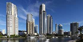
 View south at Surfers Paradise, 2007 | |
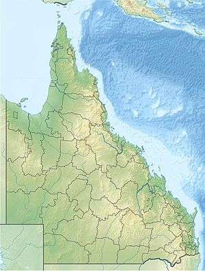 Location of the Nerang River mouth in Queensland | |
| Etymology | Yugambeh: little or shovel-nosed shark |
| Location | |
| Country | Australia |
| State | Queensland |
| Region | South East Queensland |
| Local government area | City of Gold Coast |
| City | Southport |
| Physical characteristics | |
| Source | McPherson Range |
| ⁃ location | Numinbah Valley |
| ⁃ coordinates | 28°14′34″S 153°15′15″E |
| ⁃ elevation | 138 m (453 ft) |
| Mouth | Gold Coast Broadwater |
⁃ location | Southport |
⁃ coordinates | 27°58′26″S 153°25′23″E |
⁃ elevation | 0 m (0 ft) |
| Length | 62 km (39 mi) |
| Basin size | 490 km2 (190 sq mi) |
| Basin features | |
| Tributaries | |
| ⁃ left | Nixon Creek, Tonys Creek, Crane Creek (Queensland) |
| ⁃ right | Nerang Creek, Bridge Creek (Queensland) |
| National park | Springbrook National Park |
| [1][2] | |
Course and features
The Nerang River rises in the McPherson Range in the Numinbah Valley on the New South Wales and Queensland border and heads north, then east where it flows through Nerang and reaching its mouth in the Gold Coast Broadwater at Southport on the Gold Coast and emptying into the Coral Sea. The river descends 255 metres (837 ft) over its 62-kilometre (39 mi) course. Major crossings of the river occur at Nerang where the river is crossed by the Pacific Motorway and at Southport where the river is crossed by the Gold Coast Highway.[1]
The Nerang River catchment is the largest and most significant river system on the Gold Coast.[2] Its upper reaches in the McPherson Range and Springbrook Plateau deliver flows through significant rural areas and also feed into the Hinze Dam, creating Advancetown Lake, the Gold Coast's main water supply, and Little Nerang Dam. These two reservoirs provide a large percentage of potable water for the Gold Coast and are managed by Gold Coast Water. The Hinze Dam has had a significant flood mitigation effect.[3] In the river's lower catchment, multi-branched canal developments and a number of artificial tidal and freshwater lake systems have influenced and altered large aras of the floodplain. These canal developments provide a range of opportunities for many residents including boating and recreational fishing. The canals and lakes provide habitat to a range of aquatic, terrestrial and marine flora and fauna. The canal systems provide for drainage of stormwater and contribute to flood mitigation, but can periodically be subject to contamination via stormwater drainage.[2]
A number of islands are located in the canal region of the river's lower catchment, including the Girung, Paradise, Chevron, Cronin and McIntosh Islands. Two man-made lakes are also located in the lower catchment, including the Lake Rosser and Lake Capabella.
The river's mouth was once located much further south. In the early 1800s it entered the ocean at Broadbeach and by 1930 its mouth was located where Sea World now is.[4] The main driving force for this movement is the northward drift of sand along the coast.[4]
Crossings
A number of river crossings of the Nerang River are named, including the following listed below (from upstream to downstream), together with their location relative to tributaries of the river:
| Crossing name | Location(s) | Coordinates | Image | Purpose | Notes |
|---|---|---|---|---|---|
| Lyons Crossing | 28°11′52″S 153°13′51″E | ||||
| Staffords Road Causeway | 28°09′55″S 153°13′18″E | ||||
| Nixon Creek | |||||
| Tony's Creek | |||||
| Unnamed |
| 28°09′19″S 153°13′25″E | |||
| Priems Crossing | 28°06′30″S 153°14′39″E | ||||
| Nerang Creek | |||||
| Hinze Dam | 28°02′59″S 153°16′50″E | Pedestrian only | |||
| Narrow Bridge | 28°02′44″S 153°17′08″E | Road traffic below Hinze Dam wall | |||
| Bridge Creek | |||||
| Latimers Crossing | 28°01′34″S 153°17′52″E | ||||
| The Grand Golf Club | 28°00′52″S 153°18′29″E | Private bridge | |||
| R. A. Stevens Bridge |
| 27°59′54″S 153°18′41″E | |||
| Crane Creek | |||||
| Weedons Crossing |
| 27°59′48″S 153°19′42″E | |||
| Pacific Motorway interchange |
| 27°59′26″S 153°20′19″E | |||
| 27°59′14″S 153°20′28″E | Dual carriageway | |||
| Gold Coast railway line | 27°59′12″S 153°20′53″E | Passenger rail | |||
| Ross Street Bridge | 28°00′30″S 153°22′14″E | Dual carriageway | |||
| Bermuda Street Bridge |
| 28°00′59″S 153°24′40″E | Dual carriageway | ||
| Isle of Capri Bridge |
| 28°00′34″S 153°25′36″E | Via Roma | ||
| Chevron Island |
| 27°59′51″S 153°24′55″E | 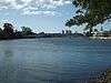 | via Thomas Drive (west) | |
| 27°59′55″S 153°25′32″E | via Thomas Drive (east) | |||
| 27°59′40″S 153°25′03″E | via Southern Cross Drive | |||
| Anabranch Bridges |
| 27°59′21″S 153°25′41″E | Gold Coast Highway | ||
| 27°58′59″S 153°25′28″E | ||||
| Sundale Bridge | 27°58′37″S 153°25′16″E | 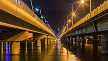 | |||
| Gold Coast Light Rail Bridge | 375 metres (1,230 ft) long with 12 spans supported by 26 bored concrete piles with steel liners. | [5] | |||
| Jubilee Bridge | 27°58′28″S 153°25′22″E | 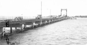 | Removed in 1966 | [6] | |
| Gold Coast Broadwater | |||||
Etymology


The river was initially named the River Barrow by government surveyor Robert Dixon when he charted the Gold Coast in 1840, after Sir John Barrow, Secretary of the Admiralty.[7][8] The surveyor general Thomas Mitchell later changed many places to Aboriginal names, and this included giving the Nerang River its present name. Neerang or neerung are Yugambeh words meaning "little shark" or "shovel-nosed shark".[7] But the local aboriginal people called the river Mogumbin or Been-goor-abee; and the peoples of the Tweed called it Talgai.
Recreation
Surfers Riverwalk


The City of Gold Coast Council is considering investing into the quality and capacity of the Surfers Riverwalk. The route would connect the Gold Coast Highway Bridge crossing of the Nerang River at Main Beach to Pacific Fair Shopping Centre at Broadbeach. The route includes
- The western facing beaches of Main Beach
- The anabranch foreshores of McIntosh Island.
- Jaraparilla Cove
- The Marriott Hotel boardwalk
- Budds Beach
- Surfers Central Riverwalk[9] from Budds Beach to Lionel Perry Park
- The Paradise Island anabranch
- Cannes Avenue Reach of the Nerang River
- Cascade Gardens foreshores of Little Tallebudgera Creek
- Gold Coast Convention & Exhibition Centre boardwalk
- The Star Gold Coast Island foreshores
- Pacific Fair Shopping Centre
Boatramps
Boatramps that are open to the public are located at Waterways Drive at Main Beach, Budds Beach, Evandale, on the Isle of Capri, TE Peters Drive at Broadbeach Waters (Convention Centre), Carrara Road, Carrara, and at the Nerang River Parklands.
Nerang Riverkeepers Group
Established in 2000, under the Beaches to Bushland Volunteer restoration program, the group works to restore local endemic species along the Nerang River.[10] A major ongoing project is control of the invasive cats claw creeper, registered as a Weed of National Significance.[11] Cat’s claw creeper was introduced to Australia. It is native to Central and South America and the West Indies. It was first reported as naturalised in the 1950s. The seeds spread by wind or water. A woody vine, it invades warm native forests killing native trees and undergrowth. If cut down it can regrow from persistent underground tubers.
References
- "Map of Nerang River, QLD". Bonzle Digital Atlas of Australia. Retrieved 28 September 2015.
- "Nerang River Catchment". City of Gold Coast. Retrieved 28 September 2015.
- "Flood Warning System For The Nerang River". Bureau of Meteorology (Australia). Retrieved 3 September 2009.
- "History of the Gold Coast Seaway". Gold Coast Waterways Authority. 28 August 2013. Retrieved 1 October 2015.
- "Piling and Bridges: Fact Sheet" (PDF). GoldLinq. June 2013. Retrieved 15 January 2015.
- "Jubilee Bridge (South Side)". Geocaching. Retrieved 15 January 2015.
- "Nerang River (entry 24050)". Queensland Place Names. Queensland Government. Retrieved 28 September 2015.
- "Place Names of South-East Queensland". Piula Publications. Archived from the original on 19 August 2008.
- Surfers Central Riverwalk
- "Nerang Riverkeepers Group". Gold Coast Parks. Retrieved 3 December 2013.
- "Weed Management Guide, Cat's claw creeper (Dolichandra unguis-cati)". Department of Agriculture, Fisheries and Forestry. Archived from the original on 6 December 2013. Retrieved 3 December 2013.
External links
| Wikimedia Commons has media related to Nerang River. |
- The History of the Gold Coast at reflections.com.au
- "Nerang River Catchment (Level 1)" (PDF) (Map). Nerang River Catchment Maps. Gold Coast City Council. 25 May 2009.
- "Nerang River Catchment: Insert (Level 1)" (PDF) (Map). Nerang River Catchment Maps. Gold Coast City Council. 25 May 2009.
Rivers of Queensland | |||||||||||||||
|---|---|---|---|---|---|---|---|---|---|---|---|---|---|---|---|
| |||||||||||||||
| |||||||||||||||
| |||||||||||||||
| |||||||||||||||
| |||||||||||||||
| |||||||||||||||