Bonogin, Queensland
Bonogin is a rural hinterland locality in the City of Gold Coast, Queensland, Australia.[2] In the 2016 census, Bonogin had a population of 4,573 people.[1]
| Bonogin Gold Coast, Queensland | |||||||||||||||
|---|---|---|---|---|---|---|---|---|---|---|---|---|---|---|---|
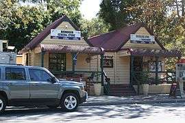 Bonogin General Store, 2012 | |||||||||||||||
 Bonogin | |||||||||||||||
| Coordinates | 28.1352°S 153.3583°E | ||||||||||||||
| Population | 4,573 (2016 census)[1] | ||||||||||||||
| • Density | 118.17/km2 (306.0/sq mi) | ||||||||||||||
| Postcode(s) | 4213 | ||||||||||||||
| Area | 38.7 km2 (14.9 sq mi) | ||||||||||||||
| Time zone | AEST (UTC+10:00) | ||||||||||||||
| Location | 81 km (50 mi) S of Brisbane | ||||||||||||||
| LGA(s) | City of Gold Coast | ||||||||||||||
| State electorate(s) | Mudgeeraba | ||||||||||||||
| Federal Division(s) | |||||||||||||||
| |||||||||||||||
Geography
Bonogin is on the edge of the Gold Coast hinterland.[3] It is about 81 kilometres (50 mi) away from Brisbane.[4]
History
The origin of name is not known, but it is speculated that it is derived from the Aboriginal word Boonoo meaning red bloodwood.[5]
European settlement commenced in the 1870s. The early industries were timber cutting and dairying. Later bananas were grown.[5]
Approval was given to establish a school in 1913.[6] Bonogin Creek State School opened on 7 July 1913. There were closures due to teacher shortages in 1917 and 1921. The school finally closed on 30 March 1924.[5][7] The school building was relocated to Wunburra (near Springbrook) in 1934.[8]
In the 1980s, some of the farms were subdivided to form acreage residential developments.[5]
According to the 2011 census it had a population of 4,182.[9][4]
In the 2016 census, Bonogin had a population of 4,573 people.[1]
Bonogin Creek
Part of the City of Gold Coast's Beaches to Bushland volunteer restoration program includes Bonogin Creek. The primary tributary of the creek begins in the Gold Coast hinterland. A hinterland regional park bushcare group was established in 1999 to address conservation of local plant species and also attempt to restore natural habitat of the creek. Davenport Park is a suburban park running along a lower point of the creek, within suburban Bonogin. In 2013 Bonogin Valley bushcare group formed to help with restoration of the park and creek area.[10]
Amenities
The Gold Coast City Council operates a fortnightly mobile library service which visits Davenport Park on Bonogin Road East.[11]
References
- Australian Bureau of Statistics (27 June 2017). "Bonogin (SSC)". 2016 Census QuickStats. Retrieved 20 October 2018.

- "Bonogin - locality in City of Gold Coast (entry 46030)". Queensland Place Names. Queensland Government. Retrieved 26 January 2020.
- Gold Coast Suburb Guide – Bonogin, QLD, 4213. Retrieved 25 August 2012.
- Bonogin Demographics (QLD) Local Stats. Retrieved 25 August 2012.
- "Bonogin History". History of our suburbs. City of Gold Coast Council. Retrieved 26 April 2014.
- "CLASSIFICATIONS AND TRANSFERS OF STATE SCHOOL TEACHERS". The Queenslander. National Library of Australia. 29 March 1913. p. 14. Retrieved 27 April 2014.
- Queensland Family History Society (2010), Queensland schools past and present (Version 1.01 ed.), Queensland Family History Society, ISBN 978-1-921171-26-0
- "PUBLIC WORKS". The Courier-Mail. Brisbane: National Library of Australia. 24 August 1934. p. 23. Retrieved 27 April 2014.
- Australian Bureau of Statistics (31 October 2012). "Bonogin (SSC)". 2011 Census QuickStats. Retrieved 26 April 2014.
- "Bonogin Bushcare Group". Gold Coast Parks. Archived from the original on 13 November 2013. Retrieved 3 December 2013.
- "Mobile Library 2018 timetable" (PDF). Gold Coast City Council. Archived from the original (PDF) on 30 January 2018. Retrieved 30 January 2018.
External links
| Wikimedia Commons has media related to Bonogin, Queensland. |
- "Bonogin". Queensland Places. Centre for the Government of Queensland, University of Queensland.