Tallebudgera Valley, Queensland
Tallebudgera Valley is an outer locality in the City of Gold Coast, Queensland, Australia.[2] It borders New South Wales.[3] In the 2016 census, Tallebudgera Valley had a population of 1624 people.[1]
| Tallebudgera Valley Gold Coast, Queensland | |||||||||||||||
|---|---|---|---|---|---|---|---|---|---|---|---|---|---|---|---|
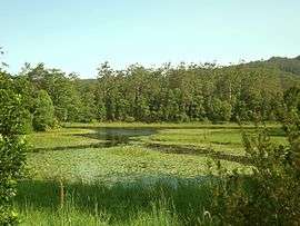 Tallebudgera Creek Dam, 2015 | |||||||||||||||
 Tallebudgera Valley | |||||||||||||||
| Coordinates | 28.1858°S 153.3627°E | ||||||||||||||
| Population | 1,624 (2016 census)[1] | ||||||||||||||
| • Density | 27.022/km2 (69.99/sq mi) | ||||||||||||||
| Postcode(s) | 4228 | ||||||||||||||
| Area | 60.1 km2 (23.2 sq mi) | ||||||||||||||
| LGA(s) | City of Gold Coast | ||||||||||||||
| State electorate(s) | Mudgeeraba | ||||||||||||||
| Federal Division(s) | McPherson | ||||||||||||||
| |||||||||||||||
Ingleside is a neighbourhood within Tallebudgera Valley (28.1658°S 153.3817°E).[4]
Geography
Tallebudgera Valley is situated in the Gold Coast hinterland along the Queensland/New South Wales border. In the far south west of the suburb the elevation rises to 800 m above sea level. This area is protected within Springbrook National Park.
History
Westbury Provisional School opened in 21 Mar 1892, becoming Westbury State School on 1 January 1909. It was renamed Ingleside State School on 25 January 1926.[5]
Demographics
In the 2011 census, Tallebudgera Valley recorded a population of 1,557 people, 49.2% female and 50.8% male.[6] The median age of the Tallebudgera Valley population was 43 years, 6 years above the national median of 37. 74.3% of people living in Tallebudgera Valley were born in Australia. The other top responses for country of birth were England 5.8%, New Zealand 5.5%, South Africa 0.9%, Netherlands 0.8%, Germany 0.6%. 89% of people spoke only English at home; the next most common languages were 0.8% French, 0.6% Dutch, 0.4% German, 0.3% Norwegian, 0.3% Maltese.[6]
Amenities
The Gold Coast City Council operates a fortnightly mobile library service which visits Ingleside State School, Tallebudgera Creek Road.[7]
Education
Ingleside State School is a government primary (Prep-6) school for boys and girls at 893 Tallebudgera Creek Road (28.1656°S 153.3814°E).[8][9] In 2017, the school had an enrolment of 109 students with 13 teachers (7 full-time equivalent) and 6 non-teaching staff (4 full-time equivalent).[10]
References
- Australian Bureau of Statistics (27 June 2017). "Tallebudgera Valley (SSC)". 2016 Census QuickStats. Retrieved 20 October 2018.

- "Tallebudgera Valley - locality in City of Gold Coast (entry 46091)". Queensland Place Names. Queensland Government. Retrieved 28 May 2019.
- "Queensland Globe". State of Queensland. Retrieved 3 May 2020.
- "Ingleside (entry 16680)". Queensland Place Names. Queensland Government. Retrieved 22 November 2015.
- Queensland Family History Society (2010), Queensland schools past and present (Version 1.01 ed.), Queensland Family History Society, ISBN 978-1-921171-26-0
- Australian Bureau of Statistics (31 October 2012). "Tallebudgera Valley (State Suburb)". 2011 Census QuickStats. Retrieved 6 February 2018.
- "Mobile Library 2018 timetable" (PDF). Gold Coast City Council. Archived from the original (PDF) on 30 January 2018. Retrieved 30 January 2018.
- "State and non-state school details". Queensland Government. 9 July 2018. Archived from the original on 21 November 2018. Retrieved 21 November 2018.
- "Ingleside State School". Archived from the original on 1 November 2018. Retrieved 21 November 2018.
- "ACARA School Profile 2017". Archived from the original on 22 November 2018. Retrieved 22 November 2018.