Maudsland, Queensland
Maudsland is a rural locality in the north of City of Gold Coast on the coast of Queensland, Australia.[2] Maudsland features acreage properties, a number of housing estates including acreage and neighbourhood ones. At the 2016 census, 5,568 people lived in the suburb.[1] The suburb's postcode is 4210.
| Maudsland Queensland | |||||||||||||||
|---|---|---|---|---|---|---|---|---|---|---|---|---|---|---|---|
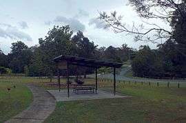 Park along Tuxedo Junction Drive, 2016 | |||||||||||||||
 Maudsland | |||||||||||||||
| Coordinates | 27°56′01″S 153°16′50″E | ||||||||||||||
| Population | 5,568 (2016 census)[1] | ||||||||||||||
| Postcode(s) | 4210 | ||||||||||||||
| Location | |||||||||||||||
| LGA(s) | City of Gold Coast | ||||||||||||||
| State electorate(s) | Theodore | ||||||||||||||
| Federal Division(s) | Wright | ||||||||||||||
| |||||||||||||||
Geography
Oxenford - Maudsland is bounded by the Coomera River in the north and west, the Pacific Motorway, Universal Street, Hervey Street, Binstead Way, Kopps Road, Saltwater Creek, Greenway Boulevard, Roberts Drive and the locality of Pacific Pines in the east, and the locality of Nerang, Beaudesert-Nerang Road and Maudsland Road in the south.
History
Maudsland Provisional School opened on 13 October 1879 under head teacher John William Scott and became a state school on 1 January 1909. It closed on 15 April 1963 and its remaining students and its buildings were transferred to Coomera State School. The school grounds were converted to parkland by the Albert Shire Council.[3][4][5][6]
Maudsland was connected to the telephone network in 1924.[7]
Estates
Acreage estates include Huntington Downs and Tuxedo Junction, both off Maudsland Road, one of the busier and important roads in the suburb. There are also non-acreage neighbourhood estates such as Parklake and Riverstone Crossing, and Huntington Rise is being constructed.
Facilities
Facilities in Maudsland include a large park and playground in the estate of Parklake, with a field, barbecue and picnic facilities, and play areas.
The Maudsland Village Shopping Centre and an adjacent childcare centre were severely damaged by fire in August 2012.[8][9] Neighbouring businesses including a liquor store and tavern were undamaged. The shopping centre reopened in 2013.
Nearby to the suburb are numerous schools and Westfield Helensvale, a large shopping centre. Also located here is the Helensvale railway station.
References
- Australian Bureau of Statistics (27 June 2017). "Maudsland (State Suburb)". 2016 Census QuickStats. Retrieved 6 February 2018.

- "Maudsland (entry 46060)". Queensland Place Names. Queensland Government. Retrieved 11 June 2014.
- "Opening and closing dates of Queensland Schools". Queensland Government. Retrieved 11 June 2014.
- Queensland Family History Society (2010), Queensland schools past and present (Version 1.01 ed.), Queensland Family History Society, ISBN 978-1-921171-26-0
- "Agency ID6193, Maudsland State School". Queensland State Archives. Retrieved 12 June 2014.
- "History". Coomera State School. Coomera State School. Retrieved 12 June 2014.
- "Telephone for Maudsland". The Brisbane Courier. National Library of Australia. 24 January 1924. p. 5. Retrieved 12 June 2014.
- "Shopping complex destroyed by fire on Maudsland Rd and Killarney Ct at Oxenford on the Gold Coast". The Courier Mail. 20 August 2012. Retrieved 28 August 2017.
- "Maudsland Shopping Village Case Study" (PDF). Bay Building Group. Retrieved 28 August 2017.
Further reading
- Coghill, Gloria A; Coomera State School (1998), 125 Years of schooling on the Coomera 1873–1998, G. Coghill, ISBN 978-0-646-35838-3 — includes Maudsland State School
External links
| Wikimedia Commons has media related to Maudsland, Queensland. |
- "Gold Coast Inner Hinterland". Queensland Places. Centre for the Government of Queensland, University of Queensland. — includes Maudsland