National Register of Historic Places listings in San Diego County, California
This is a list of the National Register of Historic Places listings in San Diego County, California.
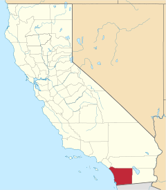
Location of San Diego County in California
This is intended to be a complete list of the properties and districts on the National Register of Historic Places in San Diego County, California, United States. Latitude and longitude coordinates are provided for many National Register properties and districts; these locations may be seen together in an online map.[1]
There are 151 properties and districts listed on the National Register in the county, including 17 National Historic Landmarks. Another 4 properties were once listed but have been removed.
- This National Park Service list is complete through NPS recent listings posted June 19, 2020.[2]
Current listings
| [3] | Name on the Register[4] | Image | Date listed[5] | Location | City or town | Description |
|---|---|---|---|---|---|---|
| 1 | Americanization School |  Americanization School |
April 8, 1994 (#94000311) |
1210 Division St. 33°11′46″N 117°22′16″W |
Oceanside | |
| 2 | Anza Borrego-Palo Verde Site, S-2 | October 25, 1985 (#85003431) |
Address Restricted |
Borrego Springs | ||
| 3 | Anza Borrego-Sin Nombre, S-4 | October 25, 1985 (#85003432) |
Address Restricted |
Borrego Springs | ||
| 4 | Anza Borrego-Split Mountain Site, S-3 |  Anza Borrego-Split Mountain Site, S-3 |
October 25, 1985 (#85003433) |
Address Restricted |
Borrego Springs | |
| 5 | Pearl Baker Row House | .jpg) Pearl Baker Row House |
September 30, 1993 (#93001018) |
6122 Paseo Delicias 33°01′15″N 117°12′06″W |
Rancho Santa Fe | |
| 6 | Balboa Park | 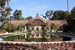 Balboa Park |
December 22, 1977 (#77000331) |
CA Quadrangle 41 32°43′50″N 117°09′03″W |
San Diego | |
| 7 | Balboa Theatre | 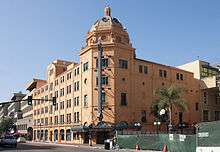 Balboa Theatre |
October 24, 1996 (#96001177) |
868 4th Ave. 32°42′50″N 117°09′38″W |
San Diego | |
| 8 | Hubert H. Bancroft Ranchhouse | .jpg) Hubert H. Bancroft Ranchhouse |
October 15, 1966 (#66000227) |
Bancroft Dr. off CA 94 32°44′11″N 116°59′18″W |
Spring Valley | |
| 9 | Bandy House | 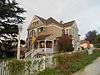 Bandy House |
January 12, 1993 (#92001754) |
638 S. Juniper 33°07′05″N 117°01′13″W |
Escondido | |
| 10 | A.H. Beach House |  A.H. Beach House |
December 30, 1993 (#93001462) |
700 S. Juniper 33°07′04″N 117°04′25″W |
Escondido | |
| 11 | Bear Valley Archeological Site | July 30, 1974 (#74000547) |
Address Restricted |
Pine Valley | ||
| 12 | John R. and Florence Porterfield Beardsley House | 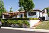 John R. and Florence Porterfield Beardsley House |
December 22, 2011 (#11000943) |
3130 Shadowlawn St. 32°44′45″N 117°12′48″W |
San Diego | |
| 13 | Berkeley (ferryboat) | 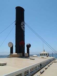 Berkeley (ferryboat) |
December 14, 1990 (#90002220) |
B St. Pier 32°43′07″N 117°10′22″W |
San Diego | |
| 14 | Samuel Bingham House | .jpg) Samuel Bingham House |
August 5, 1991 (#91000942) |
6427 La Plateada 33°01′32″N 117°11′19″W |
Rancho Santa Fe | |
| 15 | Ellis Bishop House | January 5, 1999 (#98001552) |
4802 El Arco Iris 33°00′20″N 117°13′43″W |
Rancho Santa Fe | ||
| 16 | William Black House-SDM-W-12 Locus A (CA-SDI-4669) | William Black House-SDM-W-12 Locus A (CA-SDI-4669) |
May 2, 2008 (#08000343) |
Address Restricted |
La Jolla | |
| 17 | Charles A. Braun House | January 5, 1986 (#86000010) |
790 Vale View Dr. 33°11′10″N 117°14′50″W |
Vista | ||
| 18 | Brick Row | 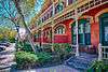 Brick Row |
July 16, 1973 (#73000431) |
A Ave. between 9th and 10th Sts. 32°40′29″N 117°06′19″W |
National City | |
| 19 | Bumann Ranch | March 6, 2020 (#100004937) |
3666 Bumann Rd. 33°03′28″N 117°12′08″W |
Encinitas | ||
| 20 | Burnham-Marston House | September 22, 1986 (#86002665) |
3563 Seventh Ave. 32°44′34″N 117°09′23″W |
San Diego | ||
| 21 | Cabrillo National Monument |  Cabrillo National Monument |
October 15, 1966 (#66000224) |
10 miles (16 km) from San Diego off U.S. 10, near S tip of Point Loma 32°40′18″N 117°14′26″W |
San Diego | |
| 22 | California Quadrangle | 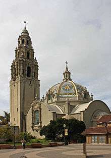 California Quadrangle |
May 17, 1974 (#74000548) |
Balboa Park-El Prado Area 32°43′53″N 117°09′06″W |
San Diego | |
| 23 | Canfield-Wright House | 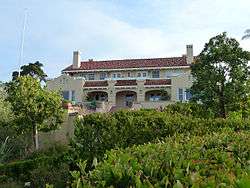 Canfield-Wright House |
May 14, 2004 (#02001747) |
420 Avenida Primavera 32°57′51″N 117°15′47″W |
Del Mar | |
| 24 | Carlsbad Santa Fe Depot | 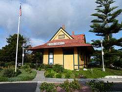 Carlsbad Santa Fe Depot |
September 30, 1993 (#93001016) |
400 Carlsbad Village Dr. (Elm Ave.) 33°09′34″N 117°20′55″W |
Carlsbad | Now houses Visitor Information Center |
| 25 | Norman and Florence B. Carmichael House | .jpg) Norman and Florence B. Carmichael House |
August 5, 1991 (#91000941) |
6855 La Valle Plateada 33°01′31″N 117°11′05″W |
Rancho Santa Fe | |
| 26 | Case Study House No. 23C | July 24, 2013 (#13000521) |
2339 Rue de Anne 32°50′36″N 117°15′11″W |
La Jolla | One of the Case Study Houses | |
| 27 | The Castle | March 30, 1978 (#78000749) |
West of Ramona 33°00′49″N 116°57′17″W |
Ramona | ||
| 28 | Chaplain's House |  Chaplain's House |
November 24, 1978 (#78000750) |
836 Washington St. 32°45′02″N 117°09′20″W |
San Diego | |
| 29 | Chicano Park | 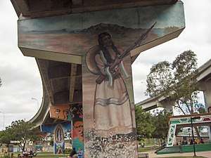 Chicano Park |
January 23, 2013 (#12001192) |
Near National Ave. & Dewey St. 32°42′01″N 117°08′35″W |
San Diego | |
| 30 | George A. C. Christiancy House | August 5, 1991 (#91000943) |
17078 El Mirador 33°01′45″N 117°11′17″W |
Rancho Santa Fe | ||
| 31 | City of San Diego Police Headquarters, Jails and Courts |  City of San Diego Police Headquarters, Jails and Courts |
July 9, 1998 (#98000833) |
801 W. Market St. 32°42′39″N 117°10′09″W |
San Diego | |
| 32 | Reginald M. and Constance Clotfelter Row House | .jpg) Reginald M. and Constance Clotfelter Row House |
August 5, 1991 (#91000939) |
6112 Paseo Delicias 33°01′14″N 117°12′08″W |
Rancho Santa Fe | |
| 33 | Coulter House |  Coulter House |
September 30, 1983 (#83001227) |
3162 2nd Ave. 32°44′18″N 117°09′42″W |
San Diego | |
| 34 | Cuyamaca Village | April 2, 2008 (#07000935) |
Address Restricted |
San Diego | ||
| 35 | Eagles Hall |  Eagles Hall |
October 4, 1985 (#85002723) |
733 Eighth Ave. 32°42′47″N 117°09′21″W |
San Diego | |
| 36 | Edgemoor Farm Dairy Barn |  Edgemoor Farm Dairy Barn |
May 16, 1985 (#85001065) |
9064 Edgemoor Dr., Edgemoor Geriatric Hospital 32°50′36″N 116°58′09″W |
Santee | |
| 37 | El Cortez Apartment Hotel | 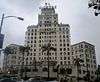 El Cortez Apartment Hotel |
January 17, 2002 (#01001458) |
702 Ash St. 32°43′14″N 117°09′25″W |
San Diego | |
| 38 | El Prado Complex | 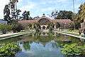 El Prado Complex |
December 12, 1976 (#76000515) |
Balboa Park 32°43′52″N 117°09′07″W |
San Diego | |
| 39 | Encinitas Boathouses | 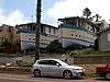 Encinitas Boathouses |
October 21, 2019 (#100004530) |
726 & 732 3rd St. 33°02′33″N 117°17′45″W |
Encinitas | |
| 40 | Estudillo House | 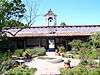 Estudillo House |
April 15, 1970 (#70000143) |
4000 Mason St. 32°45′14″N 117°11′45″W |
San Diego | |
| 41 | Fages-De Anza Trail-Southern Emigrant Road | January 29, 1973 (#73002252) |
Anza-Borrego State Park |
Borrego Springs | ||
| 42 | Felicita County Park Prehistoric Village Site | January 31, 2008 (#07001470) |
Address Restricted |
Escondido | ||
| 43 | Guy and Margaret Fleming House | 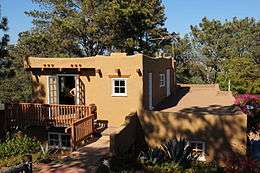 Guy and Margaret Fleming House |
June 18, 1998 (#98000700) |
12279 Torrey Pines Park Rd. 32°55′19″N 117°15′18″W |
San Diego | |
| 44 | Ford Building | 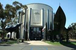 Ford Building |
April 26, 1973 (#73000433) |
Balboa Park, Palisades Area 32°43′34″N 117°09′13″W |
San Diego | |
| 45 | Fort Rosecrans National Cemetery | 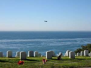 Fort Rosecrans National Cemetery |
March 8, 2016 (#16000054) |
Cabrillo Memorial Dr. 32°41′12″N 117°14′41″W |
San Diego | |
| 46 | Gaslamp Quarter Historic District | 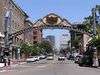 Gaslamp Quarter Historic District |
May 23, 1980 (#80000841) |
Bounded by RR tracks, Broadway, 4th, and 6th Sts. 32°42′42″N 117°09′33″W |
San Diego | |
| 47 | Georgia Street Bridge-Caltrans Bridge |  Georgia Street Bridge-Caltrans Bridge |
February 12, 1999 (#99000158) |
Georgia St. and University Ave., bet. Florida St. and Park Blvd. 32°44′55″N 117°08′40″W |
San Diego | |
| 48 | John Ginty House | 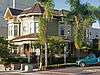 John Ginty House |
December 18, 2006 (#06001157) |
1568 Ninth Ave. 32°43′24″N 117°09′25″W |
San Diego | |
| 49 | Grand-Horton Hotel |  Grand-Horton Hotel |
June 20, 1980 (#80000842) |
332, 328 and 334 F St. 32°42′50″N 117°09′38″W |
San Diego | |
| 50 | Granger Hall | .jpg) Granger Hall |
March 18, 1975 (#75000465) |
1700 E. 4th St. 32°41′03″N 117°05′24″W |
National City | |
| 51 | U.S. Grant Hotel |  U.S. Grant Hotel |
August 27, 1979 (#79000523) |
326 Broadway St 32°42′57″N 117°09′39″W |
San Diego | |
| 52 | Guajome Ranch House | 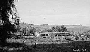 Guajome Ranch House |
April 15, 1970 (#70000145) |
2.5 miles (4.0 km) northeast of Vista 33°13′45″N 117°15′19″W |
Vista | |
| 53 | Alfred Haines House |  Alfred Haines House |
July 30, 1992 (#92000966) |
2470 E St. 32°42′54″N 117°08′25″W |
San Diego | |
| 54 | Hawthorne Inn | 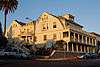 Hawthorne Inn |
March 30, 1982 (#82002245) |
2121 1st Ave. 32°43′38″N 117°09′46″W |
San Diego | |
| 55 | Heilman Villas | .jpg) Heilman Villas |
April 8, 1992 (#92000319) |
1060, 1070, 1080, 1090 Seventh St. and 706-720 (even nos.) Orange Ave. 32°41′24″N 117°10′37″W |
Coronado | |
| 56 | Holzwasser-Walker Scott Building and Owl Drug Building | 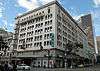 Holzwasser-Walker Scott Building and Owl Drug Building |
February 27, 2005 (#05000072) |
1014 Fifth ave. and 402-416 Broadway 32°43′05″N 117°09′39″W |
San Diego | |
| 57 | Hotel Charlotta | 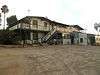 Hotel Charlotta |
January 7, 1993 (#92001752) |
637 S. Upas 33°06′36″N 117°05′26″W |
Escondido | |
| 58 | Hotel Del Coronado |  Hotel Del Coronado |
October 14, 1971 (#71000181) |
1500 Orange Ave. 32°40′51″N 117°10′39″W |
Coronado | |
| 59 | Howell House | 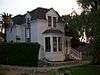 Howell House |
November 20, 1992 (#92001612) |
103 W. Eighth St. 33°06′54″N 117°04′34″W |
Escondido | |
| 60 | Independent Order of Odd Fellows Building | 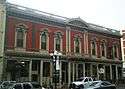 Independent Order of Odd Fellows Building |
January 31, 1978 (#78000751) |
526 Market St. 32°42′42″N 117°09′31″W |
San Diego | |
| 61 | Initial Point of Boundary Between U.S. and Mexico | .jpg) Initial Point of Boundary Between U.S. and Mexico |
September 6, 1974 (#74000550) |
South of Imperial Beach off Monument Rd. 32°32′04″N 117°07′19″W |
San Diego | |
| 62 | Johnson-Taylor Ranch Headquarters | October 31, 1980 (#80000843) |
East of San Diego and Black Mountain Rd. 32°56′18″N 117°08′18″W |
San Diego | ||
| 63 | Martha Kinsey House | August 7, 1992 (#92000968) |
1624 Ludington Ln. 32°50′52″N 117°16′28″W |
La Jolla | ||
| 64 | Kuchamaa |  Kuchamaa |
October 6, 1992 (#92001268) |
Southeast of San Diego at the US-Mexico border 32°34′38″N 116°41′28″W |
Tecate | |
| 65 | Kwaaymii Homeland | August 11, 2015 (#15000506) |
Address Restricted |
Mount Laguna | ||
| 66 | La Jolla Post Office | 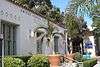 La Jolla Post Office |
January 2, 2013 (#12001109) |
1140 Wall St. 32°50′48″N 117°16′26″W |
San Diego | |
| 67 | La Jolla Woman's Club | .jpg) La Jolla Woman's Club |
November 5, 1974 (#74000546) |
715 Silverado St. 32°50′39″N 117°16′36″W |
La Jolla | |
| 68 | Lafayette Hotel | 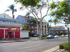 Lafayette Hotel |
July 31, 2012 (#12000443) |
2223 El Cajon Blvd. 32°45′18″N 117°08′27″W |
San Diego | |
| 69 | Las Flores Adobe | 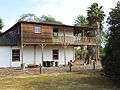 Las Flores Adobe |
November 24, 1968 (#68000021) |
Stuart Mesa Rd., about 7 miles (11 km) north of the junction -with Vandergrift Blvd. 33°17′59″N 117°27′23″W |
Camp Pendleton | 1865 Monterey Colonial, adjacent to Las Flores Estancia site |
| 70 | Las Flores Estancia | 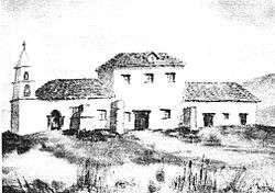 Las Flores Estancia |
May 20, 1993 (#93000391) |
Junction of Pulgas and Stuart Mesa Rds. 33°17′59″N 117°27′38″W |
Camp Pendleton | same or different than Las Flores Adobe and Las Flores Site? |
| 71 | Las Flores Site | Las Flores Site |
August 19, 1975 (#75000464) |
Address Restricted |
Camp Pendleton | Archaeological Site |
| 72 | Robert E. Lee Hotel | May 31, 1980 (#80000844) |
815 3rd Ave. and 314 F St. 32°42′50″N 117°09′39″W |
San Diego | Demolished during Westfield Horton Plaza construction | |
| 73 | Charles Libby House | 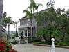 Charles Libby House |
July 12, 1978 (#78000748) |
636 Rockledge St. 33°11′29″N 117°21′58″W |
Oceanside | |
| 74 | Lindstrom House | 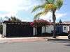 Lindstrom House |
February 13, 2001 (#01000027) |
4669 E. Talmadge Dr. 32°45′51″N 117°05′54″W |
San Diego | |
| 75 | Long-Waterman House | .jpg) Long-Waterman House |
June 14, 1976 (#76000516) |
2408 1st Ave. 32°43′49″N 117°09′48″W |
San Diego | |
| 76 | Marine Corps Recruit Depot Historic District |  Marine Corps Recruit Depot Historic District |
January 31, 1991 (#90001477) |
South of the junction of Barnett Ave. and Pacific Hwy. 32°44′31″N 117°11′50″W |
San Diego | |
| 77 | George W. Marston House | .jpg) George W. Marston House |
December 16, 1974 (#74000552) |
3525 7th Ave. 32°44′29″N 117°09′26″W |
San Diego | |
| 78 | McClintock Storage Warehouse | 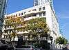 McClintock Storage Warehouse |
October 3, 1980 (#80000845) |
1202 Kettner Blvd. 32°43′05″N 117°10′07″W |
San Diego | |
| 79 | Medico-Dental Building |  Medico-Dental Building |
September 4, 1979 (#79000524) |
233 A St. 32°43′06″N 117°09′41″W |
San Diego | |
| 80 | Mission Beach Roller Coaster | Mission Beach Roller Coaster |
December 27, 1978 (#78000753) |
3000 Mission Blvd. 32°46′18″N 117°15′00″W |
San Diego | |
| 81 | Mission Brewery | 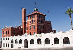 Mission Brewery |
July 6, 1989 (#89000805) |
1715 Hancock St. 32°44′30″N 117°10′59″W |
San Diego | |
| 82 | Mohnike Adobe |  Mohnike Adobe |
July 17, 2002 (#02000779) |
12115 Black Mountain Rd. 32°56′18″N 117°07′41″W |
San Diego | |
| 83 | Montecito Ranch House | July 10, 2017 (#100001284) |
1080 Montecito Way 33°03′05″N 116°54′18″W |
Ramona | ||
| 84 | Maj. Myles Moylan House | 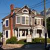 Maj. Myles Moylan House |
March 22, 1984 (#84001181) |
2214-2224 2nd Ave. 32°43′43″N 117°09′44″W |
San Diego | |
| 85 | Naval Air Station, San Diego, Historic District | 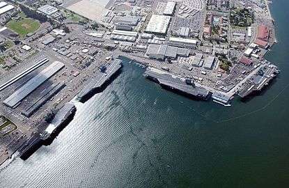 Naval Air Station, San Diego, Historic District |
May 21, 1991 (#91000590) |
Naval Air Station, North Island, N. shore 32°42′42″N 117°11′39″W |
Coronado | |
| 86 | Naval Training Center | 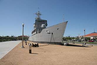 Naval Training Center |
July 5, 2001 (#00000426) |
Barnett St. and Rosecrans Blvd. 32°44′08″N 117°12′44″W |
San Diego | |
| 87 | Oak Grove Butterfield Stage Station | .jpg) Oak Grove Butterfield Stage Station |
October 15, 1966 (#66000222) |
13 miles (21 km) northwest of Warner Springs on CA 79 33°23′23″N 116°47′39″W |
Oak Grove | |
| 88 | Oceanside City Hall and Fire Station | 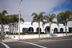 Oceanside City Hall and Fire Station |
June 7, 1989 (#89000257) |
704 and 714 Pier View Way (704 and 714 Third St.) 33°11′53″N 117°22′40″W |
Oceanside | |
| 89 | Old Mission Dam | 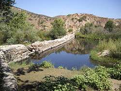 Old Mission Dam |
October 15, 1966 (#66000225) |
N side of Mission St.-Gorge Rd. 32°50′24″N 117°02′32″W |
San Diego | |
| 90 | Old Point Loma Lighthouse | 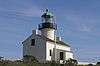 Old Point Loma Lighthouse |
June 27, 1974 (#74000350) |
Included in Cabrillo National Monument 32°40′19″N 117°14′25″W |
San Diego | |
| 91 | Old Town San Diego Historic District |  Old Town San Diego Historic District |
September 3, 1971 (#71000182) |
Junction of US 5 and US 80 32°45′15″N 117°11′47″W |
San Diego | |
| 92 | Olivenhain Town Meeting Hall |  Olivenhain Town Meeting Hall |
December 17, 1993 (#93001395) |
423 Rancho Santa Fe Rd. 33°02′36″N 117°14′04″W |
Olivenhain | |
| 93 | Juan Maria Osuna Adobe | July 10, 2017 (#100001285) |
16332 Via de Santa Fe 33°00′39″N 117°11′57″W |
Rancho Santa Fe | ||
| 94 | PCF 816 (patrol craft fast) |  PCF 816 (patrol craft fast) |
July 23, 2018 (#100002676) |
1492 N. Harbor Dr. 32°43′14″N 117°10′24″W |
San Diego | |
| 95 | Panama Hotel |  Panama Hotel |
March 22, 1984 (#84001182) |
105 W. F St. 32°42′48″N 117°09′47″W |
San Diego | |
| 96 | Park Place Methodist Episcopal Church South |  Park Place Methodist Episcopal Church South |
September 15, 1983 (#83003432) |
508 Olive St. 32°44′06″N 117°09′32″W |
San Diego | |
| 97 | Robert O. Peterson-Russell Forester House | 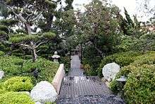 Robert O. Peterson-Russell Forester House |
April 11, 2014 (#14000136) |
567 Gage Ln. 32°42′50″N 117°14′31″W |
San Diego | |
| 98 | Pilot (boat) | 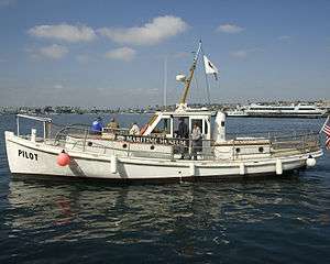 Pilot (boat) |
February 1, 2011 (#10001160) |
Maritime Museum of San Diego, 1492 N Harbor Dr. 32°43′15″N 117°10′28″W |
San Diego | |
| 99 | Portuguese Chapel of San Diego | 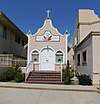 Portuguese Chapel of San Diego |
April 17, 2017 (#100000881) |
2818 Avenida de Portugal 32°43′17″N 117°13′48″W |
San Diego | |
| 100 | Pythias Lodge Building |  Pythias Lodge Building |
April 8, 1981 (#81000171) |
211 E St. and 870 3rd Ave. 32°42′52″N 117°09′41″W |
San Diego | Demolished during Westfield Horton Plaza construction; facade replica within mall shown |
| 101 | Ramona Main Street Colonnade | October 5, 2018 (#100002995) |
CA 67/78 - Main St. Coordinates missing |
Ramona | ||
| 102 | Ramona Town Hall | September 26, 1994 (#94001161) |
729 Main St. 33°02′41″N 116°51′48″W |
Ramona | ||
| 103 | Rancho De Los Kiotes |  Rancho De Los Kiotes |
March 31, 1992 (#92000261) |
6200 Flying L.C. Lane 33°07′13″N 117°14′08″W |
Carlsbad | |
| 104 | Rancho Santa Fe Land and Improvement Company Office | .jpg) Rancho Santa Fe Land and Improvement Company Office |
August 5, 1991 (#91000940) |
16915 Avenida de Acacias 33°01′10″N 117°12′11″W |
Rancho Santa Fe | |
| 105 | Red Rest and Red Roost Cottages | _Cottages_(La_Jolla%2C_CA).jpg) Red Rest and Red Roost Cottages |
March 15, 1976 (#76002247) |
1187 and 1179 Coast Blvd. 32°50′59″N 117°16′18″W |
La Jolla | |
| 106 | Renown (yacht) | 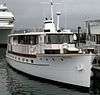 Renown (yacht) |
January 4, 2012 (#11000990) |
San Diego Marriott Marina, A Dock, 333 W. Harbor Dr. 32°42′30″N 117°10′07″W |
San Diego | Docked at Grape Street marina as of July 2014 |
| 107 | Lilian Jenette Rice House | August 5, 1991 (#91000946) |
16780 La Gracia 33°01′03″N 117°12′16″W |
Rancho Santa Fe | ||
| 108 | Robinson Hotel |  Robinson Hotel |
June 23, 1978 (#78000747) |
2032 Main St. 33°04′40″N 116°36′01″W |
Julian | |
| 109 | Rockwell Field | .jpg) Rockwell Field |
May 21, 1991 (#75002185) |
North Island 32°41′48″N 117°11′49″W |
Coronado | |
| 110 | Rosecroft |  Rosecroft |
September 22, 2003 (#03000472) |
530 Silvergate Ave. 32°41′51″N 117°14′44″W |
San Diego | |
| 111 | Rosicrucian Fellowship Temple |  Rosicrucian Fellowship Temple |
April 7, 1995 (#95000390) |
2222 Mission Ave. 33°12′36″N 117°21′30″W |
Oceanside | |
| 112 | Ruiz-Alvarado Ranch Site | 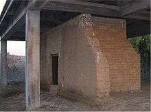 Ruiz-Alvarado Ranch Site |
January 22, 1982 (#82002246) |
Address Restricted |
San Diego | |
| 113 | San Diego Armed Services YMCA | 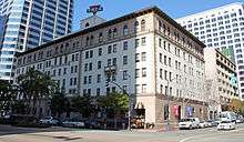 San Diego Armed Services YMCA |
November 15, 2007 (#07001177) |
500 W Broadway 32°43′05″N 117°10′05″W |
San Diego | |
| 114 | San Diego Athletic Club |  San Diego Athletic Club |
April 3, 2013 (#13000130) |
1250 6th Ave. 32°43′07″N 117°09′34″W |
San Diego | |
| 115 | San Diego Civic Center | 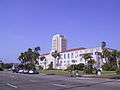 San Diego Civic Center |
May 16, 1988 (#88000554) |
1600 Pacific Hwy. 32°43′52″N 117°10′15″W |
San Diego | |
| 116 | San Diego Fire Department Shops at Station 6 | January 27, 2015 (#14001204) |
1572 Columbia St. 32°43′18″N 117°10′03″W |
San Diego | ||
| 117 | San Diego Mission Church | 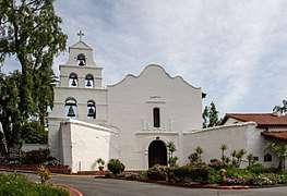 San Diego Mission Church |
April 15, 1970 (#70000144) |
5 miles (8.0 km) east of Old Town San Diego on Friars Rd. 32°47′04″N 117°06′23″W |
San Diego | |
| 118 | San Diego Presidio |  San Diego Presidio |
October 15, 1966 (#66000226) |
Presidio Park 32°45′31″N 117°11′36″W |
San Diego | |
| 119 | San Diego Rowing Club | San Diego Rowing Club |
August 30, 1979 (#79000525) |
525 E. Harbor Dr 32°42′16″N 117°09′44″W |
San Diego | |
| 120 | San Diego State College | 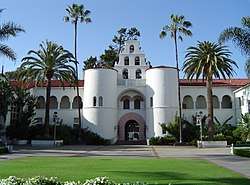 San Diego State College |
September 4, 1997 (#97000924) |
5300 Campanile Dr. 32°46′33″N 117°04′16″W |
San Diego | |
| 121 | San Diego Trust and Savings Bank Building | 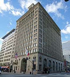 San Diego Trust and Savings Bank Building |
December 17, 1999 (#99001565) |
530-540 Broadway 32°42′57″N 117°09′31″W |
San Diego | |
| 122 | San Diego Veterans' War Memorial Building-Balboa Park | September 28, 2000 (#00001167) |
3325 Zoo Dr. 32°44′19″N 117°08′50″W |
San Diego | ||
| 123 | San Luis Rey Mission Church | San Luis Rey Mission Church |
April 15, 1970 (#70000142) |
4 miles (6.4 km) east of Oceanside on CA 76 33°13′57″N 117°19′10″W |
Oceanside | |
| 124 | Santa Fe Depot | 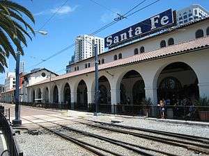 Santa Fe Depot |
June 26, 1972 (#72000248) |
1050 Kettner St. 32°43′01″N 117°10′07″W |
San Diego | |
| 125 | Santa Margarita Ranchhouse | May 6, 1971 (#71000180) |
Off Vandergrift Blvd. 33°18′36″N 117°20′25″W |
Camp Pendleton | ||
| 126 | George H. Scripps Memorial Marine Biological Laboratory | 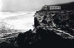 George H. Scripps Memorial Marine Biological Laboratory |
November 10, 1977 (#77000330) |
8602 La Jolla Shores Dr. 32°51′54″N 117°15′12″W |
La Jolla | |
| 127 | Charles A. Shaffer House | .jpg) Charles A. Shaffer House |
August 5, 1991 (#91000944) |
5610 La Crescenta 33°02′28″N 117°12′54″W |
Rancho Santa Fe | |
| 128 | Sorrento Valley Site | October 21, 1975 (#75000466) |
Address Restricted |
San Diego | ||
| 129 | Spreckels Theatre Building | 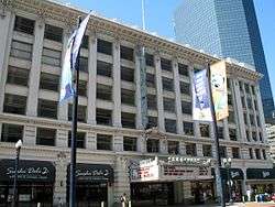 Spreckels Theatre Building |
May 28, 1975 (#75000467) |
123 W. Broadway 32°42′55″N 117°09′45″W |
San Diego | |
| 130 | St. Matthew's Episcopal Church | .jpg) St. Matthew's Episcopal Church |
October 25, 1973 (#73000432) |
521 E. 8th St. 32°40′40″N 117°06′02″W |
National City | |
| 131 | Star of India (ship) | 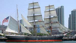 Star of India (ship) |
November 13, 1966 (#66000223) |
San Diego Embarcadero 32°42′57″N 117°10′22″W |
San Diego | |
| 132 | Station and General Office, California Southern Railroad | .jpg) Station and General Office, California Southern Railroad |
April 18, 1996 (#96000424) |
900 W. 23rd St. 32°39′36″N 117°06′38″W |
National City | |
| 133 | Sunnyslope Lodge |  Sunnyslope Lodge |
September 24, 1999 (#99001180) |
3733 Robinson Mews 32°44′44″N 117°09′52″W |
San Diego | |
| 134 | A. H. Sweet Residence and Adjacent Small House | 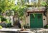 A. H. Sweet Residence and Adjacent Small House |
April 16, 1987 (#87000621) |
435 W. Spruce and 3141 Curlew Sts. 32°44′18″N 117°09′59″W |
San Diego | |
| 135 | Table Mountain District | October 28, 1983 (#83003593) |
Address Restricted |
Jacumba | ||
| 136 | Teacher Training School Building-San Diego State Normal School |  Teacher Training School Building-San Diego State Normal School |
September 9, 1998 (#98001193) |
4345 Campus Ave. 32°45′20″N 117°08′47″W |
San Diego | |
| 137 | Claude and Florence Terwilliger House | August 5, 1991 (#91000945) |
5880 San Elijo 33°02′02″N 117°12′20″W |
Rancho Santa Fe | ||
| 138 | Thomas House |  Thomas House |
December 30, 1992 (#92001684) |
208 E. Fifth Ave. 33°07′08″N 117°04′36″W |
Escondido | |
| 139 | Torrey Pines Gliderport | 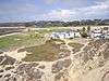 Torrey Pines Gliderport |
July 12, 1993 (#93000578) |
West of Torrey Pines Rd., bordering Torrey Pines Scenic Dr. and south and west of Torrey Pines Golf Course 32°53′23″N 117°14′54″W |
San Diego | 1930 Glider site, still used today for paragliding and hang gliding. |
| 140 | Torrey Pines Lodge | 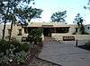 Torrey Pines Lodge |
June 18, 1998 (#98000699) |
12201 Torrey Pines Park Rd. 32°55′15″N 117°15′03″W |
San Diego | |
| 141 | Torrey Pines Park Road |  Torrey Pines Park Road |
October 22, 1998 (#98001248) |
Roughly the North/South R. within Torrey Pines State Reserve 32°55′10″N 117°15′03″W |
San Diego | |
| 142 | University Heights Water Storage and Pumping Station Historic District | 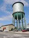 University Heights Water Storage and Pumping Station Historic District |
June 24, 2013 (#13000417) |
4236 Idaho St. 32°45′16″N 117°08′03″W |
San Diego | One building, three sites, and six structures[6] |
| 143 | U.S. Courthouse | 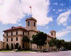 U.S. Courthouse |
January 29, 1975 (#75000468) |
325 W. F St. 32°42′48″N 117°09′55″W |
San Diego | |
| 144 | U.S. Inspection Station/U.S. Custom House | 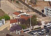 U.S. Inspection Station/U.S. Custom House |
February 10, 1983 (#83001228) |
Virginia and Tijuana Sts. 32°32′34″N 117°01′41″W |
San Ysidro | |
| 145 | US Inspection Station-Tecate | .jpg) US Inspection Station-Tecate |
February 14, 1992 (#91001748) |
CA 188 32°34′36″N 116°37′36″W |
Tecate | |
| 146 | US Post Office-Downtown Station | US Post Office-Downtown Station |
January 11, 1985 (#85000137) |
815 E St. 32°42′51″N 117°09′22″W |
San Diego | |
| 147 | Theophile Verlaque House | August 7, 1991 (#91000548) |
645 Main St. 33°02′43″N 116°51′43″W |
Ramona | ||
| 148 | Villa Montezuma | .jpg) Villa Montezuma |
May 6, 1971 (#71000183) |
1925 K St. 32°42′29″N 117°08′46″W |
San Diego | |
| 149 | Warner's Ranch | .jpg) Warner's Ranch |
October 15, 1966 (#66000228) |
4 miles (6.4 km) south of Warner Springs 33°14′19″N 116°39′03″W |
Warner Springs | |
| 150 | Watts Building | 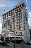 Watts Building |
April 26, 1979 (#79000526) |
520 E St. 32°42′53″N 117°09′32″W |
San Diego | |
| 151 | Wiipuk uun'yaw Trail | January 17, 2017 (#100000463) |
Address Restricted |
Mount Laguna vicinity |
Former listings
| [3] | Name on the Register | Image | Date listed | Date removed | Location | City or town | Summary |
|---|---|---|---|---|---|---|---|
| 1 | Aztec Bowl | 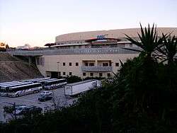 Aztec Bowl |
May 19, 1994 (#94000402) | May 30, 2012 | Hardy Ave. between 55th St. and Campanile Dr., San Diego State University 32°46′26″N 117°04′26″W |
San Diego | |
| 2 | William Heath Davis House | February 15, 1974 (#74000549) | Unknown | 227 11th St. |
San Diego | ||
| 3 | Melville Klauber House | November 13, 1974 (#74000551) | Unknown | 3060 6th Ave. |
San Diego | ||
| 4 | Temple Beth Israel | May 22, 1978 (#78000752) | Unknown | 1502 2nd Ave. |
San Diego |
See also
| Wikimedia Commons has media related to National Register of Historic Places in San Diego County, California. |
- California Historical Landmarks in San Diego County, California
- List of San Diego Historic Landmarks
- List of National Historic Landmarks in California
- Lists of National Register of Historic Places in California by county
References
- The latitude and longitude information provided in this table was derived originally from the National Register Information System, which has been found to be fairly accurate for about 99% of listings. Some locations in this table may have been corrected to current GPS standards.
- "National Register of Historic Places: Weekly List Actions". National Park Service, United States Department of the Interior. Retrieved on June 19, 2020.
- Numbers represent an ordering by significant words. Various colorings, defined here, differentiate National Historic Landmarks and historic districts from other NRHP buildings, structures, sites or objects.
- "National Register Information System". National Register of Historic Places. National Park Service. July 9, 2010.
- The eight-digit number below each date is the number assigned to each location in the National Register Information System database, which can be viewed by clicking the number.
- NPS
| General |  | |
|---|---|---|
| Sites | ||
| Topics | |
|---|---|
| Lists by state |
|
| Lists by insular areas | |
| Lists by associated state | |
| Other areas | |
| Related | |
| |
This article is issued from Wikipedia. The text is licensed under Creative Commons - Attribution - Sharealike. Additional terms may apply for the media files.