Fallbrook, California
Fallbrook is a CDP in northern San Diego County, California. Fallbrook had a population of 30,534 at the 2010 census, up from 29,100 at the 2000 census.
Fallbrook | |
|---|---|
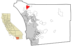 Location in San Diego County and the state of California | |
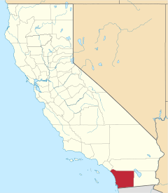
 Fallbrook Location in the United States | |
| Coordinates: 33°22′18″N 117°14′10″W | |
| Country | |
| State | |
| County | San Diego |
| Settled | 1869[1] |
| Area | |
| • Total | 17.561 sq mi (45.483 km2) |
| • Land | 17.528 sq mi (45.397 km2) |
| • Water | 0.033 sq mi (0.086 km2) 0.19% |
| Elevation | 682 ft (208 m) |
| Population (2010) | |
| • Total | 30,534 |
| • Estimate (2017) | 32,988 |
| • Density | 1,700/sq mi (670/km2) |
| Time zone | UTC−8 (Pacific) |
| • Summer (DST) | UTC−7 (PDT) |
| ZIP codes | 92028, 92088 |
| Area codes | 442/760 |
| FIPS code | 06-23462 |
| GNIS feature IDs | 1652708, 2408113 |
Fallbrook's downtown is not on a major highway route. It is 5.5 miles (8.9 km) west of Interstate 15 or 6 miles (9.7 km) north of State Route 76. Fallbrook is immediately east of the U.S. Marine Corps' Camp Pendleton. It once housed a stagecoach stop for the stage that ran from Temecula to San Diego.
Fallbrook is known for its avocado groves and claims, without any official recognition, the title "Avocado Capital of the World". It is often called or known as "The Friendly Village". The Avocado Festival is held in the downtown strip annually and frequently draws large crowds.
History
The community of Fallbrook was first settled by the Payomkawichum people, later called Luiseños by the Spanish missionaries who were present in the area in the late 1700s. Large village sites and oak groves were established by the Luiseños. One site in particular became the area known today as Live Oak County Park.
The first permanent recorded settlement was during the Mexican period in 1846, when Ysidro Alvarado was granted Rancho Monserate by then governor of Mexican California, Pio Pico, who was residing to the west of Fallbrook where Camp Pendleton is currently located.
Alvarado and Pico were second-generation Californians and San Diegans and were citizens of Mexico and the United States.
Rancho Monserate, a 13,323-acre grant stretched from the San Luis Rey River and Bonsall to the south to Stagecoach Lane and the Palomares house to the North to Mission Road to the west to Monserate Mountain to the east.
Pio's nephew and local vaquero, Jose Maria Pico, had been residing in the area now known as the Fallbrook High School during the 1860 census and his family had registered to vote in October 1868, in time for the November presidential election, the first election after the Civil War ended.
The first known image of the area was an oil painting done by James Walker in 1870 called Roping the Bear at Santa Margarita Rancho, which depicts Mexican vaqueros capturing a grizzly bear.
Later, Canadian immigrant Vital Reche settled here with his family just north of Alvarado's ranch at the site now known as Live Oak Park. They named the new community Fall Brook after their former homestead in Pennsylvania.[4]
The present town site was platted in 1885. The original Fallbrook School, though closed as a school in 1939, still serves the community as the Reche Clubhouse. One of the community's churches was constructed in 1890 and is still in use today.
Oak trees were the original primary trees in Fallbrook.[5][6] Furthermore, Olives became a major crop by the 1920s and continued through World War II, but were eventually phased out in favor of the present avocado and floral industry. There are over sixty wholesale and retail nurseries in the community.
Incorporation votes occurred in 1981 and 1987, but both votes failed.[7]
Climate and vegetation
Fallbrook has an average year-round temperature of 61 degrees. Due to the prevailing ocean breezes, the humidity is relatively low and constant.
The average daytime high in Fallbrook is 76 degrees, although in the summer, temperatures sometimes exceed 90 degrees. Most of the area is frost-free; during the coldest periods the average nighttime temperature is about 42 degrees. Due to its proximity to the ocean, days often start with early morning fog; afternoons can be breezy.
Annual rainfall is roughly 10 inches (25 cm) and comes mostly between November and April. Rainfall is higher in the surrounding hills, up to 20 inches (51 cm). The area is ideal for avocados, strawberries, tomatoes and many other sub-tropical fruits, vegetables, and flowers.
Native evergreen oak trees are common in the Fallbrook area, and in places form continuous woods (e.g. Live Oak Park area). Chaparral brushland is the other common vegetation type in the area. Avocados and Eucalyptus are the most common introduced tree species in the area.
Geography
Fallbrook stands at elevations between 500 and 1500 feet, with an average around 685 feet.
Fallbrook is located at 33°22′18″N 117°14′10″W.[8]
The Fallbrook Community Planning Area is approximately 44 square miles (110 km2). According to the United States Census Bureau, the CDP has a total area of 17.6 square miles (46 km2). 17.5 square miles (45 km2) of it is land and 0.03 square miles (0.078 km2) of it (0.19%) is water.
Demographics
| Historical population | |||
|---|---|---|---|
| Census | Pop. | %± | |
| 1930 | 9,446 | — | |
| 1940 | 10,768 | 14.0% | |
| 1950 | 15,889 | 47.6% | |
| 1960 | 20,987 | 32.1% | |
| 1970 | 25,678 | 22.4% | |
| 1980 | 25,988 | 1.2% | |
| 1990 | 26,987 | 3.8% | |
| 2000 | 27,988 | 3.7% | |
| 2010 | 29,100 | 4.0% | |
| Est. 2017 | 32,988 | 13.4% | |
2010
The 2010 United States Census[9] reported that Fallbrook had a population of 30,534. The population density was 1,738.7 people per square mile (671.3/km2). The racial makeup of Fallbrook was 20,454 (67.0%) White with 49.1% of the population being non-Hispanic whites, 489 (1.6%) African American, 233 (0.8%) Native American, 592 (1.9%) Asian, 71 (0.2%) Pacific Islander, 7,372 (24.1%) from other races, and 1,323 (4.3%) from two or more races. Hispanic or Latino of any race were 13,800 persons (45.2%).
The Census reported that 30,383 people (99.5% of the population) lived in households, 94 (0.3%) lived in non-institutionalized group quarters, and 57 (0.2%) were institutionalized.
There were 9,999 households, out of which 3,929 (39.3%) had children under the age of 18 living in them, 5,953 (59.5%) were opposite-sex married couples living together, 1,140 (11.4%) had a female householder with no husband present, 577 (5.8%) had a male householder with no wife present. There were 528 (5.3%) unmarried opposite-sex partnerships, and 45 (0.5%) same-sex married couples or partnerships. 1,782 households (17.8%) were made up of individuals and 870 (8.7%) had someone living alone who was 65 years of age or older. The average household size was 3.04. There were 7,670 families (76.7% of all households); the average family size was 3.40.
The age distribution indicated 8,045 people (26.3%) under the age of 18, 3,768 people (12.3%) aged 18 to 24, 7,022 people (23.0%) aged 25 to 44, 7,457 people (24.4%) aged 45 to 64, and 4,242 people (13.9%) who were 65 years of age or older. The median age was 34.7 years. For every 100 females, there were 99.5 males. For every 100 females age 18 and over, there were 98.3 males.
There were 10,855 housing units at an average density of 618.1 per square mile (238.7/km2), of which 5,921 (59.2%) were owner-occupied, and 4,078 (40.8%) were occupied by renters. The homeowner vacancy rate was 2.4%; the rental vacancy rate was 8.5%. 17,274 people (56.6% of the population) lived in owner-occupied housing units and 13,109 people (42.9%) lived in rental housing units.
2000
As of the census[10] of 2000, there were 29,100 people, 9,367 households, and 7,343 families residing in the CDP. The population density was 1,663.3 inhabitants per square mile (642.0/km2). There were 9,612 housing units at an average density of 549.4 per square mile (212.1/km2). The racial makeup of the CDP was 71.78% White, 1.43% African American, 0.90% Native American, 1.54% Asian, 0.30% Pacific Islander, 20.16% from other races, and 3.89% from two or more races. Hispanic or Latino of any race were 37.30% of the population.
There were 9,367 households out of which 39.5% had children under the age of 18 living with them, 63.3% were married couples living together, 10.2% had a female householder with no husband present, and 21.6% were non-families. 16.8% of all households were made up of individuals and 8.4% had someone living alone who was 65 years of age or older.
The median income for a household in the CDP was $43,778, and the median income for a family was $48,157. Males had a median income of $31,615 versus $27,116 for females. The per capita income for the CDP was $18,152. About 10.7% of families and 14.7% of the population were below the poverty line, including 20.3% of those under age 18 and 8.1% of those age 65 or over.
Government
In the California State Legislature, Fallbrook is in the 38th Senate District, represented by Republican Brian Jones, and in the 75th Assembly District, represented by Republican Marie Waldron.[11]
In the United States House of Representatives, Fallbrook is in California's 50th congressional district, seat currently vacant.[12]
2007 wildfires
On October 21, 2007, wildfires broke out across San Diego county and other parts of Southern California. By October 23, the Rice Canyon Fire had crossed Interstate 15 and spread into the east area of Fallbrook along Reche Road, prompting a mandatory evacuation order for all residents. As of October 23, 206 homes, two commercial properties, and forty outbuildings had burned. These figures include over one hundred homes that burned in the Valley Oaks Mobile Home Park and Pala Mesa Village condos.[13]
Schools
Religion
Fallbrook offers many places of worship, including:
- North Coast Church Fallbrook
- Christ the King Lutheran Church
- Fallbrook United Methodist Church
- Cornerstone Baptist Church
- Christ Church Fallbrook
- SonRise Christian Fellowship
- Inland Hills Community Church
- LifePointe Fallbrook
- First Christian Church
- St. John's Episcopal Church
- Calvary Chapel Fallbrook
- Fallbrook Spanish Seventh-day Adventist Church
- Grace Fallbrook (PCA)
- Fallbrook Church of Christ
- Fallbrook Assembly of God Church
- Hilltop Spiritual Center
- St. Peter the Apostle Parish
- Emmanuel Baptist Church
- St. Stephen Lutheran Church
Notable people
Fallbrook is a center for the arts with longtime residents fostering a creative atmosphere and newcomers bringing additional talents to the area. In the 1940s and 1950s it was the home of film director Frank Capra, who raised olives on his Red Mountain Ranch. He served on the Board of the local water district and produced a short subject film about a water rights controversy with the federal government titled "The Fallbrook Story." In the mid-2000s, Fallbrook gained popularity among Hollywood celebrities. Among those with primary or secondary residences in Fallbrook:
- James Callahan, actor
- Frank Capra
- Richard Carpenter of The Carpenters
- Rita Coolidge
- Michael Curtis, television writer and producer (Friends, JONAS)
- Edward Faulkner
- Rick Founds, Christian songwriter, best known for writing "Lord I Lift Your Name On High".
- Tony Hawk (former resident)
- Leo Howard
- Howard Keel, Fallbrook Union High School alumnus
- Tom Metzger, white supremacist and former Ku Klux Klan leader (former resident)[14]
- Martin Milner (former resident)
- Jason Mraz, musician[15]
- Dave Mustaine, musician (secondary residence)[16]
- T. Jefferson Parker
- Shane Peterson (former resident)
- Christie Repasy, floral artist
- Mark Rogowski (former resident)
- Tom Selleck
- Duke Snider
- Elise Trouw, musician (former resident)
See also
- List of census-designated places in California
References
- "History". Fallbrook Chamber of Commerce. Retrieved April 13, 2015.
- "2010 Census U.S. Gazetteer Files – Places – California". United States Census Bureau.
- "Fallbrook". Geographic Names Information System. United States Geological Survey. Retrieved November 2, 2014.
- "Welcome to Fallbrook". Retrieved January 25, 2016.
- "Fallbrook Group aims to re-establish Native Trees". The San Diego Union-Tribune. June 26, 2017. Retrieved August 4, 2017.
- Treescape Plan for the Village Area of Fallbrook, California Roger Boddaert (1992) p. 5
- Directory of Special Districts in San Diego County (PDF). San Diego Local Agency Formation Commission. 2011. Archived from the original (PDF) on 2016-01-16. Retrieved 2015-04-09.
- "US Gazetteer files: 2010, 2000, and 1990". United States Census Bureau. 2011-02-12. Retrieved 2011-04-23.
- "2010 Census Interactive Population Search: CA - Fallbrook CDP". U.S. Census Bureau. Archived from the original on July 15, 2014. Retrieved July 12, 2014.
- "U.S. Census website". United States Census Bureau. Retrieved 2008-01-31.
- "Statewide Database". UC Regents. Retrieved November 2, 2014.
- "California's 50th Congressional District - Representatives & District Map". Civic Impulse, LLC.
- "Rice Fire Investigation Report" (PDF). California Department of Forestry and Fire Prevention.
- "White supremacist Metzger no longer living in Fallbrook, he says". The San Diego Union-Tribune. 2006-03-15. Retrieved 2016-11-07.
- Blair, Tom. "Jason Mraz: Dialogue". San Diego Magazine (November 2008). Archived from the original on 2012-02-19. Retrieved 2020-01-02.
- "Megadeth's Dave Mustaine lists mega-estate in San Diego County's rural Fallbrook". Los Angeles Times. 2016-10-06. Retrieved 2017-03-13.
- "Legacy Stanley H. Rauh". Village News. 2012-10-04.
External links
| Wikimedia Commons has media related to Fallbrook, California. |
| Authority control |
|---|