Hidden Meadows, California
Hidden Meadows is a census-designated place (CDP) near Escondido in San Diego County, California. The population was 3,485 at the 2010 census, up from 3,463 at the 2000 census.
Hidden Meadows | |
|---|---|
Census designated place | |
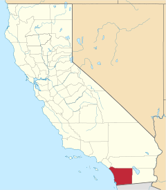
 Location in San Diego County and the state of California | |
 Hidden Meadows Location in the United States | |
| Coordinates: 33°13′46″N 117°7′29″W | |
| Country | |
| State | |
| County | San Diego |
| Area | |
| • Total | 6.583 sq mi (17.049 km2) |
| • Land | 6.583 sq mi (17.049 km2) |
| • Water | 0 sq mi (0 km2) 0% |
| Elevation | 1,496 ft (456 m) |
| Population (2010) | |
| • Total | 3,485 |
| • Density | 530/sq mi (200/km2) |
| Time zone | UTC-8 (Pacific) |
| • Summer (DST) | UTC-7 (PDT) |
| ZIP code | 92026 |
| Area codes | 442/760 |
| FIPS code | 06-33532 |
| GNIS feature ID | 1867027 |
Geography
Hidden Meadows is located at 33°13′46″N 117°7′29″W (33.229571, -117.124754).[3]

According to the United States Census Bureau, the Hidden Meadows census-designated place (CDP) has a total area of 6.6 square miles (17 km2), all land.
Demographics
| Historical population | |||
|---|---|---|---|
| Census | Pop. | %± | |
| 1990 | 2,371 | — | |
| 2000 | 3,463 | 46.1% | |
| 2010 | 3,485 | 0.6% | |
| U.S. Decennial Census[4] 1990[5] | |||
2010
At the 2010 census Hidden Meadows had a population of 3,485. The population density was 529.4 people per square mile (204.4/km²). The racial makeup of Hidden Meadows was 2,865 (82.2%) White, 66 (1.9%) African American, 11 (0.3%) Native American, 318 (9.1%) Asian, 6 (0.2%) Pacific Islander, 93 (2.7%) from other races, and 126 (3.6%) from two or more races. Hispanic or Latino of any race were 329 people (9.4%).[6]
The census reported that 3,470 people (99.6% of the population) lived in households, 15 (0.4%) lived in non-institutionalized group quarters, and no one was institutionalized.
There were 1,397 households, 279 (20.0%) had children under the age of 18 living in them, 983 (70.4%) were opposite-sex married couples living together, 49 (3.5%) had a female householder with no husband present, 49 (3.5%) had a male householder with no wife present. There were 53 (3.8%) unmarried opposite-sex partnerships, and 15 (1.1%) same-sex married couples or partnerships. 249 households (17.8%) were one person and 129 (9.2%) had someone living alone who was 65 or older. The average household size was 2.48. There were 1,081 families (77.4% of households); the average family size was 2.78.
The age distribution was 523 people (15.0%) under the age of 18, 209 people (6.0%) aged 18 to 24, 565 people (16.2%) aged 25 to 44, 1,312 people (37.6%) aged 45 to 64, and 876 people (25.1%) who were 65 or older. The median age was 52.7 years. For every 100 females, there were 97.5 males. For every 100 females age 18 and over, there were 97.5 males.
There were 1,586 housing units at an average density of 240.9 per square mile, of the occupied units 1,234 (88.3%) were owner-occupied and 163 (11.7%) were rented.The homeowner vacancy rate was 2.6%; the rental vacancy rate was 7.9%. 3,067 people (88.0% of the population) lived in owner-occupied housing units and 403 people (11.6%) lived in rental housing units.
2000
At the 2000 census there were 3,463 people, 1,549 households, and 1,149 families in the CDP. The population density was 409.6 inhabitants per square mile (158.2/km²). There were 1,649 housing units at an average density of 195.0 per square mile (75.3/km²). The racial makeup of the CDP was 93.59% White, 0.90% African American, 0.35% Native American, 1.70% Asian, 0.12% Pacific Islander, 1.18% from other races, and 2.17% from two or more races. Hispanic or Latino of any race were 5.86%.[7]
Of the 1,549 households 13.7% had children under the age of 18 living with them, 70.7% were married couples living together, 2.3% had a female householder with no husband present, and 25.8% were non-families. 21.6% of households were one person and 16.0% were one person aged 65 or older. The average household size was 2.23 and the average family size was 2.55.
The age distribution was 12.5% under the age of 18, 3.6% from 18 to 24, 15.1% from 25 to 44, 33.7% from 45 to 64, and 35.1% 65 or older. The median age was 56 years. For every 100 females, there were 92.6 males. For every 100 females age 18 and over, there were 92.2 males.
The median household income was $57,545 and the median family income was $72,878. Males had a median income of $50,341 versus $32,188 for females. The per capita income for the CDP was $33,274. About 0.6% of families and 1.5% of the population were below the poverty line, including none of those under age 18 and 0.6% of those age 65 or over.
Government
In the California State Legislature, Hidden Meadows is in the 38th Senate District, represented by Republican Brian Jones, and in the 75th Assembly District, represented by Republican Marie Waldron.[8]
In the United States House of Representatives, Hidden Meadows is in California's 50th congressional district, seat currently vacant.[9]
References
- "2010 Census U.S. Gazetteer Files – Places – California". United States Census Bureau.
- "Hidden Meadows". Geographic Names Information System. United States Geological Survey. Retrieved April 11, 2015.
- "US Gazetteer files: 2010, 2000, and 1990". United States Census Bureau. 2011-02-12. Retrieved 2011-04-23.
- "Census of Population and Housing". Census.gov. Retrieved December 26, 2019.
- "1990 Census of Population, General Population Characteristics, California, Section 1 of 3 (1990 CP-1-6)" (PDF). U.S. Department of Commerce, Economics and Statistics Administration, Bureau of the Census. Retrieved December 28, 2019.
- "2010 Census Interactive Population Search: CA - Hidden Meadows CDP". U.S. Census Bureau. Archived from the original on July 15, 2014. Retrieved July 12, 2014.
- "U.S. Census website". United States Census Bureau. Retrieved 2008-01-31.
- "Statewide Database". UC Regents. Archived from the original on February 1, 2015. Retrieved December 7, 2014.
- "California's 50th Congressional District - Representatives & District Map". Civic Impulse, LLC.
| Wikimedia Commons has media related to Hidden Meadows, California. |
| Authority control |
|
|---|