California Historical Landmarks in San Diego County, California
A list including the properties and districts listed on the California Historical Landmarks in San Diego County, Southern California.
- Note: Click the "Map of all coordinates" link to the right to view a Google map of all properties and districts with latitude and longitude coordinates in the table below.
Listed landmarks
| Image | [1] | Landmark name | Location | City or town | Summary |
|---|---|---|---|---|---|
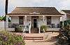
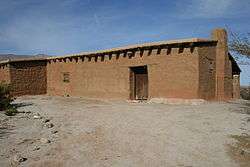
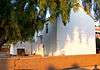 Adobe Chapel of The Immaculate Conception |
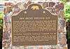
49 | Adobe Chapel of The Immaculate Conception | 3950 Conde St. 32°45′06″N 117°11′39″W |
San Diego | |
| 50 | Ballast Point Whaling Station | Naval Base Point Loma |
San Diego | ||
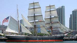
 Berkeley |
1031 | Berkeley | Docked at 1306 North Harbor Dr. 32°43′07″N 117°10′22″W |
San Diego | |
| 1045 | Camp Lockett | near Campo Rd. and Forest Gate Rd. 32°36′25″N 116°28′18″W |
Campo | ||
| 673 | San Gregorio | Borrego Sink, Anza-Borrego Desert State Park |
Borrego Springs | ||
| 472 | Box Canyon | Anza-Borrego Desert State Park |
Borrego Springs | ||
| 647 | Butterfield Overland Mail Route | Anza-Borrego Desert State Park, Blair Valley |
Borrego Springs | ||
 Cabrillo National Monument |
56 | Cabrillo National Monument | Point Loma 32°40′23″N 117°14′19″W |
San Diego | |
| 482 | Camp Wright | State Hwy 79 33°23′23″N 116°47′39″W |
Oak Grove | ||
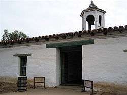
Casa de Bandini |
72 | Casa de Bandini | NE corner of Mason and Calhoun Sts., Old Town San Diego State Historic Park |
San Diego | |
| 74 | Casa de Carrillo | NE of Juan St. on Wallace St. |
San Diego | ||
| 75 | Casa de Cota | Twiggs and Congress Sts., Old Town |
San Diego | ||
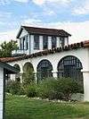
 Casa de Estudillo |
53 | Casa de Estudillo | 4000 Mason St. 32°45′14″N 117°11′45″W |
San Diego | |
| 60 | Casa de Lopez | 3890 Twiggs St., Old Town 32°45′07″N 117°11′49″W |
San Diego | ||
 Casa de Machado y Silvas |
71 | Casa de Machado y Silvas | Old Town San Diego State Historic Park |
San Diego | |
 Casa de Pedrorena de Altamirano |
70 | Casa de Pedrorena de Altamirano | 2616 San Diego Ave, Old Town San Diego State Historic Park 32°45′14″N 117°11′47″W |
San Diego | |
| 73 | Casa de Stewart | Congress and Mason Sts., Old Town San Diego State Historic Park |
San Diego | ||
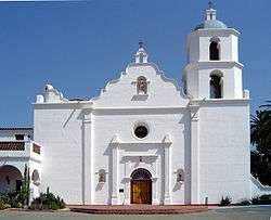
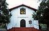 Chapel of Santa Ysabel |
369 | Chapel of Santa Ysabel | Santa Ysabel Asistencia 33°07′49″N 116°40′41″W |
Santa Ysabel | |
| 66 | Congress Hall | Vacant lot, south side of 2734 Calhoun St., Old Town San Diego State Historic Park |
San Diego | ||
| 244 | Derby Dike | Presidio Park 32°45′34″N 117°11′46″W |
San Diego | ||
| 784 | El Camino Real | Mission San Diego de Alcalá |
San Diego | ||
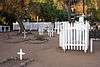 El Campo Santo |
68 | El Campo Santo | On San Diego Ave. between Arista and Conde Sts. 32°45′05″N 117°11′36″W |
San Diego | |
| 64 | El Desembarcadero | 2900 block of Farragut Rd. |
San Diego | ||
| 634 | El Vado | Anza-Borrego Desert State Park |
Borrego Springs | ||
| 491 | Exchange Hotel | 2729 San Diego Ave., Old Town San Diego State Historic Park |
San Diego | ||
| 69 | Fort Guijarros | Naval Base Point Loma 32°40′12″N 117°14′31″W |
San Diego | ||
 Fort Rosecrans |
62 | Fort Rosecrans | Naval Base Point Loma 32°40′37″N 117°14′41″W |
San Diego | |
 Fort Rosecrans National Cemetery |
55 | Fort Rosecrans National Cemetery | Cabrillo Memorial Dr. 32°41′12″N 117°14′41″W |
San Diego | |
 Fort Stockton |
54 | Fort Stockton | Presidio Park 32°45′34″N 117°11′31″W |
San Diego | |
| 411 | Gaskill Brothers' Stone Store | State Hwy 94 |
Campo | ||
Giant Dipper |
1044 | Giant Dipper | 3190 Mission Blvd. 32°46′17″N 117°15′06″W |
San Diego | |
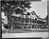
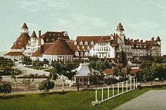 Hotel del Coronado |
844 | Hotel del Coronado | 1500 Orange Ave. 32°40′51″N 117°10′42″W |
Coronado | |
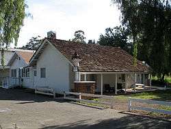 Hubert H. Bancroft Ranch House |
626 | Hubert H. Bancroft Ranch House | One block E of Memory and Bancroft Dr 32°44′11″N 116°59′18″W |
Spring Valley | |
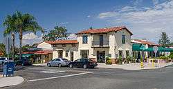
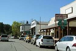 Julian |
412 | Julian | Historic district 33°04′15″N 116°35′08″W |
Julian | |
| 764 | Kate O. Sessions Nursery | Garnet Ave. and Pico St. |
San Diego | ||
| 562 | La Cristianita | Marine Corps Base Camp Pendleton, Los Cristianitos Canyon 33°25′42″N 117°36′35″W |
San Clemente | ||
| 61 | La Playa | On left side of Rosecrans St., at entrance to Military Reserve, Point Loma 32°42′44″N 117°14′43″W |
San Diego | ||
 Las Flores Estancia |
616 | Las Flores Estancia | Marine Corps Base Camp Pendleton 33°18′00″N 117°27′40″W |
San Clemente | |
| 59 | La Punta De Los Muertos | Market St. and Pacific Hwy. 32°42′36″N 117°10′16″W |
San Diego | ||
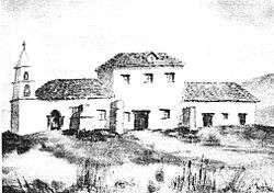
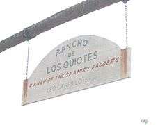 Leo Carrillo Ranch (Rancho de los Kiotes) |
1020 | Leo Carrillo Ranch (Rancho de los Kiotes) | 6200 Flying L.C. Lane |
Carlsbad | |
| 635 | Los Puertecitos | State Hwy 78 33°08′24″N 116°06′18″W |
Ocotillo Wells | ||
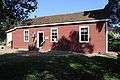 Mason Street School |
538 | Mason Street School | 3966 Mason St., Old Town San Diego State Historic Park 32°45′12″N 117°11′50″W |
San Diego | |
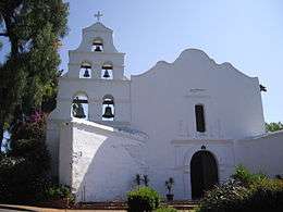 Mission San Diego de Alcalá |
242 | Mission San Diego de Alcalá | 10818 San Diego Mission Rd. 32°47′04″N 117°06′23″W |
San Diego | |
 Mission San Luis Rey de Francia |
239 | Mission San Luis Rey de Francia | 4050 Mission Ave. 33°13′57″N 117°19′13″W |
Oceanside | |
 Montgomery Memorial |
711 | Montgomery Memorial | Coronado Ave. and Beyer Blvd. 32°34′43″N 117°04′08″W |
San Diego | |
 Mule Hill |
452 | Mule Hill | Pomerado Rd. |
Escondido | |
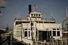
.jpg) National City Santa Fe Rail Depot |
1023 | National City Santa Fe Rail Depot | 900 West 23 St. |
National City | |
.jpg) Oak Grove Butterfield Stage Station |
502 | Oak Grove Butterfield Stage Station | 33°23′26″N 116°47′42″W |
Warner Springs | |
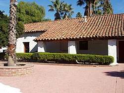
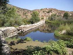 Old Mission Dam |
52 | Old Mission Dam | Mission Trails Regional Park 32°50′24″N 117°02′32″W |
San Diego | |
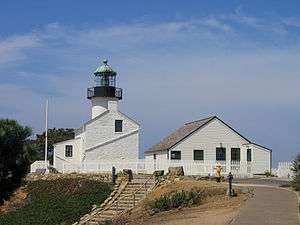 Old Point Loma Lighthouse |
51 | Old Point Loma Lighthouse | Cabrillo National Monument 32°40′18″N 117°14′27″W |
San Diego | |
 Old Town San Diego State Historic Park |
830 | Old Town San Diego State Historic Park | Old Town San Diego State Historic Park 32°45′17″N 117°11′50″W |
San Diego | |
| 639 | Palm Spring | Anza-Borrego Desert State Park |
Agua Caliente Springs | ||
 Pedro Fages Trail |
858 | Pedro Fages Trail | 1.7 mi SE on Sunrise Hwy 32°59′40″N 116°32′33″W |
Julian | |
 Peg Leg Smith Monument |
750 | Peg Leg Smith Monument | Anza-Borrego Desert State Park |
Agua Caliente Springs | |
| 63 | Plaza San Diego Viejo | Old Town San Diego State Historic Park |
San Diego | ||
 Presidio of San Diego |
59 | Presidio of San Diego | Presidio of San Diego 32°45′31″N 117°11′36″W |
San Diego | |
| 425 | Rancho Cañada de los Coches | 13468 Old Hwy 80 32°50′N 116°51′W |
Lakeside | ||
 Rancho Guajome |
940 | Rancho Guajome | Guajome Regional Park 33°16′N 117°16′W |
Vista | |
 Rancho Santa Fe |
982 | Rancho Santa Fe | Rancho Santa Fe 33°01′26″N 117°12′00″W |
Rancho Santa Fe | |
| 1026 | Rancho Santa Margarita y Las Flores | Marine Corps Base Camp Pendleton 33°23′N 117°34′W |
San Diego | ||
.jpg) Rockwell Field |
818 | Rockwell Field | North Island |
San Diego | |
 San Antonio de Pala Asistencia |
243 | San Antonio de Pala Asistencia | Mission on Pala Mission Rd. 33°21′40″N 117°04′45″W |
Pala | |
| 523 | San Diego Barracks | Parking lot on N side of Market St. |
San Diego | ||
_is_now_the_site_of_Viejas_Arena.JPG) San Diego State University |
798 | San Diego State University | Entrance to service area of Viejas Arena |
San Diego | |
 San Felipe-Butterfield Stage Station |
793 | San Felipe-Butterfield Stage Station | County Hwy. S2 33°06′07″N 116°29′02″W |
||
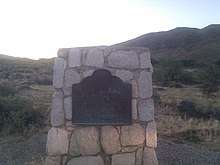
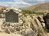
 San Pasqual Battlefield State Historic Park |
533 | San Pasqual Battlefield State Historic Park | San Pasqual Battlefield State Historic Park 33°05′10″N 116°59′24″W |
Escondido | |
 Santa Catarina |
785 | Santa Catarina | Anza-Borrego Desert State Park |
Borrego Springs | |
 Serra Palm |
67 | Serra Palm | Presidio Park 32°45′34″N 117°11′46″W |
San Diego | |
| 891 | Spanish Landing | Spanish Landing Park |
San Diego | ||
 Star of India |
1030 | Star of India | Docked at 1306 North Harbor Dr. 32°43′14″N 117°10′25″W |
San Diego | |
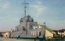 USS Recruit |
1042 | USS Recruit | In shopping center off of Laning Rd, at Tatnall Ln, San Diego 32°43′43″N 117°12′59″W |
San Diego | |
 Vallecito Station |
304 | Vallecito Station | Vallecito Stage Station County Park |
Agua Caliente Springs | |
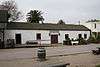
.jpg) Warner's Ranch |
311 | Warner's Ranch | On County Hwy S2 33°14′19″N 116°39′03″W |
Warner Springs | |
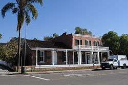 Whaley House |
65 | Whaley House | 2482 San Diego Ave., Old Town 32°45′10″N 117°11′40″W |
San Diego |
References
- "California Historical Landmarks By County". Ohp.parks.ca.gov. Retrieved 2019-04-03.
See also
| Wikimedia Commons has media related to California Historical Landmarks in San Diego County, California. |
This article is issued from Wikipedia. The text is licensed under Creative Commons - Attribution - Sharealike. Additional terms may apply for the media files.