National Register of Historic Places listings in Putnam County, West Virginia
This is a list of the National Register of Historic Places listings in Putnam County, West Virginia.
This is intended to be a complete list of the properties and districts on the National Register of Historic Places in Putnam County, West Virginia, United States. The locations of National Register properties and districts for which the latitude and longitude coordinates are included below, may be seen in a Google map.[1]
There are 6 properties and districts listed on the National Register in the county.
- This National Park Service list is complete through NPS recent listings posted June 19, 2020.[2]
Barbour - Berkeley - Boone - Braxton - Brooke - Cabell - Calhoun - Clay - Doddridge - Fayette - Gilmer - Grant - Greenbrier - Hampshire - Hancock - Hardy - Harrison - Jackson - Jefferson - Kanawha - Lewis - Lincoln - Logan - Marion - Marshall - Mason - McDowell - Mercer - Mineral - Mingo - Monongalia - Monroe - Morgan - Nicholas - Ohio - Pendleton - Pleasants - Pocahontas - Preston - Putnam - Raleigh - Randolph - Ritchie - Roane - Summers - Taylor - Tucker - Tyler - Upshur - Wayne - Webster - Wetzel - Wirt - Wood - Wyoming |
Current listings
| [3] | Name on the Register | Image | Date listed[4] | Location | City or town | Description |
|---|---|---|---|---|---|---|
| 1 | Asbury House | 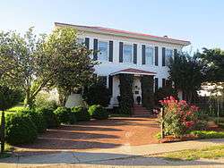 Asbury House |
March 21, 1997 (#97000266) |
2922 Putnam Ave. 38°26′02″N 82°01′08″W |
Hurricane | |
| 2 | Buffalo Indian Village Site | January 25, 1971 (#71000883) |
Address Restricted |
Buffalo | ||
| 3 | Buffalo Town Square Historic District | 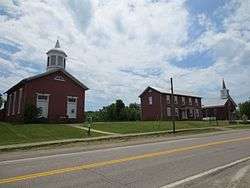 Buffalo Town Square Historic District |
August 16, 1991 (#91001009) |
Junction of WV 62 and High St. 38°37′04″N 81°58′49″W |
Buffalo | |
| 4 | James W. Hoge House | 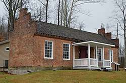 James W. Hoge House |
July 27, 2007 (#07000783) |
Hoge Ln. 38°31′56″N 81°53′22″W |
Winfield | |
| 5 | Putnam County Courthouse |  Putnam County Courthouse |
July 5, 2000 (#00000775) |
3389 Winfield Rd. 38°32′01″N 81°53′32″W |
Winfield | |
| 6 | Winfield Toll Bridge | 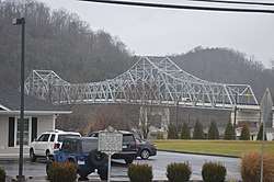 Winfield Toll Bridge |
December 15, 2011 (#11000931) |
WV 34 mile 21.34 38°32′04″N 81°53′53″W |
Winfield |
See also
| Wikimedia Commons has media related to National Register of Historic Places in Putnam County, West Virginia. |
References
- The latitude and longitude information provided in this table was derived originally from the National Register Information System, which has been found to be fairly accurate for about 99% of listings. Some locations in this table may have been corrected to current GPS standards.
- "National Register of Historic Places: Weekly List Actions". National Park Service, United States Department of the Interior. Retrieved on June 19, 2020.
- Numbers represent an ordering by significant words. Various colorings, defined here, differentiate National Historic Landmarks and historic districts from other NRHP buildings, structures, sites or objects.
- The eight-digit number below each date is the number assigned to each location in the National Register Information System database, which can be viewed by clicking the number.
| Topics | ||
|---|---|---|
| Lists by county |
| |
| Other lists | ||
| ||
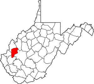
Municipalities and communities of Putnam County, West Virginia, United States | ||
|---|---|---|
| Cities | Putnam County map | |
| Towns | ||
| CDPs | ||
| Other localities |
| |
| Footnotes | ‡This populated place also has portions in an adjacent county or counties | |