Bancroft, West Virginia
Bancroft is a town in Putnam County, West Virginia, United States, along the Kanawha River. The population was 587 at the 2010 census.[6] Bancroft is a part of the Huntington-Ashland, WV-KY-OH, Metropolitan Statistical Area (MSA). As of the 2010 census, the MSA had a population of 287,702. New definitions from February 28, 2013 placed the population at 363,000.[7] It officially became a town in 1952.[8] The town was named for George Bancroft, a coal mine operator.
Bancroft, West Virginia | |
|---|---|
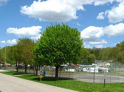 Bancroft Community Park in the spring | |
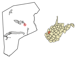 Location of Bancroft in Putnam County, West Virginia. | |
| Coordinates: 38°30′39″N 81°50′30″W | |
| Country | United States |
| State | West Virginia |
| County | Putnam |
| Government | |
| • Mayor | Donna McKneely |
| Area | |
| • Total | 0.15 sq mi (0.38 km2) |
| • Land | 0.14 sq mi (0.36 km2) |
| • Water | 0.01 sq mi (0.02 km2) |
| Elevation | 591 ft (180 m) |
| Population | |
| • Total | 587 |
| • Estimate (2018)[3] | 598 |
| • Density | 4,302.16/sq mi (1,661.83/km2) |
| Time zone | UTC-5 (Eastern (EST)) |
| • Summer (DST) | UTC-4 (EDT) |
| ZIP code | 25011 |
| Area code(s) | 304 |
| FIPS code | 54-04204[4] |
| GNIS feature ID | 1535197[5] |
| Website | www |
Geography
Bancroft is located at 38°30′39″N 81°50′30″W (38.510887, -81.841697).[9]
According to the United States Census Bureau, the town has a total area of 0.15 square miles (0.39 km2), of which, 0.14 square miles (0.36 km2) is land and 0.01 square miles (0.03 km2) is water.[10]
Demographics
| Historical population | |||
|---|---|---|---|
| Census | Pop. | %± | |
| 1960 | 469 | — | |
| 1970 | 446 | −4.9% | |
| 1980 | 528 | 18.4% | |
| 1990 | 381 | −27.8% | |
| 2000 | 367 | −3.7% | |
| 2010 | 587 | 59.9% | |
| Est. 2018 | 598 | [3] | 1.9% |
| Source:[11] | |||
2010 census
At the 2010 census there were 587 people, 240 households, and 170 families living in the town. The population density was 4,192.9 inhabitants per square mile (1,618.9/km2). There were 256 housing units at an average density of 1,828.6 per square mile (706.0/km2). The racial makeup of the town was 98.6% White, 0.2% Pacific Islander, 0.2% from other races, and 1.0% from two or more races. Hispanic or Latino of any race were 0.7%.[2]
Of the 240 households 30.0% had children under the age of 18 living with them, 54.2% were married couples living together, 10.8% had a female householder with no husband present, 5.8% had a male householder with no wife present, and 29.2% were non-families. 25.4% of households were one person and 9.6% were one person aged 65 or older. The average household size was 2.45 and the average family size was 2.88.
The median age in the town was 43.8 years. 21.1% of residents were under the age of 18; 6.4% were between the ages of 18 and 24; 23.7% were from 25 to 44; 33.4% were from 45 to 64; and 15.3% were 65 or older. The gender makeup of the town was 50.3% male and 49.7% female.
2000 census
At the 2000 census there were 367 people, 159 households, and 114 families living in the town. The population density was 2,597.6 inhabitants per square mile (1,012.1/km²). There were 185 housing units at an average density of 1,309.4 per square mile (510.2/km²). The racial makeup of the town was 100.00% White.[4] Of the 159 households 24.5% had children under the age of 18 living with them, 59.1% were married couples living together, 11.3% had a female householder with no husband present, and 27.7% were non-families. 25.8% of households were one person and 10.7% were one person aged 65 or older. The average household size was 2.31 and the average family size was 2.75.
The age distribution was 20.4% under the age of 18, 7.4% from 18 to 24, 27.8% from 25 to 44, 33.2% from 45 to 64, and 11.2% 65 or older. The median age was 42 years. For every 100 females, there were 87.2 males. For every 100 females age 18 and over, there were 86.0 males.
The median household income was $28,833 and the median family income was $30,313. Males had a median income of $35,417 versus $20,417 for females. The per capita income for the town was $15,888. About 5.5% of families and 7.4% of the population were below the poverty line, including 10.5% of those under age 18 and none of those age 65 or over.
References
- "2018 U.S. Gazetteer Files". United States Census Bureau. Retrieved Feb 16, 2020.
- "U.S. Census website". United States Census Bureau. Retrieved 2013-01-24.
- "Population and Housing Unit Estimates". Retrieved June 4, 2019.
- "U.S. Census website". United States Census Bureau. Retrieved 2008-01-31.
- "US Board on Geographic Names". United States Geological Survey. 2007-10-25. Retrieved 2008-01-31.
- "Profile of General Population and Housing Characteristics: 2010 Demographic Profile Data (DP-1): Bancroft town, West Virginia". United States Census Bureau. Retrieved November 28, 2011.
- "Population statistics" (PDF). Archived from the original (PDF) on 2013-03-19.
- "About Us". Town of Bancroft. Retrieved 3 June 2015.
- "US Gazetteer files: 2010, 2000, and 1990". United States Census Bureau. 2011-02-12. Retrieved 2011-04-23.
- "US Gazetteer files 2010". United States Census Bureau. Archived from the original on January 12, 2012. Retrieved 2013-01-24.
- "Census of Population and Housing". U.S. Census Bureau. Retrieved 3 June 2015.
Municipalities and communities of Putnam County, West Virginia, United States | ||
|---|---|---|
| Cities | 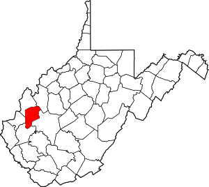 Putnam County map | |
| Towns | ||
| CDPs | ||
| Other localities |
| |
| Footnotes | ‡This populated place also has portions in an adjacent county or counties | |
Huntington-Ashland-Ironton metropolitan area | ||
|---|---|---|
| Principal cities | 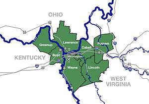 | |
| Municipalities with population over 5,000 | ||
| Municipalities with population 1,000–5,000 | ||
| Municipalities with population under 1,000 | ||
| West Virginia counties | ||
| Kentucky counties | ||
| Ohio counties | ||