National Register of Historic Places listings in Big Horn County, Wyoming
This is a list of the National Register of Historic Places listings in Big Horn County, Wyoming.
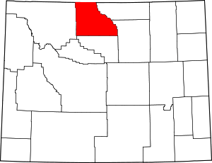
Location of Big Horn County in Wyoming
This is intended to be a complete list of the properties and districts on the National Register of Historic Places in Big Horn County, Wyoming, United States. The locations of National Register properties and districts for which the latitude and longitude coordinates are included below, may be seen in a map.[1]
There are 23 properties and districts listed on the National Register in the county, 1 of which is a National Historic Landmark.
- This National Park Service list is complete through NPS recent listings posted June 19, 2020.[2]
| Albany - Big Horn - Campbell - Carbon - Converse - Crook - Fremont - Goshen - Hot Springs - Johnson - Laramie - Lincoln - Natrona - Niobrara - Park - Platte - Sheridan - Sublette - Sweetwater - Teton - Uinta - Washakie - Weston |
Current listings
| [3] | Name on the Register | Image | Date listed[4] | Location | City or town | Description |
|---|---|---|---|---|---|---|
| 1 | American Legion Hall, Post 32 |  American Legion Hall, Post 32 |
June 27, 2014 (#14000386) |
130 N. 5th St. 44°29′26″N 108°03′14″W |
Greybull | |
| 2 | Bad Pass Trail | 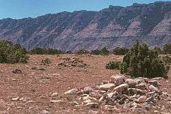 Bad Pass Trail |
October 29, 1975 (#75000215) |
East of Lovell along the Bighorn River in the Bighorn Canyon National Recreation Area 45°03′07″N 108°15′44″W |
Lovell | This trail runs from Kane, Wyoming to Fort Smith, Montana. |
| 3 | Basin Republican-Rustler Printing Building |  Basin Republican-Rustler Printing Building |
July 19, 1976 (#76001948) |
409 W. C St. 44°22′51″N 108°02′22″W |
Basin | |
| 4 | Bear Creek Ranch Medicine Wheel |  Bear Creek Ranch Medicine Wheel |
May 4, 1987 (#87000661) |
Address Restricted |
Greybull | |
| 5 | Big Horn Academy Historic District | 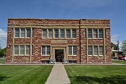 Big Horn Academy Historic District |
March 26, 1992 (#92000285) |
25 and 35 E. 1st S. 44°52′56″N 108°28′04″W |
Cowley | |
| 6 | Black Mountain Archeological District | July 2, 1987 (#86003459) |
Summit and southeastern slopes of Black Mountain[5] 44°31′24″N 107°39′42″W |
Shell | ||
| 7 | Bridger Immigrant Road-Dry Creek Crossing | January 17, 1975 (#75001900) |
26 miles east of Cody on U.S. Route 14 44°27′34″N 108°31′44″W |
Cody | ||
| 8 | Carey Block | 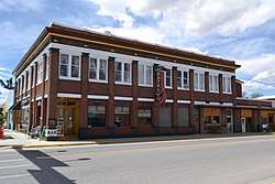 Carey Block |
December 18, 2009 (#09001110) |
602 Greybull Ave. 44°29′20″N 108°03′19″W |
Greybull | |
| 9 | EJE Bridge over Shell Creek | 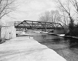 EJE Bridge over Shell Creek |
February 22, 1985 (#85000415) |
County Road CN9-57 44°32′05″N 107°48′06″W |
Shell | Replaced in 2005 |
| 10 | EJP County Line Bridge | 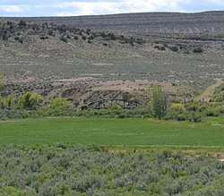 EJP County Line Bridge |
February 22, 1985 (#85000412) |
Road CN9-60 44°09′59″N 107°41′01″W |
Hyattville | |
| 11 | EJZ Bridge over Shoshone River | 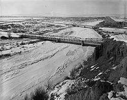 EJZ Bridge over Shoshone River |
February 22, 1985 (#85000413) |
County Road CN9-111 44°50′18″N 108°26′03″W |
Lovell | |
| 12 | Hanson Site | Hanson Site |
December 15, 1978 (#78002817) |
Address Restricted |
Shell | |
| 13 | Hyart Theater | 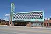 Hyart Theater |
January 8, 2009 (#08001304) |
251 E. Main St. 44°50′15″N 108°23′18″W |
Lovell | |
| 14 | Lower Shell School House |  Lower Shell School House |
February 7, 1985 (#85000247) |
U.S. Route 14 44°31′15″N 107°56′03″W |
Greybull | |
| 15 | M L Ranch | 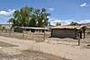 M L Ranch |
July 15, 1992 (#92000836) |
Off Alternate U.S. Route 14 near the eastern shore of Bighorn Lake, 13 miles east of Lovell, Bighorn Canyon National Recreation Area 44°49′49″N 108°09′28″W |
Lovell | |
| 16 | Medicine Lodge Creek Site | July 5, 1973 (#73001926) |
4800 County Road 52 44°17′57″N 107°32′28″W |
Hyattville | Winter dwelling site with petrogyphs and pictographs on a cliff face, part of a state park | |
| 17 | Medicine Wheel-Medicine Mountain | 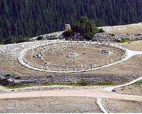 Medicine Wheel-Medicine Mountain |
April 16, 1969 (#69000184) |
Near the summit of Medicine Mountain[6] 44°49′34″N 107°55′18″W |
Kane | |
| 18 | Paint Rock Canyon Archeological Landscape District | Paint Rock Canyon Archeological Landscape District |
July 12, 1990 (#80004881) |
Address Restricted |
Hyattville | |
| 19 | Rairden Bridge | 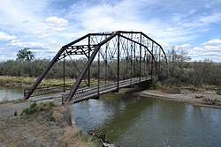 Rairden Bridge |
February 22, 1985 (#85000414) |
South of Big Horn County Road CN9-30 44°11′40″N 107°54′53″W |
Manderson | |
| 20 | Schunk Lodge | January 4, 2018 (#100001955) |
Approx. 1 mi. N of Red Grade Rd. & Big Goose RS, Bighorn NF 44°36′08″N 107°12′58″W |
Big Horn vicinity | ||
| 21 | Southsider Shelter | Southsider Shelter |
August 1, 2012 (#12000470) |
Address Restricted |
Ten Sleep | |
| 22 | US Post Office-Basin Main | 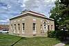 US Post Office-Basin Main |
May 19, 1987 (#87000779) |
402 W. C St. 44°22′53″N 108°02′19″W |
Basin | |
| 23 | US Post Office-Greybull Main | 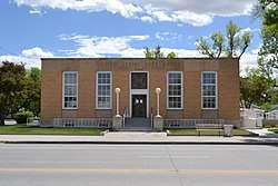 US Post Office-Greybull Main |
May 22, 1987 (#87000780) |
401 Greybull Ave. 44°29′19″N 108°03′08″W |
Greybull |
See also
| Wikimedia Commons has media related to National Register of Historic Places in Big Horn County, Wyoming. |
References
- The latitude and longitude information provided in this table was derived originally from the National Register Information System, which has been found to be fairly accurate for about 99% of listings. Some locations in this table may have been corrected to current GPS standards.
- "National Register of Historic Places: Weekly List Actions". National Park Service, United States Department of the Interior. Retrieved on June 19, 2020.
- Numbers represent an ordering by significant words. Various colorings, defined here, differentiate National Historic Landmarks and historic districts from other NRHP buildings, structures, sites or objects.
- The eight-digit number below each date is the number assigned to each location in the National Register Information System database, which can be viewed by clicking the number.
- Finley, Judson B., et al. "Rockshelter Archaeology and Geoarchaeology in the Bighorn Mountains, Wyoming". Plains Anthropologist 50.195 (2005): 227-248: 228.
- Grinnell, George Bird. "The Medicine Wheel". American Anthropologist 24.3 (1922): 299-310: 304.
| Topics | |
|---|---|
| Lists by state |
|
| Lists by insular areas | |
| Lists by associated state | |
| Other areas | |
| Related | |
| |
Municipalities and communities of Big Horn County, Wyoming, United States | ||
|---|---|---|
| Towns | | |
| CDPs | ||
| Unincorporated communities | ||
| Footnotes | ‡This populated place also has portions in an adjacent county or counties | |
This article is issued from Wikipedia. The text is licensed under Creative Commons - Attribution - Sharealike. Additional terms may apply for the media files.