Mingaladon Township
Mingaladon Township (Burmese: မင်္ဂလာဒုံ မြို့နယ် [mɪ̀ɰ̃ɡəlàdòʊɰ̃ mjo̰nɛ̀]) is located in the northernmost part of Yangon, Myanmar. The township comprises 31 wards, and shares borders with Hmawbi Township in the north, North Okkalapa Township in the east, Insein Township and Shwepyitha Township in the west, and Mayangon Township in the south.[1] Mingaladon is still relatively undeveloped and lacks basic municipal services.
Mingaladon Township မင်္ဂလာဒုံ မြို့နယ် Mingalardon Township | |
|---|---|
Township of Yangon | |
| Mingaladon Township | |
 Mingaladon Township | |
| Coordinates: 16°54′26″N 96°08′0″E | |
| Country | Myanmar |
| Division | Yangon |
| City | Yangon |
| Township | Mingaladon |
| Area | |
| • Total | 106.6 km2 (41.14 sq mi) |
| Elevation | 9 m (30 ft) |
| Population (2000)[1] | |
| • Total | 136,000 |
| • Density | 1,300/km2 (3,300/sq mi) |
| Time zone | UTC6:30 (MST) |
| Postal codes | 11021 |
| Area code(s) | 1 (mobile: n/a) |
| YCDC[1] | |
Mingaladon is home to the Yangon International Airport and the Hlawga National Park
Etymology
The Burmese place name Mingaladon (မင်္ဂလာဒုံ) is a portmanteau of two words: Pali mangala ("blessed") and Mon ဍုၚ် ([dɜŋ], "town").[2]
Climate
| Climate data for Mingaladon (1981–2010) | |||||||||||||
|---|---|---|---|---|---|---|---|---|---|---|---|---|---|
| Month | Jan | Feb | Mar | Apr | May | Jun | Jul | Aug | Sep | Oct | Nov | Dec | Year |
| Average high °C (°F) | 32.6 (90.7) |
34.9 (94.8) |
36.6 (97.9) |
37.5 (99.5) |
34.1 (93.4) |
30.6 (87.1) |
30.2 (86.4) |
29.9 (85.8) |
30.7 (87.3) |
32.1 (89.8) |
32.5 (90.5) |
31.8 (89.2) |
32.8 (91.0) |
| Average low °C (°F) | 17.5 (63.5) |
18.8 (65.8) |
21.2 (70.2) |
23.7 (74.7) |
24.6 (76.3) |
24.2 (75.6) |
24.1 (75.4) |
23.9 (75.0) |
23.9 (75.0) |
23.9 (75.0) |
22.1 (71.8) |
18.7 (65.7) |
22.2 (72.0) |
| Average rainfall mm (inches) | 0.5 (0.02) |
3.1 (0.12) |
8.9 (0.35) |
34.3 (1.35) |
288.6 (11.36) |
537.3 (21.15) |
565.8 (22.28) |
530.8 (20.90) |
383.2 (15.09) |
195.2 (7.69) |
68.4 (2.69) |
4.3 (0.17) |
2,620.4 (103.17) |
| Source: Norwegian Meteorological Institute[3] | |||||||||||||
Transport
Mingaladon's Aung Mingala Bus Terminal serves all the highway buses to all major cities and towns in the country, except for those in the Ayeyarwady Division.[4]
Mingaladon Air Base
Mingaladon is home to an air base (ICAO: VYHB) of the Myanmar Air Force. Formerly called 502 Air Base.
Education
The University of Computer Studies, Yangon, one of the country's best universities, is located in the western part of the township on the west bank of Hlawga National Park. The township is also home to the Defence Services Institute of Nursing and Paramedical Science.
References
- "Mingaladon Township". Yangon City Development Committee. Archived from the original on 2 October 2011. Retrieved 2009-03-21.
- Hopple, Paulette (May 2003). "2. Burmese Grammatical Units". The Structure of Nominalization in Burmese (PDF). University of Texas at Arlington. p. 71.
- "Myanmar Climate Report" (PDF). Norwegian Meteorological Institute. pp. 23–36. Archived from the original (PDF) on 8 October 2018. Retrieved 30 November 2018.
- "Getting Around Yangon". Myanmar's Net. Retrieved 2008-10-14.
| Wikimedia Commons has media related to Mingaladon Township. |
Capital: Yangon | ||
| East Yangon District | 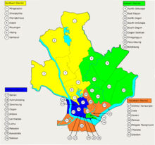 | |
| North Yangon District | ||
| South Yangon District |
| |
| West Yangon District (Downtown) | ||
1 - part of South Yangon City; 2 - part of North Yangon City | ||
Capital: Yangon | ||
| East Yangon District |  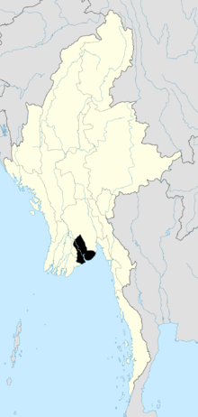 | |
| North Yangon District | ||
| South Yangon District |
| |
| West Yangon District (Downtown) | ||
| Main cities and towns | ||
1 - part of South Yangon City; 2 - part of North Yangon City | ||