Mayangon Township
Mayangone Township (Burmese: မရမ်းကုန်း မြို့နယ် [məjáɰ̃ɡóʊɰ̃ mjo̰nɛ̀]; is located in the northern part of Yangon. The township comprises ten wards, and shares borders with Insein Township and Mingaladon Township in the north, North Okkalapa Township and Yankin Township in the east, the Hlaing river and Hlaingthaya Township in the west, and Kamayut Township and Hlaing Township in the south. The township has 30 primary schools, seven middle schools and five high schools.
Mayangone Township မရမ်းကုန်း မြို့နယ် | |
|---|---|
Township of Yangon | |
| Mayangone Township | |
 | |
 Mayangone Township | |
| Coordinates: 16°49′0″N 96°6′0″E | |
| Country | Myanmar |
| Division | Yangon |
| City | Yangon |
| Township | Mayangon |
| Area | |
| • Total | 25.34 km2 (9.782 sq mi) |
| Population (2000) | |
| • Total | 137,000 |
| • Density | 5,400/km2 (14,000/sq mi) |
| Time zone | UTC6:30 (MST) |
| Postal codes | 11061, 11062, 11063 |
| Area code(s) | 1 (mobile: 80, 99) |
| YCDC[1] | |
One of the upscale neighbourhoods such as Parami is included in Mayangon Township.[1]
Landmarks
The following is a list of landmarks protected by the city in Mayangon township.[2]
| Structure | Type | Address | Notes |
|---|---|---|---|
| Aung Shwebontha Dhamma Beikman Monastery | Monastery | 9 Mile Junction, Pyay Road | |
| Kaba Aye Pagoda | Pagoda | Kaba Aye Pagoda Road | |
| Kyaik Kale Pagoda | Pagoda | Yangon-Pyay Road | |
| Kyaik Kalo Pagoda | Pagoda | Yangon-Pyay Road | |
| Kyaik Waing Pagoda | Pagoda | Kyaik Waing Pagoda Road | |
| St. Edward's Roman Catholic Church | Church | Yangon-Pyay Road | |
| St. George's Anglican Church | Church | Yangon-Pyay Road | |
| Tatmadaw Orthopedic Hospital | Hospital | Yangon-Pyay Road | Former military officers training school |
References
- "Mayangon Township". Yangon City Development Committee. Archived from the original on 2 October 2011. Retrieved 2009-03-15.
- "Special Reports: Heritage List". The Myanmar Times. 2001-10-29. Archived from the original on 15 June 2009.
| Wikimedia Commons has media related to Mayangon Township. |
Capital: Yangon | ||
| East Yangon District | 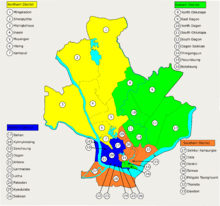 | |
| North Yangon District | ||
| South Yangon District |
| |
| West Yangon District (Downtown) | ||
1 - part of South Yangon City; 2 - part of North Yangon City | ||
Capital: Yangon | ||
| East Yangon District |  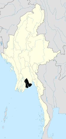 | |
| North Yangon District | ||
| South Yangon District |
| |
| West Yangon District (Downtown) | ||
| Main cities and towns | ||
1 - part of South Yangon City; 2 - part of North Yangon City | ||
This article is issued from Wikipedia. The text is licensed under Creative Commons - Attribution - Sharealike. Additional terms may apply for the media files.