East Dagon Township
East Dagon Township (also East Dagon Myothit; Burmese: ဒဂုံမြို့သစ်အရှေ့ပိုင်း မြို့နယ် [dəɡòʊɰ̃ mjo̰ðɪʔ ʔəʃḛbáɪɴ mjo̰nɛ̀]) is located in the easternmost part of Yangon, Myanmar. The township comprises 54 wards and three village tracts. It shares borders with Hlegu Township in the north, North Dagon Township in the west, and South Dagon Township in the south and west.[2] One of new satellite towns founded in 1989 by the military government that came to power in 1988, East Dagon is still largely undeveloped and lacks basic municipal services.
East Dagon Township ဒဂုံမြို့သစ်အရှေ့ပိုင်း မြို့နယ် | |
|---|---|
Township of Yangon | |
| East Dagon Township | |
 East Dagon Township | |
| Coordinates: 16°53′0″N 96°17′0″E | |
| Country | Myanmar |
| Division | Yangon |
| City | Yangon |
| Township | East Dagnorth dagon. on |
| Settled | 1989[1] |
| Area | |
| • Total | 91.03 km2 (35.148 sq mi) |
| Population (2000)[2] | |
| • Total | 71,000 |
| • Density | 780/km2 (2,000/sq mi) |
| Time zone | UTC6:30 (MST) |
| Postal codes | 11451 |
| Area code(s) | 1 /(mobile phone:+9595+) |
| YCDC[2] | |
The township has 19 primary schools, four middle schools and two high schools.[2]
The Ngamoyeik creek cuts through East Dagon Township. The Togyaunggalay Railway Station is a stop on the Yangon Circular Railway, and Myanmar Railways's Yangon-Bago line. Several bus lines connect East Dagon to downtown and other parts of the city.
References
- Kyaw Kyaw (2006). Frauke Krass; Hartmut Gaese; Mi Mi Kyi (eds.). Megacity yangon: transformation processes and modern developments. Berlin: Lit Verlag. pp. 333–334. ISBN 3-8258-0042-3.
- "East Dagon Township". Yangon City Development Committee. Archived from the original on 2 October 2011. Retrieved 2009-03-21.
Capital: Yangon | ||
| East Yangon District | 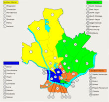 | |
| North Yangon District | ||
| South Yangon District |
| |
| West Yangon District (Downtown) | ||
1 - part of South Yangon City; 2 - part of North Yangon City | ||
Capital: Yangon | ||
| East Yangon District |  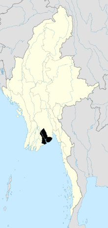 | |
| North Yangon District | ||
| South Yangon District |
| |
| West Yangon District (Downtown) | ||
| Main cities and towns | ||
1 - part of South Yangon City; 2 - part of North Yangon City | ||
| States | ||
|---|---|---|
| Regions | ||
| Self-Administered Zones | ||
| Self-Administered Divisions | ||
| Union Territories | ||