Dawbon Township
Dawbon Township (Burmese: ဒေါပုံ မြို့နယ် [dɔ́bòʊɰ̃ mjo̰nɛ̀]) is located in the southeastern part of Yangon, Myanmar. The township comprises 14 wards, and shares borders with Thingangyun township in the north, Mingala Taungnyunt township in the west, Thaketa township in the east, and Pazundaung township in the south across the Pazundaung Creek.[1] Dawbon is connected to downtown Yangon via the Maha Bandula Bridge.
Dawbon Township ဒေါပုံ မြို့နယ် | |
|---|---|
Township of Yangon | |
| Dawbon Township | |
_-_panoramio_(1).jpg) | |
 Location of the township in Yangon. | |
 Dawbon Township Location of the township in Yangon. | |
| Coordinates: 16°40′0″N 96°11′0″E | |
| Country | |
| Division | Yangon |
| City | Yangon |
| Township | Dawbon |
| Area | |
| • Total | 3.7 km2 (1.42 sq mi) |
| Population (2000)[1] | |
| • Total | 70,000 |
| • Density | 19,000/km2 (49,000/sq mi) |
| Time zone | UTC6:30 (MST) |
| Postal codes | 11241 |
| Area code(s) | 1 (mobile: 80, 99) |
| YCDC[1] | |
The township has twelve primary schools, four middle schools and one high school.[1]
Population
Dawbon Township's population is over 75,000 with 51.2% of female residents and 48.8% of male residents as of 2014.[2]
References
- "Dawbon Township". Yangon City Development Committee. Archived from the original on 2 October 2011. Retrieved 2009-03-21.
- "Dawbon (Township, Myanmar) - Population Statistics, Charts, Map and Location". citypopulation.info. Retrieved 2020-03-13.
| Wikimedia Commons has media related to Dawbon Township. |
Capital: Yangon | ||
| East Yangon District | 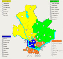 | |
| North Yangon District | ||
| South Yangon District |
| |
| West Yangon District (Downtown) | ||
1 - part of South Yangon City; 2 - part of North Yangon City | ||
Capital: Yangon | ||
| East Yangon District |  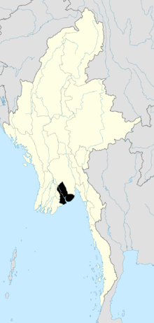 | |
| North Yangon District | ||
| South Yangon District |
| |
| West Yangon District (Downtown) | ||
| Main cities and towns | ||
1 - part of South Yangon City; 2 - part of North Yangon City | ||
This article is issued from Wikipedia. The text is licensed under Creative Commons - Attribution - Sharealike. Additional terms may apply for the media files.