Hlaing Township
Hlaing Township (Burmese: လှိုင် မြို့နယ်, pronounced [l̥àiɰ̃ mjo̰nɛ̀]) is an area of Yangon, Myanmar. The township comprises 16 wards and shares borders with Mayangon township and Thamaing Creek in the north, Mayangon township and Inya Lake in the east, Kamayut Township in the south and Hlaingthaya Township in the west. In 2000, the township's population was estimated to be about 125,000. It has 32 primary schools, eight middle schools and four high schools.[1]
Hlaing Township လှိုင် မြို့နယ် | |
|---|---|
Township of Yangon | |
| Hlaing Township | |
 Hlaing Township | |
| Coordinates: 16°51′30.0″N 96°8′0″E | |
| Country | Myanmar |
| Division | Yangon |
| City | Yangon |
| District | West Yangon District |
| Township | Hlaing |
| Area | |
| • Total | 13.7 km2 (5.29 sq mi) |
| Elevation | 2 m (6 ft) |
| Population (2000) | |
| • Total | 125,000 |
| • Density | 9,100/km2 (24,000/sq mi) |
| Time zone | UTC6:30 (MST) |
| Postal codes | 11051, 11052 |
| Area code(s) | 1 (mobile: 80, 99) |
| YCDC[1] | |
Landmarks
The following is a list of landmarks protected by the city in Hlaing township.[2]
| Structure | Type | Address | Notes |
|---|---|---|---|
| Sri Mariamman Temple | Hindu Temple | 49 Yangon-Insein Road |
References
- "Hlaing Township". Yangon City Development Committee. Retrieved 2008-11-30.
- "Special Reports: Heritage List". The Myanmar Times. 2001-10-29. Archived from the original on 15 June 2009. Retrieved 14 March 2009.
Capital: Yangon | ||
| East Yangon District | 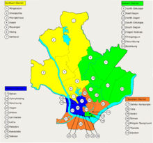 | |
| North Yangon District | ||
| South Yangon District |
| |
| West Yangon District (Downtown) | ||
1 - part of South Yangon City; 2 - part of North Yangon City | ||
Capital: Yangon | ||
| East Yangon District |  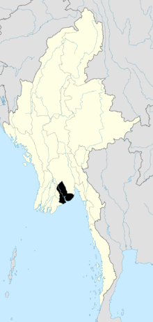 | |
| North Yangon District | ||
| South Yangon District |
| |
| West Yangon District (Downtown) | ||
| Main cities and towns | ||
1 - part of South Yangon City; 2 - part of North Yangon City | ||
This article is issued from Wikipedia. The text is licensed under Creative Commons - Attribution - Sharealike. Additional terms may apply for the media files.