Mihitikri
Mihitikri is a census town in Kolaghat CD block in Tamluk subdivision of Purba Medinipur district in the state of West Bengal, India.
Mihitikri | |
|---|---|
Census town | |
 Mihitikri Location in West Bengal, India  Mihitikri Mihitikri (India) | |
| Coordinates: 22.4353°N 87.8436°E | |
| Country | |
| State | West Bengal |
| District | Purba Medinipur |
| Area | |
| • Total | 2.1513 km2 (0.8306 sq mi) |
| Population (2011) | |
| • Total | 6,906 |
| • Density | 3,200/km2 (8,300/sq mi) |
| Languages | |
| • Official | Bengali, English |
| Time zone | UTC+5:30 (IST) |
| Telephone/STD code | 03228 |
| Lok Sabha constituency | Tamluk |
| Vidhan Sabha constituency | Panskura Purba |
| Website | purbamedinipur |
Geography
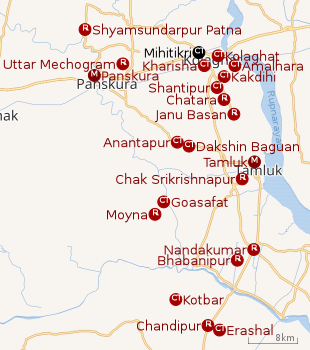 |
| Cities and towns in Tamluk subdivision of Purba Medinipur district M: municipal city/ town, CT: census town, R: rural/ urban centre Owing to space constraints in the small map, the actual locations in a larger map may vary slightly |
Location
Mihitikri is located at 22.4353°N 87.8436°E.
Urbanisation
94.08% of the population of Tamluk subdivision live in the rural areas. Only 5.92% of the population live in the urban areas, and that is the second lowest proportion of urban population amongst the four subdivisions in Purba Medinipur district, just above Egra subdivision.[1]
Note: The map alongside presents some of the notable locations in the subdivision. All places marked in the map are linked in the larger full screen map.
Demographics
As per 2011 Census of India Mihitikri had a total population of 6,906 of which 3,541 (51%) were males and 3,365 (49%) were females. Population below 6 years was 630. The total number of literates in Mihitikri was 5,296 (84.38% of the population over 6 years).[2]
Infrastructure
As per the District Census Handbook 2011, Mihitikri covered an area of 2.1513 km2. It had the facility of a railway station at Mecheda 3 km away and bus route in the town. Amongst the civic amenities it had 600 domestic electric connections. Amongst the medical facilities it had a hospital 2 km away, a nursing home 2 km away, a dispensary/ health centre 1 km away, a maternity home 1 km away and 1 medicine shop in the town. Amongst the educational facilities it had were 4 primary schools, 2 middle schools, 2 secondary schools and 1 senior secondary school in the town. The nearest degree college was at Panskura 14 km away. Amongst the recreational and cultural facilities a cinema theatre was there at Mecheda 4 km away and a reading room in the town.[3]
Transport
Mihitikri is off National Highway 16 (Kolkata-Mumbai Highway).[4]
References
- "District Statistical Handbook 2014 Purba Medinipur". Table 2.2. Department of Planning and Statistics, Government of West Bengal. Archived from the original on 21 January 2019. Retrieved 20 April 2019.
- "2011 Census – Primary Census Abstract Data Tables". West Bengal – District-wise. Registrar General and Census Commissioner, India. Retrieved 2 April 2019.
- "District Census Handbook Purba Medinipur, Census of India 2011, Series 20, Part XII A" (PDF). Section II Town Directory, Statement I: Growth History, Pages 1207-1209; Statement II: Physical Aspects and Location of Towns, Page 1210; Statement III: Civic and other Amenities, Pages 1211-1212; Statement IV: Medical Facilities 2009, Pages 1212-1213; Section: Educational, Recreational and Cultural Facilities, Pages 1213-1215. Directorate of Census Operations, West Bengal. Retrieved 7 April 2019.
- Google maps
Cities, towns, locations and neighbourhoods in Purba Medinipur District | |||||||||
|---|---|---|---|---|---|---|---|---|---|
| Cities, municipal and census towns |
| ||||||||
| Locations other than cities and towns |
| ||||||||
| Neighbourhoods |
| ||||||||
| Related topics |
| ||||||||