Reyepara
Reyepara is a village, in Nandigram II CD Block in Haldia subdivision of Purba Medinipur district in the state of West Bengal, India.
Reyepara | |
|---|---|
Village | |
 Reyepara Location in West Bengal, India  Reyepara Reyepara (India) | |
| Coordinates: 22°03′24.8″N 87°53′48.1″E | |
| Country | |
| State | West Bengal |
| District | Purba Medinipur |
| Population (2011) | |
| • Total | 3,059 |
| Languages | |
| • Official | Bengali, English |
| Time zone | UTC+5:30 (IST) |
| PIN | 721650 (Reyepara) |
| Telephone/STD code | 03224 |
| Lok Sabha constituency | Tamluk |
| Vidhan Sabha constituency | Nandigram |
| Website | purbamedinipur |
Geography
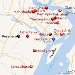 |
| Cities and towns in Haldia subdivision of Purba Medinipur district M: municipal city/ town, CT: census town, R: rural/ urban centre, S: port Owing to space constraints in the small map, the actual locations in a larger map may vary slightly |
CD block HQ
The headquarters of Nandigram II CD block are located at Reyepara.[1]
Urbanisation
79.19% of the population of Haldia subdivision live in the rural areas. Only 20.81% of the population live in the urban areas, and that is the highest proportion of urban population amongst the four subdivisions in Purba Medinipur district.[2]
Note: The map alongside presents some of the notable locations in the subdivision. All places marked in the map are linked in the larger full screen map.
Demographics
As per 2011 Census of India Reyepara had a total population of 3,059 of which 1,528 (50%) were males and 1,531 (50%) were females. Population below 6 years was 321. The total number of literates in Reyepara was 2,439 (89.08% of the population over 6 years).[3]
Transport
The Chandipur-Nandigram Road passes through Reyepara.[4]
Healthcare
Reapara Rural Hospital at Reapara (with 30 beds) is the main medical facility in Nandigram II CD block. There are primary health centres at Boyal (with 6 beds) and Amdabad (with 10 beds).[5]
References
- "District Census Handbook: Purba Medinipur" (PDF). Map of Purba Medinipur with CD Block HQs and Police Stations. Directorate of Census Operations, West Bengal, 2011. Retrieved 10 November 2016.
- "District Statistical Handbook 2014 Purba Medinipur". Table 2.2. Department of Planning and Statistics, Government of West Bengal. Retrieved 21 April 2019.
- "2011 Census – Primary Census Abstract Data Tables". West Bengal – District-wise. Registrar General and Census Commissioner, India. Retrieved 10 November 2016.
- Google maps
- "Health & Family Welfare Department". Health Statistics. Government of West Bengal. Retrieved 27 March 2019.
Cities, towns, locations and neighbourhoods in Purba Medinipur District | |||||||||
|---|---|---|---|---|---|---|---|---|---|
| Cities, municipal and census towns |
| ||||||||
| Locations other than cities and towns |
| ||||||||
| Neighbourhoods |
| ||||||||
| Related topics |
| ||||||||