Janka, Contai
Janka is a village, in Khejuri II CD block in Contai subdivision of Purba Medinipur district in the state of West Bengal, India. Khejuri police station is located at Janka.
Janka | |
|---|---|
Village | |
 Janka Location in West Bengal, India  Janka Janka (India) | |
| Coordinates: 21°50′51.0″N 87°54′05.4″E | |
| Country | |
| State | West Bengal |
| District | Purba Medinipur |
| Population (2011) | |
| • Total | 2,804 |
| Languages | |
| • Official | Bengali, English |
| Time zone | UTC+5:30 (IST) |
| Lok Sabha constituency | Kanthi |
| Vidhan Sabha constituency | Khejuri |
| Website | purbamedinipur |
Geography
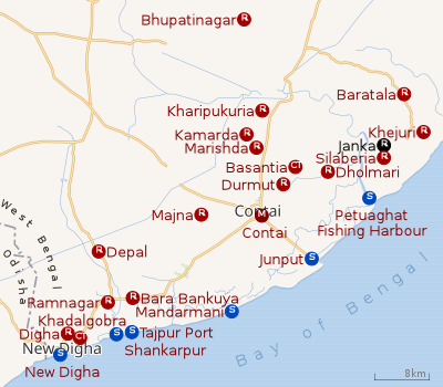 |
| Cities and towns in Contai subdivision of Purba Medinipur district M: municipal city/ town, CT: census town, R: rural/ urban centre, S: port, sea-beach Owing to space constraints in the small map, the actual locations in a larger map may vary slightly |
Police station
Khejuri police station is located at Janka. It has jurisdiction over Khejuri I and Khejuri II CD Blocks. It covers an area of 268.47 km2 with a population of 231,777.[1]
CD block HQ
The headquarters of Khejuri II CD block are located at Janka.[2]
Urbanisation
93.55% of the population of Contai subdivision live in the rural areas. Only 6.45% of the population live in the urban areas and it is considerably behind Haldia subdivision in urbanization, where 20.81% of the population live in urban areas.[3]
Note: The map alongside presents some of the notable locations in the subdivision. All places marked in the map are linked in the larger full screen map.
Demographics
As per 2011 Census of India Janka had a total population of 2,804 of which 1,452 (52%) were males and 1,352 (48%) were females. Population below 6 years was 347. The total number of literates in Janka was 2,214 (90.11% of the population over 6 years).[4]
Healthcare
There is a primary health centre at Janka (with 10 beds).[5]
References
- "Khejuri PS". Purba Medinipur District Police. Archived from the original on 12 November 2016. Retrieved 10 November 2016.
- "District Census Handbook: Purba Medinipur" (PDF). Map of Purba Medinipur with CD Block HQs and Police Stations. Directorate of Census Operations, West Bengal, 2011. Retrieved 9 November 2016.
- "District Statistical Handbook 2014 Purba Medinipur". Table 2.2. Department of Planning and Statistics, Government of West Bengal. Retrieved 22 April 2019.
- "2011 Census – Primary Census Abstract Data Tables". West Bengal – District-wise. Registrar General and Census Commissioner, India. Retrieved 10 November 2016.
- "Health & Family Welfare Department". Health Statistics. Government of West Bengal. Retrieved 16 April 2019.
Cities, towns, locations and neighbourhoods in Purba Medinipur District | |||||||||
|---|---|---|---|---|---|---|---|---|---|
| Cities, municipal and census towns |
| ||||||||
| Locations other than cities and towns |
| ||||||||
| Neighbourhoods |
| ||||||||
| Related topics |
| ||||||||