Maradi Region
The Region of Maradi is one of seven Region of Niger. It is located in south-central Niger, east of the Region of Tahoua, west of Zinder, and north of the Nigerian city of Kano. The administrative centre is at Maradi. The population of the Region is predominantly Hausa.
Maradi | |
|---|---|
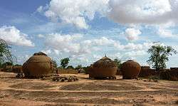 A village in Maradi | |
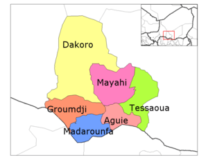
 Location within Niger | |
| Coordinates: 13°30′N 7°6′E | |
| Country | |
| Capital | Maradi |
| Area | |
| • Total | 35,100 km2 (13,600 sq mi) |
| Population (2011[1]) | |
| • Total | 3,117,810 |
| • Density | 89/km2 (230/sq mi) |
| Time zone | UTC+1 (West Africa Time) |
| HDI (2017) | 0.335[2] low |
Geography
Maradi borders Agadez Region to the north, Zinder Region to the east, Nigeria to the south (specifically the states of Katsina, Zamfara and Sokoto), and Tahoua Region to the west. Most of the 35,100 km²[3] of land is classified as "Sahel", though the northern parts merge into the Sahara desert, and the very southern edges along the border with Nigeria get almost 600 mm a year in average rainfall, with some areas receiving as much as 650–700 mm in better years.[3] Lake Madarounfa lies to the south of Maradi, into which flow the seasonal Goulbi N'Gabi and Goulbi N'Maradi rivers.[4]
Settlements
Maradi is the regional capital; other major settlements include Adjekoria, Aguie, Attantane, Azagor, Bader Goula, Baoudetta, Bermo, Birni Lalle, Chadakori, Dakoro, Dan-Goulbi, Djiratawa, El Allassane Maireyrey, Gababedji, Gabi, Gangara, Gazaoua, Guidan Amoumoune, Guidan Roumji, Guidan Sori, Hawandawaki, Issawane, Kanan-Bakache, Kollo, Koona, Korahane, Korgom, Kornaka, Madarounfa, Maiyara, Mar-Jirgui, Mayahi, Ourafane, Roumboui, Sabon-Machi, Safo, Sarkin Haoussa, Sarkin Yamma, Tagriss, Tchadoua, Tchake, Tessaoua and Tibiri.[5]
Economy
The Niger-Nigeria border dips south below the Region's capital, forming an area sometimes called the "breadbasket" of Niger. While tobacco, mangoes, wheat, soy beans and even cotton are cultivated in some areas, the predominant crops are groundnuts, grown as a commercially, and millet, sorghum and cow peas, typically grown for domestic consumption.[4]
Demographics
Maradi is most densely populated region of Niger,[3] with a population of 3,117,810 as of 2011.[6] Culturally, Maradi Region forms the west central section of Nigerien Hausaland, which extends along the Nigerian border west to Dogondoutchi and east to just beyond Zinder. Other groups include the Fula people (including the Wodaabe, who predominate to the north and east of the region), and Tuareg peoples, especially in the north of the region and along major trade routes.[7] The Tagdal language, thought to be a mixed Songhay-Tuareg language, is also spoken.[8]
| Historical population | ||
|---|---|---|
| Year | Pop. | ±% |
| 1977 | 949,747 | — |
| 1985 | 1,389,433 | +46.3% |
| 2001 | 2,235,570 | +60.9% |
| 2012 | 3,402,094 | +52.2% |
| source:[9] | ||
References
- Annuaire statistique du Niger
- "Sub-national HDI - Area Database - Global Data Lab". hdi.globaldatalab.org. Retrieved 2018-09-13.
- Samuel Decalo, Historical Dictionary of Niger (3rd ed.). Scarecrow Press, Boston & Folkestone, (1997) ISBN 0-8108-3136-8 pp.209–210
- Geels, Jolijn, (2006) Bradt Travel Guide - Niger, pgs. 203-212
- "Carte de référence: Niger - Région de Maradi (1 février 2019)" (PDF). REACH Initiative. Retrieved 29 October 2019.
- Annuaire statistique du Niger
- "Languages of Niger". Ethnologue. Retrieved 24 October 2019.
- "Languages of Niger". Ethnologue. Retrieved 24 October 2019.
- Niger: Administrative Division population statistics
External links
