Manang District, Nepal
Manang District (Nepali: मनाङ जिल्ला ![]()
Manang District मनाङ | |
|---|---|
District | |
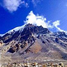
 Annapurna, Manang District | |
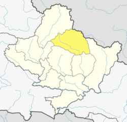 Location of Manang (dark yellow) in Gandaki Pradesh | |
| Country | |
| Province | Gandaki Pradesh |
| Admin HQ. | Chame |
| Government | |
| • Type | Coordination committee |
| • Body | DCC, Manang |
| Area | |
| • Total | 2,246 km2 (867 sq mi) |
| Population (2011) | |
| • Total | 6,538 |
| • Density | 2.9/km2 (7.5/sq mi) |
| Time zone | UTC+05:45 (NPT) |
| Telephone Code | 066 |
| Website | ddcmanang |
The pass of Thorung La at 5415 meters above the sea connects the district to Mustang District by providing a route between the towns of Manang and Muktinath. Manang district gets least amount of rainfall among districts of Nepal as it lies to the north of the Himalayas which blocks monsoon air. The Manang Valley, which lies close to the Nepal-Tibet border, offers tremendous opportunities due to its rich natural flora and fauna. Three tracks start from here. The first, via Thorangla, Muktinath, and Mustang to Lhasa—a journey that takes four days; the second via Naur Khola and Naurgaon, which takes five days to Lhasa; and finally the third via Larkiya bazar, which is the one most commonly used by the people of Central Nepal.
Along with the Marwaris who have migrated from India to Nepal in large numbers, the Manangies are the best known traders of Nepal. They have received special dispensation from the King to trade in South East Asia, and travel abroad with precious stones and metals, musk, herbs and other items. They import ready-made garments, watches and electronic goods. Many of the Manangies spend as much as six months away from home, returning only during the summers. Many of them reside in Kathmandu, where their children study in the English medium schools. The parents' lack of proficiency in the English language is irrelevant as it in no way affects their trading skills.
Since the area was opened to outsiders in the late 1970s, many have switched from the traditional agriculture to hoteleering.
The trail from Manang to Muktinath has been used by the locals for hundreds of years to transport huge herds of sheep and yak in and out of Manang. It is an important route for the people of the region.
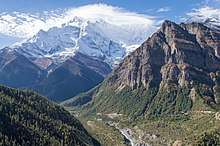
The northern parts of Manang Valley are dry, brown and desolate places, very different from the thick forests and brown green valleys of Sikkim and Eastern Nepal.
Geography and Climate
| Climate Zone[2] | Elevation Range | % of Area |
|---|---|---|
| Subtropical | 1,000 to 2,000 meters 3,300 to 6,600 ft. |
0.3% |
| Temperate | 2,000 to 3,000 meters 6,400 to 9,800 ft. |
3.7% |
| Subalpine | 3,000 to 4,000 meters 9,800 to 13,100 ft. |
14.6% |
| Alpine | 4,000 to 5,000 meters 13,100 to 16,400 ft. |
13.9% |
| Nival | above 5,000 meters | 25.4% |
| Trans-Himalayan[3] | 3,000 to 6,400 meters 9,800 to 21,000 ft. |
42.1% |
Demographics
At the time of the 2011 Nepal census, Manang District had a population of 6,538. Of these, 56.9% spoke Gurung, 21.0% Nepali, 8.5% Tamang, 7.3% Sherpa, 1.7% Magar, 1.1% Newari and 0.8% Thakali as their first language.
76.9% of the population in the district spoke Nepali and 0.6% Sherpa as their second language.[5]
Administration
The district consists of four rural municipalities. These are as follows:[6]
- Chame
- Nason Rural Municipality
- Narpa Bhumi Rural Municipality
- Manang Ngisyang Rural Municipality
Former Municipalities and Village Development Committees
Prior to the restructuring of the district, Manang District consisted of the following municipalities and Village development committees:
See also
- Zones of Nepal (Former)
References
- "National Population and Housing Census 2011 (National Report)" (PDF). Central Bureau of Statistics. Archived from the original (PDF) on 2013-04-18. Retrieved November 2012. Check date values in:
|accessdate=(help) - The Map of Potential Vegetation of Nepal - a forestry/agroecological/biodiversity classification system (PDF), . Forest & Landscape Development and Environment Series 2-2005 and CFC-TIS Document Series No.110., 2005, ISBN 87-7903-210-9, retrieved Nov 22, 2013
- Shrestha, Mani R.; Rokaya, Maan B.; Ghimire, Suresh K. (2005). "Vegetation pattern of Trans-Himalayan zone in the North-West Nepal". Nepal Journal of Plant Sciences. 1: 129–135. Retrieved Feb 7, 2014.
- Banerji, Gargi; Basu, Sejuti. "Climate Change and Himalayan Cold Deserts: Mapping vulnerability and threat to ecology and indigenous livelihoods" (PDF). Pragya. Gurgaon, Haryana, India. Retrieved February 7, 2014.
- 2011 Nepal Census, Social Characteristics Tables
- "स्थानिय तह" (in Nepali). Ministry of Federal Affairs and General Administration. Archived from the original on 31 August 2018. Retrieved 1 September 2018.
External links
| Wikimedia Commons has media related to Manang District. |
Manang District | ||
|---|---|---|
Headquarters: Chame Rural Municipality | ||
| Rural municipalities |
|  |
| Former VDCs | ||