Mae Poen District
Mae Poen (Thai: แม่เปิน, pronounced [mɛ̂ː pɤ̄n]) is a district (amphoe) in the western part of Nakhon Sawan Province, central Thailand.
Mae Poen แม่เปิน | |
|---|---|
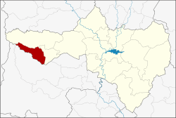 District location in Nakhon Sawan Province | |
| Coordinates: 15°39′28″N 99°28′9″E | |
| Country | Thailand |
| Province | Nakhon Sawan |
| Seat | Mae Poen |
| Area | |
| • Total | 260.2 km2 (100.5 sq mi) |
| Population (2005) | |
| • Total | 19,730 |
| • Density | 76/km2 (200/sq mi) |
| Time zone | UTC+7 (ICT) |
| Postal code | 60150 |
| Geocode | 6014 |
History
Tambon Mae Poen was separated from Lat Yao District to become a minor district (king amphoe) on 15 July 1996.[1]
On 15 May 2007, all of Thailand's 81 minor districts were upgraded to full districts.[2] With publication in the Royal Gazette on 24 August, the upgrade became official .[3]
Geography
Neighboring districts are (from the north clockwise): Mae Wong and Chum Ta Bong of Nakhon Sawan Province, Lan Sak and Ban Rai of Uthai Thani Province, and Umphang of Tak Province.
Administration
The district is divided into a single sub-district (tambon), which is further subdivided into 24 villages (mubans). There are no municipal (thesaban) areas, and a single tambon administrative organization (TAO).
| No. | Name | Thai name | Villages | Pop. |
|---|---|---|---|---|
| 1. | Mae Poen | แม่เปิน | 24 | 19,730 |
References
- ประกาศกระทรวงมหาดไทย เรื่อง แบ่งเขตท้องที่อำเภอลาดยาว จังหวัดนครสวรรค์ ตั้งเป็นกิ่งอำเภอแม่เปิน (PDF). Royal Gazette (in Thai). 113 (Special 18 ง): 15. June 15, 1996.
- แถลงผลการประชุม ครม. ประจำวันที่ 15 พ.ค. 2550 (in Thai). Manager Online.
- พระราชกฤษฎีกาตั้งอำเภอฆ้องชัย...และอำเภอเหล่าเสือโก้ก พ.ศ. ๒๕๕๐ (PDF). Royal Gazette (in Thai). 124 (46 ก): 14–21. August 24, 2007.