Chum Ta Bong District
Chum Ta Bong (Thai: ชุมตาบง, pronounced [t͡ɕʰūm tāː bōŋ]) is a district (amphoe) in the western part of Nakhon Sawan Province, central Thailand.
Chum Ta Bong ชุมตาบง | |
|---|---|
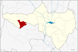 District location in Nakhon Sawan Province | |
| Coordinates: 15°37′54″N 99°33′10″E | |
| Country | Thailand |
| Province | Nakhon Sawan |
| Seat | Chum Ta Bong |
| Area | |
| • Total | 379.04 km2 (146.35 sq mi) |
| Population (2016) | |
| • Total | 18,997 |
| • Density | 50/km2 (130/sq mi) |
| Time zone | UTC+7 (ICT) |
| Postal code | 60150 |
| Geocode | 6015 |
History
The Chum Ta Bong community was established by the people from Tambon Wang Mueang, Lat Yao District in 1967. They had Mr. Bong Charawan (นายบง ชาระวัน) as their leader. The community was in Tambon Huai Nam Hom.
When the government established the minor district Mae Wong in 1992, Huai Nam Hom was included in the district. Later Huai Nam Hom was divided to become three tambons: Huai Nam Hom, Chum Ta Bong, and Pang Sawan.
Effective on 1 July 1997, Tambon Chum Ta Bong and Pang Sawan were separated from Mae Wong to become the minor district (king amphoe) Chum Ta Bong.[1]
On 15 May 2007, all of Thailand's 81 minor districts were upgraded to full districts.[2] With publication in the Royal Gazette on 24 August the upgrade became official .[3]
Geography
Neighboring districts are (from the north clockwise) Mae Wong and Lat Yao of Nakhon Sawan Province, Sawang Arom and Lan Sak of Uthai Thani Province, and Mae Poen of Nakhon Sawan.
Administration
The district is divided into two sub-districts (tambons), which are further subdivided into 22 villages (mubans). There are no municipal (thesaban) areas, and two tambon administrative organizations (TAO).
| No. | Name | Thai name | Villages | Pop. |
|---|---|---|---|---|
| 1. | Chum Ta Bong | ชุมตาบง | 12 | 11,623 |
| 2. | Pang Sawan | ปางสวรรค์ | 10 | 6,746 |
References
- ประกาศกระทรวงมหาดไทย เรื่อง แบ่งเขตท้องที่อำเภอลาดยาว จังหวัดนครสวรรค์ ตั้งเป็นกิ่งอำเภอชุมตาบง (PDF). Royal Gazette (in Thai). 114 (Special 51 ง): 12. June 25, 1997.
- แถลงผลการประชุม ครม. ประจำวันที่ 15 พ.ค. 2550 (in Thai). Manager Online.
- พระราชกฤษฎีกาตั้งอำเภอฆ้องชัย...และอำเภอเหล่าเสือโก้ก พ.ศ. ๒๕๕๐ (PDF). Royal Gazette (in Thai). 124 (46 ก): 14–21. August 24, 2007.