Tak Fa District
Tak Fa (Thai: ตากฟ้า, pronounced [tàːk fáː]) is a district (amphoe) in southeastern part of Nakhon Sawan Province.
Tak Fa ตากฟ้า | |
|---|---|
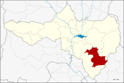 District location in Nakhon Sawan Province | |
| Coordinates: 15°20′55.8″N 100°29′44.8″E | |
| Country | Thailand |
| Province | Nakhon Sawan |
| Seat | Tak Fa |
| Area | |
| • Total | 570.7 km2 (220.3 sq mi) |
| Population (2005) | |
| • Total | 41,192 |
| • Density | 72/km2 (190/sq mi) |
| Time zone | UTC+7 (ICT) |
| Postal code | 60190 |
| Geocode | 6012 |
History
When Thai government built the Phahonyothin Highway, the district was formed by territory taken from Takhli District. It became a district on 13 October 1970.[1][2]
The word "Tak Fa" means "sun drying" or "sunbath" in Thai, because the terrain here is a ground and jungle. The villagers therefore clothed in the sun and called here "Lan Tak Pha" (ลานตากผ้า) and mispronounced to Tak Fa finally.[3]
Geography
Neighboring districts are (from the southwest clockwise): Takhli, Phayuha Khiri, Tha Tako, and Phaisali of Nakhon Sawan Province, and Nong Muang of Lopburi Province.
Administration
The district is divided into seven sub-districts (tambons), which are further subdivided into 77 villages (mubans). The township (thesaban tambon) of Tak Fa covers parts of the tambon Tak Fa and Suk Samran. There are a further seven tambon administrative organizations (TAO).
| No. | Name | Thai name | Villages | Pop. |
|---|---|---|---|---|
| 1. | Tak Fa | ตากฟ้า | 10 | 7,292 |
| 2. | Lam Phayon | ลำพยนต์ | 12 | 4,724 |
| 3. | Suk Samran | สุขสำราญ | 11 | 7,628 |
| 4. | Nong Phikun | หนองพิกุล | 10 | 3,471 |
| 5. | Phu Nok Yung | พุนกยูง | 16 | 3,850 |
| 6. | Udom Thanya | อุดมธัญญา | 9 | 10,438 |
| 7. | Khao Chai Thong | เขาชายธง | 9 | 3,789 |
References
- Department of Agricultural Extension
- พระราชกฤษฎีกาตั้งอำเภอตากฟ้า พ.ศ. ๒๕๑๓ (PDF). Royal Gazette (in Thai). 87 (94 ก): 690–692. October 13, 1970.
- "ข้อมูลตำบลตากฟ้า อำเภอตากฟ้า นครสวรรค์" [Information, Tak Fa Subdistrict, Tak Fa District, Nakhon Sawan]. ThaiTambon (in Thai).