Madison Park, New Jersey
Madison Park is an unincorporated community and census-designated place (CDP) located within Old Bridge Township, in Middlesex County, New Jersey, United States.[6][7] As of the 2010 United States Census, the CDP's population was 7,144.[3] The name "Madison Park" reflects Old Bridge's original name of "Madison Township" which it had when it was formed on March 2, 1869 from portions of South Amboy Township, until November 5, 1975, when voters approved a referendum changing the township's name to Old Bridge Township.[8][9]
Madison Park, New Jersey | |
|---|---|
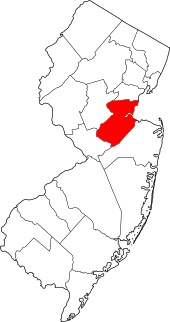
 Map of Madison Park CDP in Middlesex County. Inset: Location of Middlesex County in New Jersey. | |
| Coordinates: 40.445716°N 74.296163°W | |
| Country | |
| State | |
| County | Middlesex |
| Township | Old Bridge |
| Area | |
| • Total | 1.687 sq mi (4.368 km2) |
| • Land | 1.659 sq mi (4.296 km2) |
| • Water | 0.028 sq mi (0.071 km2) 1.64% |
| Elevation | 118 ft (36 m) |
| Population | |
| • Total | 7,144 |
| • Density | 4,306.9/sq mi (1,662.9/km2) |
| Time zone | UTC-5 (Eastern (EST)) |
| • Summer (DST) | UTC-4 (Eastern (EDT)) |
| Area code(s) | 732/848 |
| FIPS code | 3442540[1][4] |
| GNIS feature ID | 02390107[1][5] |
Madison Park is the name of a residential development located west of U. S. route 9 bounded by Bordentown Avenue, Cheesequake Road, and Ernston Road. Portions of Madison Park are served by ZIP Code 08859 for Parlin, New Jersey. Madison Park has a fire department (District 4 Old Bridge Township), a volunteer first aid squad, and a school all located within the development. All of the streets in the development are named after prominent universities, with Princeton Road as an oval interior road connecting to the entire development.
Geography
According to the United States Census Bureau, the CDP had a total area of 1.687 square miles (4.368 km2), including 1.659 square miles (4.296 km2) of land and 0.028 square miles (0.071 km2) of water (1.64%).[1][10]
Demographics
| Historical population | |||
|---|---|---|---|
| Census | Pop. | %± | |
| 1980 | 7,447 | — | |
| 1990 | 7,490 | 0.6% | |
| 2000 | 6,929 | −7.5% | |
| 2010 | 7,144 | 3.1% | |
| Population sources: 1980[11] 2000[12] 2010[3] | |||
Census 2010
The 2010 United States Census counted 7,144 people, 730 households, and 1,858.289 families in the CDP. The population density was 4,306.9 per square mile (1,662.9/km2). There were 730 housing units at an average density of 1,648.3 per square mile (636.4/km2). The racial makeup of the CDP was 52.14% (3,725) White, 13.26% (947) Black or African American, 0.24% (17) Native American, 25.74% (1,839) Asian, 0.00% (0) Pacific Islander, 4.23% (302) from other races, and 4.40% (314) from two or more races. Hispanic or Latino of any race were 13.91% (994) of the population.[3]
The 730 households accounted 33.3% with children under the age of 18 living with them; 51.1% were married couples living together; 13.7% had a female householder with no husband present, and 29.1% were non-families. Of all households, 23.0% were made up of individuals, and 4.6% had someone living alone who was 65 years of age or older. The average household size was 2.72 and the average family size was 3.28.[3]
In the CDP, the population age was spread out with 23.4% under the age of 18, 9.3% from 18 to 24, 30.9% from 25 to 44, 27.9% from 45 to 64, and 8.4% who were 65 years of age or older. The median age was 35.9 years. For every 100 females, the population had 98.3 males. For every 100 females ages 18 and older there were 95.8 males.[3]
Census 2000
As of the 2000 United States Census[4] there were 6,929 people, 730 households, and 730 families living in the CDP. The population density was 1,631.3/km2 (4,216.1/mi2). There were 730 housing units at an average density of 596.3/km2 (1,541.3/mi2). The racial makeup of the CDP was 56.36% White, 13.75% African American, 0.10% Native American, 19.97% Asian, 0.12% Pacific Islander, 4.17% from other races, and 5.53% from two or more races. Hispanic or Latino of any race were 13.05% of the population.[12]
There were 730 households out of which 39.1% had children under the age of 18 living with them, 53.7% were married couples living together, 12.5% had a female householder with no husband present, and 28.2% were non-families. 23.2% of all households were made up of individuals and 5.3% had someone living alone who was 65 years of age or older. The average household size was 2.81 and the average family size was 3.37.[12]
In the CDP the population was spread out with 27.2% under the age of 18, 8.3% from 18 to 24, 35.9% from 25 to 44, 20.3% from 45 to 64, and 8.3% who were 65 years of age or older. The median age was 34 years. For every 100 females, there were 95.7 males. For every 100 females age 18 and over, there were 91.7 males.[12]
The median income for a household in the CDP was $52,263, and the median income for a family was $56,025. Males had a median income of $40,766 versus $31,890 for females. The per capita income for the CDP was $21,622. About 6.0% of families and 8.0% of the population were below the poverty line, including 10.5% of those under age 18 and 7.9% of those age 65 or over.[12]
References
- Gazetteer of New Jersey Places, United States Census Bureau. Accessed July 21, 2016.
- U.S. Geological Survey Geographic Names Information System: Madison Park Park Census Designated Place, Geographic Names Information System. Accessed November 28, 2012.
- DP-1 - Profile of General Population and Housing Characteristics: 2010 Demographic Profile Data for Madison Park CDP, New Jersey, United States Census Bureau. Accessed November 28, 2012.
- U.S. Census website, United States Census Bureau. Accessed September 4, 2014.
- US Board on Geographic Names, United States Geological Survey. Accessed September 4, 2014.
- New Jersey: 2010 - Population and Housing Unit Counts - 2010 Census of Population and Housing (CPH-2-32), United States Census Bureau, August 2012. Accessed November 28, 2012.
- GCT-PH1 - Population, Housing Units, Area, and Density: 2010 - County -- County Subdivision and Place from the 2010 Census Summary File 1 for Middlesex County, New Jersey Archived 2020-02-12 at Archive.today, United States Census Bureau. Accessed November 28, 2012.
- Snyder, John P. The Story of New Jersey's Civil Boundaries: 1606-1968, Bureau of Geology and Topography; Trenton, New Jersey; 1969. p. 170. Accessed March 11, 2012.
- "New Names Voted for 2 Communities", The New York Times, November 6, 1975. p. 88
- US Gazetteer files: 2010, 2000, and 1990, United States Census Bureau. Accessed September 4, 2014.
- Staff. 1980 Census of Population: Number of Inhabitants United States Summary, p. 1-141. United States Census Bureau, June 1983. Accessed June 28, 2015.
- DP-1 - Profile of General Demographic Characteristics: 2000 from the Census 2000 Summary File 1 (SF 1) 100-Percent Data for Madison Park CDP, New Jersey Archived 2020-02-12 at Archive.today, United States Census Bureau. Accessed November 28, 2012.