Los Chiles (canton)
Los Chiles is the 14th canton in the province of Alajuela in Costa Rica.[1] The canton covers an area of 1,358.86 square kilometres (524.66 sq mi),[2] and has a population of 28,694 (estimate as of 2013).[3] The capital city of the canton is also called Los Chiles.
Los Chiles | |
|---|---|
Cantón | |
 | |
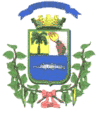
 Flag  Seal | |
 Location of Los Chiles Canton in Alajuela Province | |
| Country | Costa Rica |
| Province | Alajuela |
| Area | |
| • Total | 1,358.86 km2 (524.66 sq mi) |
| Population (June 2013) | |
| • Total | 28,694 |
| • Density | 21/km2 (55/sq mi) |
Geography
The canton lies along the border of Nicaragua at the top of the Llanura de San Carlos (San Carlos Plain) in north central Costa Rica. The Río Pocosol (Little Sun River) forms the southeastern boundary of the canton, with (from north to south) the Río Rita, Río Mónico, Río Frío (Cold River) and the Río Purgatorio (Purgatory River) establishing the southwestern border. This is a low-lying, sparsely settled region primarily devoted to large agricultural enterprises.
Districts
The canton of Los Chiles is subdivided into four districts (distritos):[1]
- Los Chiles
- Caño Negro
- El Amparo
- San Jorge
History
The canton was established by a decree of March 17, 1970.
References
- "División Territorial Administrativa de Costa Rica" (PDF) (in Spanish). Instituto de Fomento y Asesoria Municipal (IFAM). 5 May 2009. Archived from the original (PDF) on 2 August 2015.
- Instituto Geográfico Nacional (IGN), 2001.
- Estadísticas Vitales 2013 Archived 2015-04-02 at the Wayback Machine - INEC