List of road junctions in the United Kingdom: C
This is part of the list of road junctions in the United Kingdom.
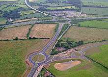
Thickthorn Interchange
Many road junctions are named after pubs. For more information regarding the derivation of pub names see pub names.
C
| Junction Name | Type | Location | Roads | Grid Reference | Notes | |
|---|---|---|---|---|---|---|
| Cadditon Cross | Crossroads | Bondleigh, West Devon |
|
50.8262°N 3.9357°W | Named on road sign at junction | |
| Caenby Corner | Caenby, Lincolnshire | 53°23′34″N 0°32′51″W | ||||
| Caldecotte Roundabout | Caldecotte, Milton Keynes | 52°00′30″N 0°42′34″W | See also Bletcham Roundabout | |||
| Calder Roundabout | Hermiston, Edinburgh |
|
NT186704 | |||
| California Cross | Modbury, Ivybridge, Devon |
|
50.362°N 3.823°W | |||
| California Crossroads | Finchampstead, Berkshire |
|
51.377°N 0.856°W | |||
| Calver Crossroads | Calver, Derbyshire |
|
53°16′13″N 1°38′35″W | |||
| Calverton Lane Roundabout | Two Mile Ash, Milton Keynes |
|
52°02′28″N 0°49′12″W | |||
| Camberwell Green | Camberwell, LB Southwark |
|
51°28′28″N 0°05′36″W | |||
| Cambridge Circus | Crossroads | Central London | TQ299810 | |||
| Cambridge Junction | Portsmouth, Hampshire | SZ636996 | ||||
| Camel Cross | West Camel, Somerset |
|
ST566249 | |||
| Camelford Station | Staggered | Slaughterbridge, Cornwall |
|
50.6385°N 4.6883°W | Named on road sign approaching from N | |
| Campbell Park Roundabout | Roundabout | Central Milton Keynes |
|
52°02′49″N 0°45′01″W | ||
| Canal Bridge | Peckham, LB Southwark |
|
51°29′03″N 0°03′59″W | |||
| Canalside Roundabout | Roundabout | Milton Keynes |
|
SP868396 | ||
| Canaston Bridge | Pembrokeshire |
|
51.8017°N 4.8047°W | |||
| Canderside Toll | Larkhall, South Lanarkshire | NS770483 | ||||
| Canderwater Interchange[1] (former site of) | Canderwater, South Lanarkshire |
|
NS786447 | |||
| Canegore Corner | West Camel, Somerset |
|
ST578254 | |||
| Canklow Roundabout | Canklow, South Yorkshire | 53°24′35″N 1°21′44″W | ||||
| Cannard's Grave | Shepton Mallet, Somerset | 51°10′34″N 2°32′06″W | Named for a local highwayman who was hanged here | |||
| Canning Town | Canning Town, LB Newham | 51°30′56″N 0°00′30″E | ||||
Cannock Interchange
|
Roundabout Interchange | Cannock, Staffordshire |
|
52°39′28″N 2°03′49″W | ||
| Canons Corner | Stanmore, LB Harrow | 51°37′19″N 0°17′34″W | ||||
| Capability Green Junction | Luton, Bedfordshire |
|
51°51′44″N 0°24′30″W | Named after the business park. | ||
| Cardnold Interchange | Glasgow |
|
55°51′17″N 4°20′35″W | webcam | ||
| Carfax | Crossroads | Oxford |
|
SP513062 | Derived from the French for 'Crossroads', Carrefour. | |
| Carholme Roundabout | Lincoln, Lincolnshire | SK953272 | ||||
| Carland Cross | Mitchell, Cornwall | SW847540 | ||||
| Carmyle Avenue Interchange | Glasgow |
|
55°50′05″N 4°09′36″W | |||
| Carpenters Lodge Roundabout[2] | Grade Separated Dumbbell Interchange | Stamford, Lincolnshire |
|
TF037046 | Named after the Carpenters Lodge, a few hundred metres south along the A1, where it intersects Racecourse Road. Upgraded from a roundabout to grade separated dumbbell interchange in 2008/9 | |
| Carracawn Cross | Hessenford, Cornwall |
|
SX322573 | |||
| Carrville Interchange | Durham, County Durham | 54°47′38″N 1°31′46″W | ||||
| Castle Bromwich | Castle Bromwich, West Midlands | 52°30′30″N 1°47′41″W | ||||
| Castle Gate Island | Dudley, West Midlands |
|
52°30′48″N 2°04′24″W | |||
| Catcliffe Roundabout | Rotherham, South Yorkshire | 53°23′57″N 1°20′57″W | ||||
| Catford Gyratory | Catford, LB Lewisham | 51°26′46″N 0°01′10″W | ||||
| Cathill Roundabout | Darfield, South Yorkshire | 53°32′02″N 1°21′14″W | ||||
| Caton Cross | Goodstone, Devon |
|
SX782718 | |||
| Catshill Interchange | Catshill, Worcestershire | SO954729 | ||||
| Catterlen | Penrith, Cumbria |
|
54°41′38″N 2°47′29″W | |||
| Catthorpe Interchange | Catthorpe, Leicestershire | 52°24′11″N 1°10′36″W | ||||
| Caxton Gibbet | Roundabout | Caxton, Cambridgeshire | 52°13′43″N 0°06′12″W | |||
| Cemetery Junction | Bournemouth |
|
50.732°N 1.8740°W | Next to the main Bournemouth Cemetery. The main London-Waterloo to Weymouth, Dorset railway line passes below this junction. | ||
| Cemetery Junction | Reading | 51°27′10″N 0°56′57″W | ||||
| Chain Bar Interchange[3] | Cleckheaton, West Yorkshire | 53°44′12″N 1°43′36″W | ||||
| Chalker's Corner | LB Richmond upon Thames | 51°28′09″N 0°16′35″W | Named after John Chalker's shop in 1911, it remained in the Chalker family until around 1993 after which it became a veterinary surgery - Medivet. | |||
| Chandler's Corner | Rainham, LB Havering |
|
51°31′14″N 0°12′20″E | |||
| Chapel Ash Island | Wolverhampton, West Midlands |
|
52°35′06″N 2°08′05″W | |||
| Chapel Cross | South Cadbury, Somerset |
|
ST631263 | |||
| Charaton Cross | Charaton, Cornwall |
|
SX301698 | |||
| Charing Cross (on Trafalgar Square) | Crossroads | City of Westminster |
|
51°30′28″N 0°07′38″W | ||
| Charlestown Junction | Charlestown, Fife |
|
NJ932006 | |||
| Charlie Brown's Roundabout | Roundabout Interchange | South Woodford, LB Redbridge |
|
51°35′37″N 0°02′12″E | The pub on the roundabout was called The Roundabout but known as Charlie Brown's (the landlord was the son of Charlie Brown, a boxer and landlord of a pub of the same name in Limehouse). This pub was demolished in the 70s with the construction of the M11.[4] | |
| Charlie Sweep's Corner | Garforth, West Yorkshire |
|
53°47′02″N 1°23′09″W | |||
| Charvill's Roundabout | Ware, Hertfordshire |
|
TL356146 | Named after former motor repair and car dealer on the site | ||
| Cheals Roundabout | Crawley, West Sussex |
|
51°06′24″N 0°12′15″W | Immediately next to the century-old Cheals nursery - MichaelT1979 | ||
| Cheam Village | Cheam, LB Sutton | 51°21′28″N 0°12′59″W | ||||
| Cheerbrook Roundabout | Nantwich, Cheshire | SJ674517 | Situated next to Cheerbrook Farm | |||
| Cheldon Cross | Staggered | Chulmleigh, North Devon | unclass. roads to
|
50.9074°N 3.7995°W | Named on fingerpost | |
| Chelston Roundabout | Wellington, Somerset |
|
50°58′55″N 3°12′15″W | |||
| Chequerbent Roundabout | Over Hulton, Greater Manchester |
|
53°33′05″N 2°29′52″W | |||
| Cherwell Valley Interchange | Ardley, Oxfordshire |
|
51°56′54″N 1°12′20″W | |||
| Chevening Cross | Crossroads | Chevening, Kent |
|
51°17′34″N 0°08′23″E | ||
| Chevening Interchange | Chevening, Kent | 51°17′29″N 0°08′36″E | ||||
| Chieveley Interchange | Roundabout Interchange | Chieveley, Berkshire |
|
51°27′09″N 1°18′37″W | ||
| Child's Corner | South Woodford, LB Redbridge |
|
TQ409904 | Originally a cross roads, with the construction of the M11 terminus at Charlie Browns this junction now just provides restricted access to residential streets | ||
| Chiswell Interchange | Bricket Wood, Hertfordshire | 51°42′59″N 0°23′08″W | ||||
Chiswick Roundabout
|
Gunnersbury, LB Hounslow |
|
51°29′29″N 0°16′55″W | |||
| Chiverton Cross | Blackwater, Cornwall | SW747470 | ||||
| Chowns Mill Roundabout | Higham Ferrers, Northamptonshire |
|
SP959699 | |||
| Churchill Gate | Churchill, Somerset | ST448598 | ||||
| Cinder Bank Island | Dudley, West Midlands |
|
52°30′01″N 2°05′27″W | |||
| Cinderhill | Nottingham, Nottinghamshire | SK536436 | ||||
| City Road Junction | Stoke-on-Trent, Staffordshire | SJ881451 | ||||
| Claggybottom | Crossroads | Kimpton, Hertfordshire |
|
51°51′19″N 0°18′39″W | ||
| Clandon Crossroads | West Clandon, Surrey | TQ046510 | ||||
| Clapham Common | Clapham, LB Lambeth | TQ294753 | ||||
| Clark's Green Roundabout | Capel, Surrey |
|
TQ171398 | |||
| Clay Corner | Chertsey, Surrey |
|
TQ049660 | |||
| Clay Mills | Burton upon Trent, Staffordshire |
|
52°50′15″N 1°36′46″W | (aka Burton North) | ||
| Cleveland Tontine | Ingleby Arncliffe, North Yorkshire |
|
54°23′14″N 1°19′09″W | Named after the inn at the junction | ||
| Clifton's Roundabout | Roundabout | Horn Park, Eltham, LB Greenwich |
|
51°27′0″N 0°1′45″E | Named after the Clifton Service Station, the adjacent Esso garage. Sometimes referred to as the World of Leather roundabout, from the store formerly located opposite. | |
| The Clock | Roundabout Interchange | Welwyn, Hertfordshire | 51°50′0″N 0°12′34″W | Named after the hotel on the site, and notable for having Roman Baths excavated under the A1 at the southern end of the junction | ||
| Clockhouse Roundabout | LB Hounslow |
|
51°26′57″N 0°26′49″W | |||
| Clovelly Cross | Roundabout | Higher Clovelly, near Clovelly, Devon |
|
50.9847°N 4.4048°W | ||
| Coal House Roundabout | Team Valley, Gateshead |
|
54°55′16″N 1°36′45″W | The NCB had a regional headquarters there in the 1970s. The site is now occupied by a Sainsbury's. | ||
| Cobbler's Corner | East Kirkby, Lincolnshire |
|
TF341627 | |||
| Cockhedge Green Island | Roundabout | Warrington, Cheshire | SJ611885 | |||
| Codnor | Codnor, Ripley, Derbyshire | SK420496 | ||||
| Coffee Hall Roundabout | Coffee Hall, Milton Keynes |
|
52°01′19″N 0°44′20″W | |||
| Coisley Hill Roundabout | Handsworth, South Yorkshire |
|
53°21′21″N 1°23′19″W | |||
| Coldra Interchange | Newport | ST360896 | ||||
| Coldwind Cross | Crossroads | near Coldwind, Cornwall |
|
SW771406 | ||
| Colenso Cross | Crossroads | Perran Downs, Cornwall |
|
SW559305 | ||
| Colham Roundabout | Colham Green, LB Hillingdon |
|
51°31′06″N 0°27′25″W | |||
| Collan's Cross | near Camelford, Cornwall |
|
SX122853 | |||
| College Road Roundabout | Rotherham, South Yorkshire | 53°25′59″N 1°21′48″W | ||||
| Colliers Wood | Colliers Wood, LB Merton |
|
51°25′04″N 0°10′42″W | |||
| Colnbrook Interchange | Four Level Stack | Slough, Berkshire | 51°25′04″N 0°10′42″W | |||
| Colsterworth Roundabout | Colsterworth, Lincolnshire | 52°48′13″N 0°36′39″W | ||||
| Concord Roundabout | Roundabout | Heathrow, LB Hillingdon |
|
TQ075769 | Named after the model Concorde plane that was sited on the roundabout for 16 years. | |
| The Cone Roundabout | Bristol |
|
ST582809 | |||
| Connaught Roundabout | Roundabout | Custom House, LB Newham |
|
TQ416808 | ||
| Cook's Corner | Harwich, Essex |
|
TM174308 | |||
| Cooks Ferry Roundabout | Roundabout Interchange | LB Waltham Forest |
|
51°36′46″N 0°02′15″W | ||
| Coombe Cross | Crossroads | Ashburton, Devon |
|
SX782707 | ||
| Coombe Cross | Crossroads | Tipton St John, Devon | unclassified roads:
|
50.7198°N 3.2829°W | ||
| Coombe Lane Junction | New Malden, Royal Borough of Kingston |
|
51°24′56″N 0°15′03″W | |||
| Coombe Street Lane Roundabout | Yeovil, Somerset |
|
50°57′24″N 2°38′58″W | |||
| Cooper Dean | Roundabout with Flyover | Bournemouth, Dorset |
|
50.7477°N 1.8281°W | Named after a local landowner | |
| Coopers Cross | T junction | Chawleigh, Mid Devon | unclass. roads to
|
50.8917°N 3.8140°W | Named on fingerpost | |
| The Comet Roundabout | Roundabout | Hatfield, Hertfordshire | 51°45′38″N 0°14′35″W | Named after the pub-hotel on the roundabout, itself named after the de Havilland DH.88 Comet. Aerospace connections all over the town are evident in road and junction names. | ||
| Commonhead Roundabout | Roundabout Interchange | Swindon, Wiltshire |
|
SU193824 | Work to add a flyover for A419 over the roundabout completed 2007 | |
| Copdock Interchange | Roundabout Interchange | Ipswich, Suffolk |
|
52°02′10″N 1°05′54″E | ||
| Coppid Beech Roundabout | Roundabout | Bracknell / Wokingham | 51.413°N 0.799°W | |||
| Copt Heath | Copt Heath, West Midlands |
|
SP171786 | |||
| Corey's Mill | Roundabout Interchange | Stevenage, Hertfordshire | 51°55′40″N 0°13′11″W | |||
| Corntown Cross | Cornwood, Devon |
|
SX604588 | |||
| Cotley Hill Roundabout | Warminster, Wiltshire |
|
51°11′06″N 2°07′12″W | Named after the Hillfort north of the roundabout | ||
| Countess Wear Roundabout | Roundabout | Countess Wear, Exeter |
|
50.7003°N 3.4935°W | ||
| Cowley Interchange | Cowley, Oxfordshire |
|
51°43′47″N 1°12′09″W | |||
| County Islands | ||||||
Coven Heath
|
Coven, Staffordshire | 52°38′17″N 2°07′32″W | ||||
| Craigend Interchange[5] | Perth, Scotland |
|
NO121204 | |||
| Craighall | Port Dundas, Scotland |
|
NS592664 | webcam | ||
| Craigton Interchange[6] | Glasgow | 55°54′04″N 4°29′03″W | ||||
| Crawley Junction | Crawley, West Sussex | TQ301387 | ||||
| Crelly Cross | Porkellis, near Helston, Cornwall |
|
50.1514°N 5.2510°W | |||
| Cribbs Causeway Interchange | Bristol | ST578813 | ||||
| Cribbs Causeway Roundabout | Bristol |
|
ST574809 | |||
| Crick | Crick, Northamptonshire | 52°21′02″N 1°09′17″W | ||||
| Crittall's Corner[7] | Roundabout with flyover | Sidcup, Kent |
|
51°24′47″N 0°6′47″E | Named after a Crittall Windows factory that was located there. | |
| Croft Interchange | Warrington, Cheshire | 53°25′31″N 2°33′03″W | ||||
| Crookbarrow | Worcester, Worcestershire |
|
52°10′07″N 2°10′50″W | Named after Crookbarrow Hill overlooking the interchange | ||
| The Crooked Billett Roundabout | Staines, Surrey | 51°26′13″N 0°30′01″W | ||||
| The Crooked Billet | Roundabout Interchange | Walthamstow, LB Waltham Forest |
|
51°36′03″N 0°00′57″W | ||
| Crooklands | Crooklands, Cumbria | 54°14′13″N 2°42′59″W | ||||
| The Cross in Hand | Lutterworth, Leicestershire |
|
52°27′03″N 1°15′21″W | |||
| Cross Lanes | Crossroads | near Chacewater, Cornwall |
|
SW766428 | ||
| Cross Lanes | Heighington, County Durham |
|
54°35′05″N 1°37′55″W | |||
| The Crosshands | Llandenny, Monmouthshire |
|
SO431039 | |||
| Crosspoles Junction | Laurencekirk, Aberdeenshire |
|
NO671678 | |||
| Crosthwaite Roundabout | Keswick, Cumbria |
|
54°36′34″N 3°08′28″W | |||
| Crown and Sceptre | Feltham, LB Hounslow |
|
51°27′31″N 0°24′12″W | |||
| The Crown Crossroads | Walton, Merseyside | SJ379953 | ||||
| Crown Island | Nottingham, Nottinghamshire |
|
SK543400 | Named after the pub on the north side of the roundabout | ||
| Crownhill Roundabout | Crownhill, Milton Keynes |
|
52°02′04″N 0°48′15″W | |||
| Crowwood Roundabout | Stepps, North Lanarkshire |
|
NS670690 | webcam | ||
| Cuckolds Cross | Crossroads | Kimpton, Hertfordshire |
|
51°51′37″N 0°17′35″W | ||
| Culdrose Roundabout | Roundabout | Culdrose, Helston, Cornwall |
|
50.0733°N 5.2401°W | ||
| Cumberland Basin System | Hotwells, Bristol |
|
ST569724 | Named after the area of Bristol's Floating Harbour it bridges. The Cumberland Basin itself is named after the Duke of Cumberland who was a chief financier of the new entrance to the Floating Harbour. | ||
| Cumbernauld Road Interchange | Glasgow |
|
55°52′25″N 4°11′04″W | |||
References
- http://hansard.millbanksystems.com/written_answers/1982/jun/08/motorways
- "Archived copy". Archived from the original on 10 February 2009. Retrieved 10 January 2009.CS1 maint: archived copy as title (link)
- http://www.opsi.gov.uk/si/si1989/Uksi_19890449_en_1.htm
- "GO BRITANNIA! Travel Guide: London's East End - Mystery of the Charlie Brown Roundabout". Archived from the original on 29 October 2013. Retrieved 6 August 2007.
- http://hansard.millbanksystems.com/written_answers/1982/jun/08/motorways
- http://hansard.millbanksystems.com/written_answers/1982/jun/08/motorways
- Statutory Instrument 1987 No.1542 The A20 Trunk Road (Sidcup Bypass, Bexley and Bromley) (Prescribed Routes) Order 1987
This article is issued from Wikipedia. The text is licensed under Creative Commons - Attribution - Sharealike. Additional terms may apply for the media files.