Stepps
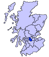
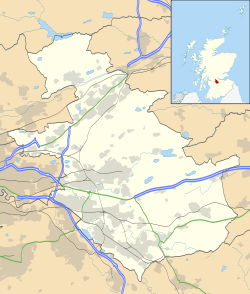
Stepps is a thriving settlement in North Lanarkshire, Scotland, near the north-eastern outskirts of Glasgow.[2] It enjoys recently upgraded facilities that include a new primary school, library, and sports facilities while retaining a historic heart around its church in Whitehill Avenue and its Victorian and Edwardian housing. Excellent travel connections by road and rail mean residents work in Glasgow, Edinburgh, Falkirk, Stirling and beyond. At the same time its location means that excellent walks in the new Seven Lochs Wetland Park are on the doorstop, from which views to the Campsies and Loch Lomond can be enjoyed.[3] It has a population of around 6,730.[4]
Stepps
| |
|---|---|
| Population | 6,730 Mid-2012 estimate[1] |
| OS grid reference | NS655685 |
| Lieutenancy area | |
| Country | Scotland |
| Sovereign state | United Kingdom |
| Post town | GLASGOW |
| Postcode district | G33 |
| Dialling code | 0141 |
| Police | Scotland |
| Fire | Scottish |
| Ambulance | Scottish |
| UK Parliament | |
| Scottish Parliament | |
History
The etymology of the name is uncertain but may relate to stepping stones over boggy ground. Early maps give the name as Coshnocksteps.[5] Steps is included on several old documents including maps by John Ainslie, Thomas Richardson and William Forrest.[6]
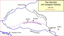
Originally part of the Garnkirk estate, the name for the settlement appears to post-date that of the main road through its centre, Steps Road, which was named in the 19th century. The railway came to Steps around 1831.[7] The name and spelling Stepps only became accepted when the name of the railway station formally changed to Stepps in 1924.
Stepps is home to one of Scotland's oldest Hockey Clubs. Formed in 1913, Stepps Hockey Club is building towards its centenary celebrations and currently competes in the Second Division of the Scottish National Hockey League. The tennis club was founded in 1905 and new facilities, including all-weather courts, were recently completed. The local cultural centre is home to the library, meeting rooms for local clubs and all-weather facilities for football and hockey. It is located on the same campus as Stepps Primary School, all of which was built in 2007.
Transport
.jpg)
.jpg)
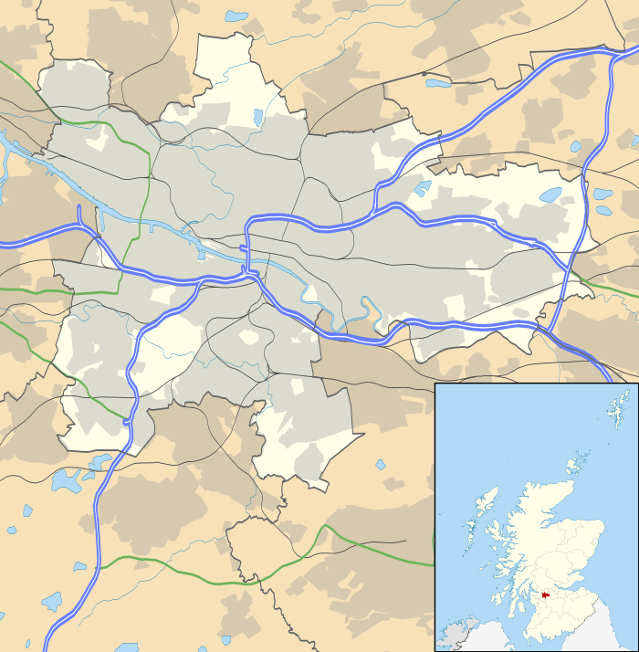
The town is served by a railway station on SPT's Cumbernauld Line, providing a quick commute to central Glasgow, and by the A80 road. The town was bypassed by the southern section of the M80 motorway in 1992; that section of motorway is still referred to locally as the Stepps Bypass. The M80 upgrade between Stepps and Haggs began in 2009 and was completed on 26 August 2011. The project cost around £320 million.[8]
The town's main bus service is the number 38C bus.
Schools
Stepps has two primary schools. Stepps Primary School was established in 1902 but opened in new premises, shared with Stepps Public Library on a different site in 2007. Most of its pupils go on to Chryston High School. St Joseph's Roman Catholic Primary School was first opened in 1900 but a new building was opened in 1985. Most of its pupils go on to Our Lady's High School, Cumbernauld.
Business

Historical industries in the area include a brass foundry, whisky blending, and coal mining. In the 1990s the Buchanan Business Park was developed.[9] Modern businesses include Bannatyne's Health Club and Solutions Driven.[10] The town is home to the Garfield House Hotel and Premier Inn both on Cumbernauld Road.
References
- Bunyan, Freda; Kidd, Neil (1996). The Story of Stepps. Strathkelvin District Libraries. ISBN 0-904966-44-5.
- "Estimated population of localities by broad age groups, mid-2012" (PDF). Retrieved 3 January 2018.
- "OS 25 inch 1892-1949". National Library of Scotland. Ordnance Survey. Retrieved 26 October 2017.
- "Details of Stepps". Retrieved 17 September 2014.
- "Estimated population of localities by broad age groups, mid-2012" (PDF). Retrieved 3 January 2018.
- Drummond, Peter, John (2014). An analysis of toponyms and toponymic patterns in eight parishes of the upper Kelvin basin (PDF). Glasgow: Glasgow University. p. 175. Retrieved 3 July 2017.
- "Old County Maps". NLS. Retrieved 27 January 2018.
- "Stepps". Gazetteer of Scotland. Retrieved 24 February 2018.
- "M80 Stepps to Haggs Upgrade Project". roadtraffic-technology. Retrieved 2 March 2018.
- "Stepps". Gazetteer of Scotland. Retrieved 24 February 2018.
- Peattie, Karen (17 March 2017). "Digital drives global growth". Business Quarter. Retrieved 2 March 2018.
External links
- CANMORE/RCAHMS record for Glasgow, Stepps, Cardowan Colliery
- RCAHMS record for Glasgow, Cranhill, Stepps Road, Water Tower
- Scotland's Places: Stepps
- Stepps Online Community Website
- Stepps Lawn Tennis Club
.jpg) Buchanan Business Park (2018) higher
Buchanan Business Park (2018) higher.jpg) Buchanan Business Park (2018) lower
Buchanan Business Park (2018) lower.jpg) Stepps from the air
Stepps from the air.jpg) The A80 and M80 from the air
The A80 and M80 from the air