A25 road
The A25 road is a main road in the South East of England. It carries traffic from Guildford in Surrey eastward through Dorking along the southern edge of the North Downs, i.e. the Vale of Holmesdale, between that range and the Greensand Ridge to reach mid-west Kent. En route, the road passes through Reigate, Redhill, Nutfield, Bletchingley, Godstone, Oxted, Westerham, Brasted, Sevenoaks and Borough Green. It passes over six of the seven rivers which drain the vale and land to the south, in separate catchments. A short distance beyond Borough Green, at Wrotham Heath, Platt, Kent the A25 ends at a junction with the A20, which continues eastward towards Maidstone. It continues for a short distance beyond the traditional Portsmouth Road, since replaced by a bypass which the road does not reach, and thus extends into Zone 3.
| |
|---|---|
 | |
| Major junctions | |
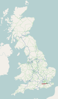
| West end | Guildford, Surrey |
| East end | Wrotham Heath, Kent |
| Location | |
| Primary destinations | Sevenoaks Reigate Dorking |
| Road network | |

Route
The east of the route the Victoria County History describes as a main road in 1911.[1] Relatively briefly the modern road uses bypasses and straightened cuts. Many of the inns along its path were one time staging inns. One of the earliest sections of the M25 motorway runs parallel and to the north of the A25: hence the London Orbital Road was numbered M25.
As such, most of the route is a single carriageway and a very small minority of it is a dual carriageway: the junctions at Guildford and Redhill.
Its route is 1 mile (1.6 km) or less at all points south of the North Downs which has the Pilgrims' Way (here also known as the North Downs Way) and roughly follows an ancient trackway, which was longer and stretched to Salisbury, Wiltshire, the Harrow Way. The range is an intermittently broken by river valleys, variable width escarpment with a steep southern slope, often quarried away into vertical faces, it includes Botley Hill and Box Hill and this ridge is one of the two mentioned ranges of hills which form in the western half the Surrey Hills AONB.[2]
The route has been included in the London-Surrey Cycle Classic alongside the entrances to Hatchlands Park and Clandon Park in Surrey. The east of the county has Reigate Castle along its route. Combe Bank Landscaped Grounds and Squerryes Court are along the route in west Kent, bringing the total of listed English gardens along the route to four.
See also
References
- H.E. Malden (editor) (1912). "Parishes: Limpsfield". A History of the County of Surrey: Volume 4. Institute of Historical Research. Retrieved 3 February 2014.CS1 maint: extra text: authors list (link)
- Natural England - Geodiversity Archived 2 October 2013 at the Wayback Machine
A roads in Zone 2 of the Great Britain road numbering scheme | ||
|---|---|---|