List of listed buildings in Aberfeldy, Perth and Kinross
List
| Name | Location | Date Listed | Grid Ref. [note 1] | Geo-coordinates | Notes | LB Number [note 2] | Image |
|---|---|---|---|---|---|---|---|
| Crieff Road, Church Of Scotland Parish Church Including Boundary Walls | 56°37′03″N 3°52′05″W | Category C(S) | 20837 |  | |||
| 13 Kenmore Street | 56°37′08″N 3°52′09″W | Category C(S) | 20843 | | |||
| 15 - 19 (Odd Nos) And 19A Kenmore Street | 56°37′07″N 3°52′10″W | Category B | 20844 | | |||
| 21, 23 And 25 Kenmore Street With Fonesca Cottage | 56°37′07″N 3°52′11″W | Category C(S) | 20845 | | |||
| 35 - 41 (Odd Nos) Kenmore Street | 56°37′07″N 3°52′14″W | Category C(S) | 20846 | | |||
| 43, 43A And 45 Kenmore Street With Ivy Cottage | 56°37′06″N 3°52′16″W | Category B | 20847 | | |||
| 38 - 44 (Even Nos) Kenmore Street Including Ancillary Building | 56°37′07″N 3°52′14″W | Category C(S) | 20853 | | |||
| 8 The Square, Royal Bank Of Scotland | 56°37′10″N 3°51′56″W | Category B | 20857 | | |||
| 22 The Square, Co-Op Buildings And 6 Dunkeld Street | 56°37′10″N 3°51′52″W | Category C(S) | 20858 | | |||
| Home Street, Our Lady Of Mercy (Roman Catholic) Church Including Boundary Walls, Gate And Railings | 56°37′17″N 3°51′49″W | Category B | 48853 | | |||
| Taybridge Road, Rose Cottage Including Ancillary Building, Boundary Walls And Gatepiers | 56°37′12″N 3°52′09″W | Category C(S) | 48862 | | |||
| 12 - 16 (Even Nos) Kenmore Street | 56°37′08″N 3°52′11″W | Category C(S) | 20850 | | |||
| 46 - 50 (Even Nos) Kenmore Street Including Ancillary Building | 56°37′07″N 3°52′16″W | Category C(S) | 20854 | | |||
| 1 Bank Street, Bank House And Bank Building Including Boundary Walls, Gates And Railings | 56°37′08″N 3°52′00″W | Category B | 20855 | | |||
| Bridgend, Highland Gift Shop Including Boundary Walls And Railings | 56°37′08″N 3°51′56″W | Category C(S) | 48841 | | |||
| Dunkeld Road, Aberfeldy Distillery And Dewar's World Of Whisky Including Stalk And Ancillary Buildings | 56°37′28″N 3°50′59″W | Category B | 48846 | | |||
| The Square (Off), Former Congregational Church | 56°37′11″N 3°51′56″W | Category C(S) | 48870 | | |||
| Crieff Road, Ivybank, Rosemount And Moncrieff Surveyors Including Boundary Walls And Gatepiers | 56°37′08″N 3°52′07″W | Category B | 20840 | | |||
| Kenmore Street, Armoury Toll House Including Boundary Walls | 56°37′06″N 3°52′18″W | Category B | 20848 | | |||
| 4- 8 (Even Nos) Kenmore Street | 56°37′09″N 3°52′09″W | Category C(S) | 20849 | | |||
| 30 - 36 (Even Nos) Kenmore Street | 56°37′08″N 3°52′13″W | Category C(S) | 20852 | | |||
| 1 Old Crieff Road And 5 Tomchulan Court Including Terrace And Railings | 56°37′10″N 3°51′51″W | Category B | 20856 | | |||
| Taybridge Drive, Black Watch Monument | 56°37′15″N 3°52′23″W | Category B | 20862 | | |||
| 45 Dunkeld Street, Viewfield | 56°37′14″N 3°51′45″W | Category B | 20863 | | |||
| 1- 6 (Inclusive Nos) Breadalbane Terrace Including Boundary Wall | 56°37′16″N 3°51′42″W | Category C(S) | 48839 | | |||
| Bridgend, War Memorial | 56°37′08″N 3°51′56″W | Category C(S) | 48842 | | |||
| 5 - 9 (Odd Nos) Chapel Street | 56°37′11″N 3°51′55″W | Category C(S) | 48843 | | |||
| Old Crieff Road, Aberfeldy Cottage Hospital Including Boundary Walls And Gatepiers | 56°37′06″N 3°51′28″W | Category C(S) | 48860 | | |||
| 21 The Square, Hobart House, Co-Op Building And 10 Tomchulan Court | 56°37′10″N 3°51′52″W | Category C(S) | 48869 | | |||
| Crieff Road, Bridge Over Moness Burn | 56°36′58″N 3°51′59″W | Category B | 20841 | | |||
| 22 - 26 (Even Nos) Kenmore Street | 56°37′08″N 3°52′12″W | Category C(S) | 20851 | | |||
| Taybridge Road, Church Hall And Tower Including Boundary Walls | 56°37′10″N 3°52′06″W | Category C(S) | 20860 | | |||
| 17, 19, 21, 21A And Post Office, Dunkeld Street | 56°37′12″N 3°51′51″W | Category C(S) | 48847 | | |||
| Home Street, Prospect House Including Boundary Walls And Gate | 56°37′14″N 3°51′45″W | Category C(S) | 48852 | | |||
| Taybridge Terrace, Tweed Mill Including Boundary Walls | 56°37′18″N 3°52′04″W | Category B | 48865 | | |||
| The Square And Old Crieff Road, Bank Of Scotland, Struan House And Tulloch Bank Including Boundary Walls, Gatepiers, Gates And Railings | 56°37′09″N 3°51′52″W | Category B | 48871 | | |||
| The Square, Water Fountain | 56°37′09″N 3°51′54″W | Category C(S) | 48872 | | |||
| Urlar Road, Torr Hill Including Gatepiers, Gates And Boundary Walls | 56°36′52″N 3°52′05″W | Category B | 48873 | | |||
| Mill Street, Aberfeldy Water Mill | 56°37′10″N 3°52′02″W | Category A | 20859 | | |||
| Tay Bridge | 56°37′17″N 3°52′25″W | Category A | 20861 | 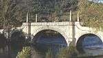 | |||
| Alma Avenue, Dun Aluinn Including Terrace Walls | 56°36′55″N 3°52′34″W | Category C(S) | 48835 | | |||
| 2- 6 (Even Nos) Bank Street | 56°37′09″N 3°51′59″W | Category B | 48837 | | |||
| Bank Street, Library And Area Office With Crieff Road, Municipal Buildings Including Ancillary Building, Boundary Walls And Gatepiers | 56°37′08″N 3°52′05″W | Category B | 48838 | | |||
| Chapel Street, Former Free Church Including Boundary Walls And Gates | 56°37′13″N 3°51′53″W | Category B | 48844 | | |||
| Dunkeld Street, Station Hotel | 56°37′14″N 3°51′46″W | Category C(S) | 48851 | | |||
| 1 And 2 The Square | 56°37′11″N 3°51′54″W | Category C(S) | 48867 | | |||
| 3 - 7 (Inclusive Nos) The Square | 56°37′11″N 3°51′55″W | Category C(S) | 48868 | | |||
| Crieff Road, Aberfeldy Town Hall Including Boundary Walls | 56°37′06″N 3°52′03″W | Category B | 20839 | | |||
| 18 - 24 (Even Nos) Dunkeld Street | 56°37′12″N 3°51′49″W | Category C(S) | 48849 | | |||
| 32 Dunkeld Street, Alexandra House, Including Boundary Walls | 56°37′12″N 3°51′48″W | Category B | 48850 | | |||
| Kenmore Street, Dunolly Including Cottage, Boundary Walls, Gatepiers, Railings And Gates | 56°37′05″N 3°52′28″W | Category C(S) | 48859 | | |||
| Taybridge Terrace, Strawberry Bank | 56°37′15″N 3°52′06″W | Category C(S) | 48863 | | |||
| Taybridge Terrace, Victoria Park, Pavilion | 56°37′20″N 3°52′06″W | Category C(S) | 48866 | | |||
| Crieff Road, Dean House Including Boundary Walls | 56°37′04″N 3°52′02″W | Category C(S) | 20838 | | |||
| Crieff Road, Moness Country Club, Moness House | 56°36′58″N 3°51′47″W | Category B | 20842 | | |||
| Appin Place, Workshop | 56°37′13″N 3°51′54″W | Category C(S) | 48836 | | |||
| 39 Dunkeld Street, Breadalbane Bakery | 56°37′13″N 3°51′47″W | Category C(S) | 48848 | | |||
| Breadalbane Terrace, Palace Hotel Including Ancillary Building And Boundary Walls | 56°37′15″N 3°51′43″W | Category B | 48840 | | |||
| Crieff Road, Breadalbane Academy Including Ancillary Buildings | 56°37′03″N 3°52′14″W | Category C(S) | 48845 | | |||
| Kenmore Street, Dundarach Including Boundary Walls And Gates | 56°37′05″N 3°52′21″W | Category C(S) | 48858 | | |||
| Taybridge Drive, Dunvarlich Including Boundary Walls | 56°37′10″N 3°52′23″W | Category B | 48861 | | |||
| Taybridge Terrace, Mill House | 56°37′17″N 3°52′04″W | Category C(S) | 48864 | |
Key
The scheme for classifying buildings in Scotland is:
- Category A: "buildings of national or international importance, either architectural or historic; or fine, little-altered examples of some particular period, style or building type."[1]
- Category B: "buildings of regional or more than local importance; or major examples of some particular period, style or building type, which may have been altered."[1]
- Category C: "buildings of local importance; lesser examples of any period, style, or building type, as originally constructed or moderately altered; and simple traditional buildings which group well with other listed buildings."[1]
In March 2016 there were 47,288 listed buildings in Scotland. Of these, 8 per cent were Category A, and 50 per cent were Category B, with the rest listed at Category C.[2]
Notes
- Sometimes known as OSGB36, the grid reference (where provided) is based on the British national grid reference system used by the Ordnance Survey.
• "Guide to National Grid". Ordnance Survey. Retrieved 12 December 2007.
• "Get-a-map". Ordnance Survey. Retrieved 17 December 2007. - Historic Environment Scotland assign a unique alphanumeric identifier to each designated site in Scotland, for listed buildings this always begins with "LB", for example "LB12345".
References
- All entries, addresses and coordinates are based on data from Historic Scotland. This data falls under the Open Government Licence
- "What is Listing?". Historic Environment Scotland. Retrieved 29 May 2018.
- Scotland's Historic Environment Audit 2016 (PDF). Historic Environment Scotland and the Built Environment Forum Scotland. pp. 15–16. Retrieved 29 May 2018.
This article is issued from Wikipedia. The text is licensed under Creative Commons - Attribution - Sharealike. Additional terms may apply for the media files.