Leidschendam-Voorburg
Leidschendam-Voorburg ([ˈlɛitsə(n)ˌdɑm ˈvoːrbɵrx] (![]()
Leidschendam-Voorburg | |
|---|---|
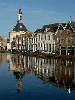 The Vliet through Leidschendam | |
 Flag Coat of arms | |
.svg.png) Location in South Holland | |
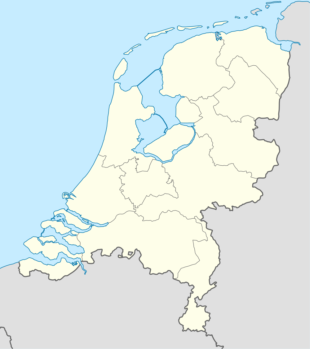 Leidschendam-Voorburg Location in the Netherlands | |
| Coordinates: 52°5′N 4°24′E | |
| Country | Netherlands |
| Province | |
| Established | 1 January 2002[1] |
| Government | |
| • Body | Municipal council |
| • Mayor | Klaas Tigelaar (CU) |
| Area | |
| • Total | 35.62 km2 (13.75 sq mi) |
| • Land | 32.70 km2 (12.63 sq mi) |
| • Water | 2.92 km2 (1.13 sq mi) |
| Elevation | 0 m (0 ft) |
| Population (January 2019)[5] | |
| • Total | 75,425 |
| • Density | 2,307/km2 (5,980/sq mi) |
| Time zone | UTC+1 (CET) |
| • Summer (DST) | UTC+2 (CEST) |
| Postcode | 2260–2275 |
| Area code | 070, 071 |
| Website | www |
Origin
The municipality of Leidschendam-Voorburg is the result of merging the municipalities Leidschendam and Voorburg in 2002. It consists of the two towns Leidschendam and Voorburg, which grew towards each other in the first half of the 20th century. The village Stompwijk and a hamlet called Wilsveen also belong to the municipality.
Leidschendam-Voorburg abuts the city of The Hague and is often regarded as its suburb, even though it is an independent municipality. It is part of the Haaglanden conurbation. Stompwijk is still a rural village, located a few kilometres northeast of Leidschendam.
Historic town centers
Leidschendam as well as Voorburg have their own historic town center, which are both decentral situated.
Historic Leidschendam lies around the acien locks in the Vliet canal in the eastern part of the town.
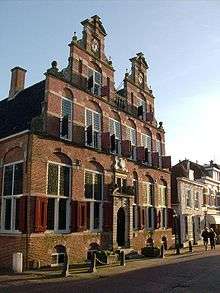
About 3 kilometers more to the South is the beginning of the Herenstraat, the most important and longest street of the Voorburg town center. Historic Voorburg is mainly situated in between this half a kilometer long street and (again) the Vliet. The canal forms also the eastern border of the town. The most important buildings like Swaensteyn House, the Old Church (Oude Kerk) and Hofwijck are in or very near the Herenstraat.
Mall of the Netherlands
Until 2019 the current Leidschendam shopping mall: Leidsenhage is undergoing a total makeover. By that year this project should be completed. The new shopping area will be expanded to 117.000 square meters[6]. The center also will get a new name: "Mall of the Netherlands".
Sister cities
Leidschendam-Voorburg is twinned with:
|
Transport
Public transport
Railway
Three railway stations are located within the municipality, providing links with all major cities in the Randstad. The main trainstation is Voorburg on The Hague - Utrecht line. This station is on the Southern edge of the town center.
There are two stations on the Rotterdam-Amsterdam line, which are situated on the border of The Hague: Den Haag Laan van NOI (for some Intercity trains and local trains) and Den Haag Mariahoeve (only for local trains).
Light rail
Leidschendam-Voorburg has two stations on the RandstadRail lines. RandstadRail is the official name for a light rail project connecting the cities of The Hague, Rotterdam and Zoetermeer. These lines use former train routes, which are now converted for use by light rail vehicles.
It is a somewhat confusing name as for travelers RandstadRail is only used for tram 3 and 4 to Zoetermeer. The line to Rotterdam is exploited as a branch of the Rotterdam metro: Rotterdam metro line E.
Stations in Leidschendam-Voorburg (for both trams and metro) are Voorburg 't Loo and Leidschendam-Voorburg. RandstadRail also stops at Den Haag Laan van NOI train station.
Bus and tram
There are two major bus services running through this municipality. They are HTM and Veolia. Several tram trajectories through Leidschendam-Voorburg - run by HTM - connect various parts of the city with each other, as well as with various neighbouring cities.
Roads
Leidschendam-Voorburg is connected to the A4 (Amsterdam - Belgian border by Rotterdam) and A12 (The Hague - German border by Utrecht) motorways, which cross each other near the city center of Voorburg.
The N14 dual carriageway, which connects the A4 at Leidschendam to the N44 dual carriageway at Wassenaar runs through a series of tunnels in the municipality.
Together with a part of motorway A4 and several local roads the N14 forms the Ring Den Haag.
Cycle paths
Like every dutch municipality Leidschendam-Voorburg provide in a wide range of facilities for cyclers. On the eastern edge there are for example two large cycle bridges which cross different roads and ditches.
Notable people


Public thinking & Public Service
- Jan van Valckenborgh (ca.1575 in Voorburg − 1624) a military engineer who built fortresses
- Barbera van Meerten-Schilperoort (1778 in Geestbrug – 1853) a Dutch women's rights activist
- Guillaume Groen van Prinsterer (1801 in Voorburg – 1876) a Dutch politician and historian [8]
- Jacobus Aarden (1914-1997) lived much of his life and died in Voorburg. A member of the municipal council of Voorburg for 20 years, member of House of Representatives
- Willem Scholten (1927 – 2005 in Leidschendam) a politician, held several ministerial offices
- Jan Broekman (born 1931 in Voorburg) a philosopher, legal and social scientist, lives in Belgium
- Theo van Boven (born 1934 in Voorburg) a jurist and professor emeritus in international law
- Jan de Leeuw (born 1945 in Voorburg) a Dutch statistician, psychometrician and academic
- Johannes Willibrordus Maria Hendriks (born 1954 in Leidschendam) the Auxiliary Bishop-elect of the Roman Catholic Diocese of Haarlem-Amsterdam since 2011
- Maxime Verhagen (born 1956) a retired Dutch politician, Deputy Prime Minister 2010/2012, lives in Voorburg
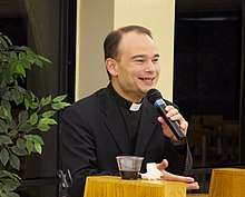
- Father Roderick Vonhögen (born 1968 in Leidschendam) a Roman Catholic priest, podcaster and new media producer
- Carla Dik-Faber (born 1971 in Voorburg) a Dutch art historian and politician
The Arts
- Jacob Elias la Fargue (1735–1778) & Karel la Fargue (1738–1793), brothers and painters
- Marcellus Emants (1848 in Voorburg – 1923) a Dutch naturalist novelist
- Cornelis Rol (1877-1963) a Dutch graphic artist, painter, lithographer and illustrator; lived and worked in Voorburg from 1929
- Willem van Genk (1927 in Voorburg – 2005) a Dutch painter and graphic artist of Outsider Art
- Xander de Buisonjé (born 1973 in Voorburg) a Dutch singer and TV presenter [9]
- Hans van Hemert (born 1945 in Voorburg) a Dutch record producer and songwriter [10]
- Toon Verhoef (born 1946 in Voorburg) a Dutch painter, ceramist and art lecturer
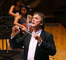
- Johan de Meij (born 1953 in Voorburg) a Dutch conductor, trombonist and composer
- Frans Schrofer (born 1956 in Voorburg) a Dutch furniture designer and industrial designer
- Ariane Schluter (born 1966 in Voorburg) a Dutch film actress [11]
Sport
- Bertha Brouwer (1930 in Leidschendam – 2006) a Dutch sprinter, silver medallist at the 1952 Summer Olympics
- Christiaan van Velzen (born 1932 in Voorburg) a retired Dutch shooter, competed at the 1980 Summer Olympics
- Gerben Karstens (born 1942 in Voorburg) a former professional racing cyclist, won a team gold medal at the 1964 Summer Olympics
- André Stafleu (born 1955 in Leidschendam) a retired Dutch footballer with over 350 club caps
- Peter Blangé (born 1964 in Voorburg) a retired volleyball player, team silver and gold medallist in the 1992 and 1996 Summer Olympics
- Edwin Vurens (born 1968 in Stompwijk) a Dutch football manager and former international player with 268 club caps
- Maurits Crucq (born 1968 in Voorburg) a former field hockey defender, team bronze and gold medallist in the 1988 and 1996 Summer Olympics
- Maarten van der Linden (born 1969 in Voorburg) a former rower, team silver medallist at the 1996 Summer Olympics
- Sander van Gessel (born 1976 in Leidschendam) a Dutch footballer with 280 club caps
- Pascal Matla (born 1981 in Leidschendam) a former American football player, grew up in Voorburg
- Daan van Bunge (born 1982 in Voorburg) a Dutch cricketer
- Cees Juffermans (born 1982) is a former Dutch short track speed skater, competed at the 2002 and 2006 Winter Olympics
- Eljero Elia (born 1987 in Voorburg) a Dutch footballer with over 300 club caps
- Darius van Driel (born 1989 in Leidschendam) a Dutch professional golfer who plays on the Challenge Tour
- Daryl Janmaat (born 1989 in Leidschendam) a professional footballer with over 300 club caps
- Inge Janssen (born 1989 in Voorburg) a Dutch rower, team silver medallist at the 2016 Summer Olympics
Gallery
 Along The Vliet in Leidschendam
 Leidschendam-Voorburg, Meerburger Watering
 Stompwijk, dorpszicht
 Watertoren Voorburg, 1900
References
- "Gemeentelijke indeling op 1 januari 2002" [Municipal divisions on 1 January 2002]. cbs.nl (in Dutch). CBS. Retrieved 9 August 2013.
- "Municipal Council" [Gemeenteraad] (in Dutch). Gemeente Leidschendam-Voorburg. Retrieved 10 August 2013.
- "Kerncijfers wijken en buurten" [Key figures for neighbourhoods]. CBS Statline (in Dutch). CBS. 2 July 2013. Retrieved 12 March 2014.
- "Postcodetool for 2264BM". Actueel Hoogtebestand Nederland (in Dutch). Het Waterschapshuis. Archived from the original on 21 September 2013. Retrieved 10 August 2013.
- "Bevolkingsontwikkeling; regio per maand" [Population growth; regions per month]. CBS Statline (in Dutch). CBS. 1 January 2019. Retrieved 1 January 2019.
- https://fd.nl/ondernemen/1190588/ballast-nedam-bouwt-overdekt-winkelcentrum-leidsenhage
- http://www.stedenband-leidschendam-voorburg.eu/
- 1911 Encyclopædia Britannica, Volume 12, Groen van Prinsterer, Guillaume retrieved 24 December 2019
- IMDb Database retrieved 24 December 2019
- IMDb Database retrieved 24 December 2019
- IMDb Database retrieved 24 December 2019
External links
| Wikimedia Commons has media related to Leidschendam-Voorburg. |
Places adjacent to Leidschendam-Voorburg | ||||||||||
|---|---|---|---|---|---|---|---|---|---|---|
| ||||||||||

| Authority control |
|
|---|