Klang District
The Klang District is a district in Selangor, Malaysia. It is located in the western part of Selangor. It borders the Kuala Selangor District to the north, Petaling to the east, Kuala Langat district to the south and Malacca Straits to the west. The district was further divided into two mukims which is Klang and Kapar that covers 626.78 square km of land with 53.75 km of coastline.[3]
Klang District | |
|---|---|
| Daerah Klang | |
| Other transcription(s) | |
| • Jawi | کلڠ |
| • Chinese | 巴生县 |
| • Tamil | கிள்ளான் |
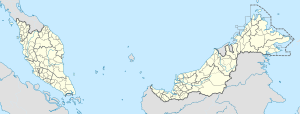
 Location of Klang District in Selangor | |
 Klang District Location of Klang District in Malaysia | |
| Coordinates: 3°05′N 101°25′E | |
| Country | |
| State | |
| Seat | Klang |
| Local area government(s) | Klang Municipal Council (West) Shah Alam City Council (East) |
| Government | |
| • District officer | Zainal Nor[1] |
| • Sultan's Representative | Abdul Ghani Pateh Akhir[2] |
| Area | |
| • Total | 626.78 km2 (242.00 sq mi) |
| Population (2010)[4] | |
| • Total | 861,189 |
| • Density | 1,400/km2 (3,600/sq mi) |
| Time zone | UTC+8 (MST) |
| • Summer (DST) | UTC+8 (Not observed) |
| Postcode | 40xxx-42xxx |
| Calling code | +6-03-3, +6-03-51 |
| Vehicle registration plates | B |
The district's principal town is Klang City. Other towns in the district include Port Klang, Pandamaran, Kapar and Meru and Bandar Sultan Sulaiman.
The Klang River flows through the Klang district and end near Port Klang and it has many islands such as Klang, Indah, Chet Mat Zin, Crab, Tengah, Rusa, Selat Kering and Pintu Gedong Island.[3]
Administrative divisions

Klang District is divided into 2 mukims, which are Kapar and Klang:[5] Kapar is the areas north of Klang River (Kapar itself is also the name of a town), while Klang covers the area south of the river. Klang city itself includes areas both north and south of the river.[6]
History
In addition to its present-day territory, Klang district before 1974 also included the mukims (communes or sub-districts) of Bukit Raja and Damansara, which covered what is today Shah Alam, Subang Jaya, Bandar Sunway and Kelana Jaya. In 1974, after Kuala Lumpur was made a Federal Territory, the subdistricts of Damansara and Bukit Raja joined with Petaling Jaya, Puchong and Sungai Buloh to form the Petaling District.[7] [8]
Demographics
In 1980, the census figures for the 3 main ethnic groups in the Klang District were: Malays 105,195, Chinese 119,186, and Indians 54,159.[9] The following are the 2010 census figures for Klang District, which include the city of Klang, Port Klang and part of Shah Alam.[4]
| Ethnicity | 2010 | |
|---|---|---|
| Population | Percentage | |
| Malays | 376606 | 43.73% |
| Other Bumiputeras | 12620 | 1.47% |
| Chinese | 225425 | 26.18% |
| Indians | 165382 | 19.2% |
| Others | 4179 | 0.49% |
| Malaysian total | 784212 | 91.06% |
| Non-Malaysian | 76977 | 8.94% |
| Total | 861189 | 100.00% |
Federal Parliament and State Assembly Seats

List of Klang district representatives in the Federal Parliament (Dewan Rakyat)
| Parliament | Seat Name | Member of Parliament | Party |
|---|---|---|---|
| P108 | Shah Alam | Khalid Samad | Pakatan Harapan (Amanah) |
| P109 | Kapar | Abdullah Sani bin Abdul Hamid | Pakatan Harapan (PKR) |
| P110 | Klang | Charles Anthony R. Santiago | Pakatan Harapan (DAP) |
| P111 | Kota Raja | Mohd bin Sabu | Pakatan Harapan (Amanah) |
List of Klang district representatives in the State Legislative Assembly of Selangor
- Kota Anggerik (partial)
- Batu Tiga (partial)
- Meru
- Sementa
- Selat Klang
- Bandar Baru Klang
- Pelabuhan Klang
- Pandamaran
- Sentosa
- Sungai Kandis
- Kota Kemuning
| Parliament | State | Seat Name | State Assemblyman | Party |
|---|---|---|---|---|
| P108 | N40 | Kota Anggerik | Mohd Najwan bin Halimi | Pakatan Harapan (PKR) |
| P108 | N41 | Batu Tiga | Rodziah binti Ismail | Pakatan Harapan (PKR) |
| P109 | N42 | Meru | Mohd Fakhrulrazi bin Mohd Mokhtar | Pakatan Harapan (PKR) |
| P109 | N43 | Sementa | Daroyah binti Alwi | Pakatan Harapan (PKR) |
| P109 | N44 | Selat Klang | Abdul Rashid bin Asari | Pakatan Harapan (PKR) |
| P110 | N45 | Bandar Baru Klang | Teng Chang Khim | Pakatan Harapan (DAP) |
| P110 | N46 | Pelabuhan Klang | Azmizam bin Zaman Huri | Pakatan Harapan (PKR) |
| P110 | N47 | Pandamaran | Leong Tuck Chee | Pakatan Harapan (DAP) |
| P111 | N48 | Sentosa | Gunarajah a/l R George | Pakatan Harapan (PKR) |
| P111 | N49 | Sungai Kandis | Zawawi Ahmad Mughni | Pakatan Harapan (PKR) |
| P111 | N50 | Kota Kemuning | Ganabatirau a/l Veraman | Pakatan Harapan (DAP) |
References
- "Portal Rasmi PDT Klang Perutusan Pegawai Daerah Klang". www2.selangor.gov.my.
- "Portal Rasmi PDT Klang Orang Besar Daerah Klang". www2.selangor.gov.my.
- "BACKGROUND". luas.gov.my.
- "Population Distribution and Basic Demographic Characteristics, 2010" (PDF). Department of Statistics, Malaysia. Archived from the original (PDF) on 22 May 2014. Retrieved 19 April 2012.
- "Official Website of the Hulu Selangor District Council". Archived from the original on 5 March 2016. Retrieved 14 October 2013.
- "Persempadanan Mukim". Pejabat Daerah / Tanah Klang.
- "Peta Mukim Negeri Selangor". Retrieved 31 August 2016.
- "Soil Maps of the World - Peninsular Malaysia". Retrieved 31 August 2016.
- Katiman Rostam. "Population Change of the Klang-Langat Extended Metropolitan Region, Maalaysia, 1957-2000" (PDF). Akademika. 79 (1): 1–18.
