Ampang Jaya
Ampang Jaya, more commonly known as just Ampang, is a town, a mukim and a parliamentary constituency straddling parts of the Hulu Langat District and Gombak District, in eastern Selangor, Malaysia. It is located just outside the eastern border of Kuala Lumpur Federal Territory.
Ampang | |
|---|---|
| Other transcription(s) | |
| • Chinese | 安邦 |
| • Tamil | அம்பாங் |
| • Jawi | امڤڠ |
_(exterior)%2C_Ampang%2C_Selangor.jpg) | |
 Flag | |
| Motto(s): Bakti, Bersih, Berbudaya | |
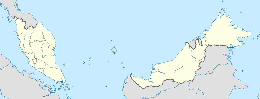 Ampang Location in Malaysia | |
| Coordinates: 3°9′0″N 101°46′12″E | |
| Country | |
| State | Selangor |
| Granted Municipal Status | 1 July 1992 |
| Government | |
| • Administered by | Majlis Perbandaran Ampang Jaya (Ampang Jaya Municipal Council) |
| • Yang diPertua (Councillor) | Mohammad Yacob |
| Area | |
| • Total | 143.5 km2 (55.4 sq mi) |
| Population (2010) | |
| • Total | 126,285[1] |
| • Density | 880/km2 (2,300/sq mi) |
| Time zone | UTC+8 (MST) |
| • Summer (DST) | Not observed |
| Website | http://www.mpaj.gov.my |
It is administered by the Ampang Jaya Municipal Council (MPAJ), which is the formal name of the township as well. The member of parliament for Ampang is Zuraida Kamaruddin, who is the current Minister of Housing and Local Government of Malaysia.
History
According to history, Kuala Lumpur was founded in 1857 at the confluence of the Sungei Lumpur (now Gombak River) and the Klang River, which now houses the Kuala Lumpur Jamek Mosque. Before the arrival of the Chinese for tin mining, Kuala Lumpur was a small hamlet with only several shops and houses.[2] Raja Abdullah, who is also the representative of the Sultan in Klang, and Raja Juma'at of Lukut sent 87 Chinese miners from Lukut in 1857 to open tin mines in Ampang, thus beginning the development of Kuala Lumpur.[3] Ampang was one of the earliest areas in the Klang Valley to be opened for tin mining. The name "Ampang" derives from the old spelling of the Malay word empangan (or ampangan), meaning dam; the place was named in reference to the miners' dams.[2] A road was built to connect Ampang to Kuala Lumpur which became Jalan Ampang of today.
Between colonial rule and February 1974, Ampang district was part of the greater Kuala Lumpur district in Selangor. Following the creation of the Federal Territory of Kuala Lumpur on 1 February 1974, Ampang district was split into two; the western part, located within the Federal Territory, became Ampang Hilir,[4] and the eastern part, remained in Selangor, as part of Hulu Langat (Kajang) District.[5]
During the height of the Malayan Emergency in the 1950s, the British established the Ampang New Village, which became one of the largest Chinese settlements in the Klang Valley. The Kau Ong Yah Lam Thian Kiong Temple (安邦南天宮) in Ampang New Village is famous for the 9 Emperor Gods festival, which is celebrated annually on the 9th month of the Chinese lunar calendar, between late-September and early-October.
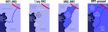
On 1 July 1992, the Gombak District Council (Majlis Daerah Gombak) and the Hulu Langat District Council (Majlis Daerah Hulu Langat) respectively ceded the districts of Ulu Klang and Ampang, forming the Ampang Jaya Municipal Council.
One block of the Highland Towers, located within Ampang Jaya's territory, collapsed on 11 December 1993.
On 16 December 1996, Malaysia's first metro line, the LRT Ampang Line, opened for service.
Geography
%2C_Ampang%2C_Selangor.jpg)
Situated to the east of Kuala Lumpur, Ampang Jaya covers an area of 143.5 km2, covering the parliamentary constituencies of Ampang, Pandan and Gombak, and stretches from Pandan Indah from the south, through Ampang town, Hulu Klang, Melawati, and touching the Klang Gates Dam in the north.
Clockwise, Ampang Jaya borders the remainder of Hulu Langat District in the east and south, the Federal Territory of Kuala Lumpur in the west, Gombak District in the north, and a short border with Bentong (Pahang) in the northeast.
Neighbourhoods
The oldest neighbourhoods are
- Kampung Tasik
- Tasek Permai
- Ampang New Village
- Ampang Town
- Ampang Malay Village
- Ampang Newtown
- Taman Dagang
- Dato' Ahmad Razali Flats
- Taman Nirwana
Other major neighbourhoods in Ampang are
- Ampang Indah
- Ampang Mewah
- Ampang Permai
- Ampang Jaya
- Lembah Jaya
- Taman Dagang
- Taman Ampang Indah
- Kampung Ampang Indah
- Taman Dagang Jaya
- Taman Cahaya
- Taman Cempaka
- Taman Bakti
- Taman Nirwana
- Taman Kosas
- Taman Sri Watan
- Taman Rasmi Jaya
- Taman Bukit Indah
- Taman Kesuma
- Taman Hillview
- Taman Sri Raya
- Taman Tasik Tambahan
- Taman Putra
- Ulu Kelang
- Pandan Jaya
- Pandan Indah
- Taman Tun Abdul Razak (Taman TAR)
Taman TAR is one of the most expensive residential areas in the country.
Attractions and shopping
Pekan Ampang, the colonial quarter of the town, is located just east of the Ampang LRT station, along the intersection of Jalan Besar Ampang and Jalan Ampang. The building's architecture in town is similar to most towns and cities in the developing world during the British colonial period.
Ampang has a few small shopping complexes such as Ampang Point (near One Ampang Avenue and beside the Kuala Lumpur Middle Ring Road 2 (MRR2), MidPoint (Pandan Indah), Paragon (Taman Muda Ampang), Pandan Kapital (beside Menara MPAJ in Pandan Indah), Spectrum Mall Ampang (Bandar Baru Ampang), Galaxy Ampang (near Taman Nirwana Ampang) and Ampang Tesco (beside the MRR2 near the Pandan Jaya exit) and also a newly opened Aeon Big (previously known as Carrefour) Ampang at the end of Jalan Ampang, near Taman Dagang.
Demographics
Ampang is known for its diverse ethnic makeup. Data from MPAJ shows that 56.5% of Ampang Jaya's residents are Malays, while the Chinese make up about 30%. Indians make up 7%, while the remainder is made up of other ethnicities, nationalities and expatriates.[6]
Malays mostly concentrate in the wards of Ulu Klang, Taman Melawati and Bukit Antarabangsa, while the Chinese are more concentrated around Pandan Indah, Taman Putra, Bandar Baru Ampang, and the Ampang New Village.
Ampang Jaya is notable for being home to Malaysia's largest Korean settlement, centred at the One Ampang Avenue ward, just across Jalan Ampang from the Ampang Point shopping mall. Ampang Jaya is also home to a sizeable Arab community, as well as Indonesians. During the 1980s and 1990s there were also Japanese expatriates.
Food
Thanks to its ethnic makeup, one can find a large variety of cuisine in the city, especially Malay and Indonesian cuisine. Ampang is known for its Lemang, a Malay sticky rice with coconut milk in bamboo. Lemang stalls can be found at any major roadsides in Ampang, more often during the Fasting month and Eid-ul-Fitr. Other local foods include Burger Bakar (Toast Burger), Satay (a specialty of Kajang), Laksa and variety of Malay kueh. Popular food districts in Ampang include Taman Muhibbah, Taman Dagang, Desa Pandan, Lembah Keramat, Bukit Antarabangsa and Pandan Indah. Pandan Indah is notable for its concentration of Chinese and Hong Kong-styled cafés.
Ampang is also known for its Yong Tau Foo, a Chinese stuffed vegetable soup dish with Hakka origins. Three restaurants in Ampang New Village serve the dish. Ampang also has many Korean restaurants, mostly near the One Ampang Avenue apartments near the Ampang Point shopping complex.
Education
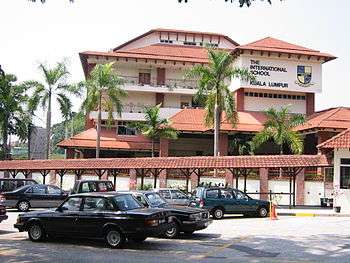
The International School of Kuala Lumpur (ISKL) secondary campus is in Ampang. The ADNI Islamic school is also based in the town.
Primary school
- SK Tasek Permai
- SK Taman Tasik
- SK Taman Nirwana
- SK Taman Kosas
- SK Taman Bukit Indah
- SK Lembah Jaya
- SK Hulu Kelang
- SK Ampang Campuran
- SK Ampang
- SK Taman Keramat
- SK Taman Melawati
- SK Taman Melawati (2)
- SK (2) Kuala Ampang
- SK (1) Kuala Ampang
- SJK (T) Ampang
- SJK (T) Taman Melawati
- SJK (C) On Pong 2
- SJK (C) On Pong
- SJK (C) Kampung Baru Ampang
Secondary school
- SMK Tasek Permai
- SMK Taman Tasik
- SMK Taman Seraya
- SMK Taman Kosas
- SMK Pandan Indah
- SMK Hulu Kelang
- SMK Dato' Ahmad Razali
- SMK Bukit Indah
- SMK Bandar Baru Ampang
- SMK Taman Keramat
- SMK Lembah Keramat
- SMK Seri Keramat
- SMK Taman Melawati
Hospitals
Ampang has three hospitals:
- KPJ Ampang Hospital (behind Ampang Point shopping complex);
- Pantai Hospital Pandan Indah (in Pandan Indah); and
- the public Hospital Ampang (in Pandan Indah).
Parks
For nature lovers, the National Zoo of Malaysia (Zoo Negara) is nearby and is one of the best attractions in Ampang, Selangor. Located in Hulu Klang, the National Zoo is only 10 minutes away from Ampang through Jalan Hulu Klang from Ampang Point shopping mall.
Virtually unknown to outsiders, Taman Rimba Ampang (Ampang Recreational Forest) is a small recreational park with a small and shallow river. The Kuala Lumpur Look Out Point Tourist Complex was another hot spot located at Jalan Ampang–Hulu Langat but is closed for safety reasons.
Politics
Ampang is represented in the Dewan Rakyat of the Malaysian Parliament by Zuraida Kamaruddin of BERSATU. She has held the seat since 2008.
On the state level, Ampang contributes two seats to the Selangor State Legislative Assembly, namely:
- Lembah Jaya, represented by Haniza Mohamed Talha of PKR; and
- Bukit Antarabangsa, represented by Azmin Ali of BERSATU, who is also the incumbent Minister of International Trade and Industry.
The Ampang Jaya municipality however also covers the Pandan parliamentary constituency and the Hulu Klang state constituency within the Gombak parliamentary constituency.
Transportation
Car
Effectively a suburb of Kuala Lumpur, Ampang is well connected to other places by a series of federal highways, tolled highways and state routes. Jalan Ampang ![]()
![]()
![]()
![]()
Besides that, there is a state-level hill road to Hulu Langat ![]()
Public transportation
AG18 Ampang is the namesake and terminus of the Ampang Line, which is Malaysia's first LRT/metro system. The station, renovated in 2012, is located along Jalan Ampang. The stretch between Ampang and Plaza Rakyat used to be part of KTM Intercity until the 1990s. KTM presently does not serve Ampang or its surroundings.
Other than the aforementioned Ampang station, the Ampang Jaya municipal district is also served by the AG17 Cahaya, AG16 Cempaka, AG15 Pandan Indah and AG14 Pandan Jaya stations, all on the Ampang Line.
The Cempaka-Pandan Jaya stretch is however not in Ampang proper, but located in the adjacent constituency of Pandan instead.
According to unofficial proposals, a MRT Circle Line, surrounding downtown Kuala Lumpur would be built. Ampang station was reportedly one of the possible stops, along Abdullah Hukum, Bandar Malaysia, Segambut, Sentul Timur, Jelatek and Taman Midah.
Besides the LRT, bus and taxi options are available. For example, rapidKL bus route 300 leads from the Ampang LRT station to KLCC.
See also
- Ampang, Kuala Lumpur, Kuala Lumpur's portion of greater Ampang
References
- "Archived copy" (PDF). Archived from the original (PDF) on 27 February 2012. Retrieved 5 December 2012.CS1 maint: archived copy as title (link) table 13.1
- J.M. Gullick (1983). The story of Kuala Lumpur, 1857–1939. Eastern Universities Press (M). pp. 1–2. ISBN 978-967-908-028-5.
- J.M. Gullick (1955). "Kuala Lumpur 1880–1895" (PDF). Journal of the Malayan Branch of the Royal Asiatic Society. 24 (4): 10–11. Archived from the original (PDF) on 28 May 2015.
- "JPS WPKL - Profil Daerah" (PDF). Retrieved 22 January 2020.
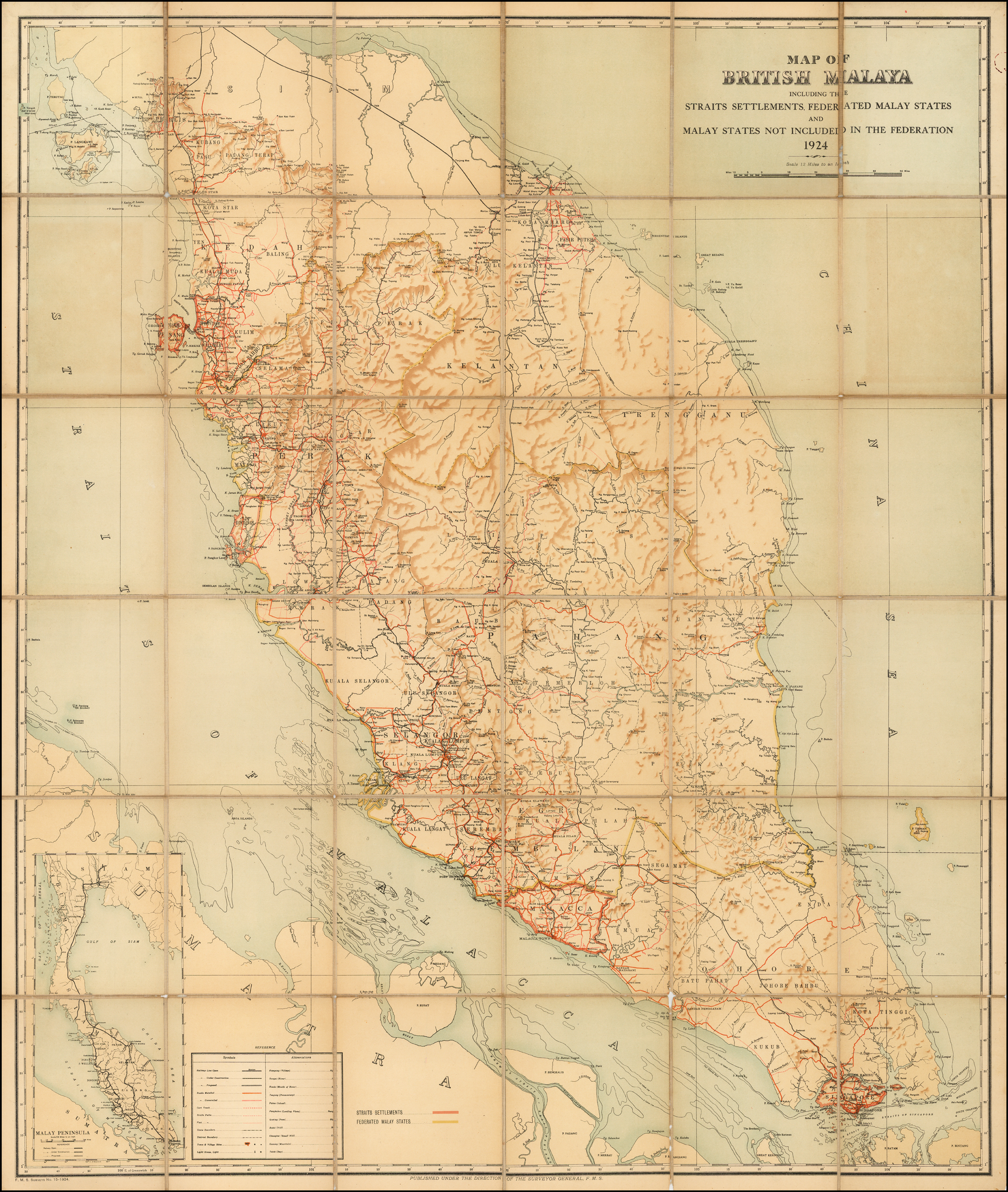
- "Map of British Malaya, including the Straits Settlements, Federated Malay States and Malay States not included in the Federation, 1924". Raremaps.com. Retrieved 22 January 2020.
- "Statistik". Majlis Perbandaran Ampang Jaya. Retrieved 22 January 2020.
| Wikimedia Commons has media related to Ampang, Selangor. |
Places adjacent to Ampang Jaya | ||||||||||
|---|---|---|---|---|---|---|---|---|---|---|
| ||||||||||
