Khurai
Khurai is a city in Sagar District and a municipality in the Indian state of Madhya Pradesh. It is located in the northeastern region of Madhya Pradesh.
Khurai | |
|---|---|
town | |
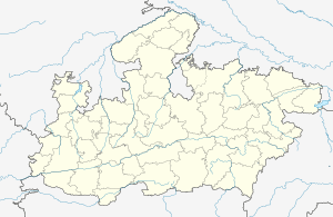 Khurai Location in Madhya Pradesh, India  Khurai Khurai (India) | |
| Coordinates: 24.05°N 78.32°E | |
| Country | |
| State | Madhya Pradesh |
| District | Sagar District |
| Founded | 1893 |
| ratan s | Khurai |
| Government | |
| • Mayor | Dr. Subrota Das |
| • Member of Legislative Assembly | Mr. Bhupendra Singh Thakur |
| • Commissioner | P.S Khan |
| Area | |
| • Total | 126.77 km2 (48.95 sq mi) |
| Elevation | 421 m (1,381 ft) |
| Population (2011) | |
| • Total | 51,000 |
| • Rank | 993 |
| • Density | 24/km2 (60/sq mi) |
| Languages | |
| • Official | Hindi, Bundelkhandi, Urdu, English |
| Time zone | UTC+5:30 (IST) |
| PIN | 470117 |
| Telephone code | 91-7581 |
| ISO 3166 code | IN-MP |
| Vehicle registration | MP 15 |
| Coastline | 0 kilometres (0 mi) |
| Nearest city | Bina Junction, India |
| Distance from Delhi | 949 kilometres (590 mi) S |
| Distance from Mumbai | 1,089 kilometres (677 mi) NE |
| Distance from Kolkata | 1,921 kilometres (1,194 mi) W |
| Distance from Chennai | 2,418 kilometres (1,502 mi) N |
| Climate | AW (Köppen) |
| Precipitation | 231 millimetres (9.1 in) |
| Avg. annual temperature | 24.03 °C (75.25 °F) |
| Avg. summer temperature | 42.33 °C (108.19 °F) |
| Avg. winter temperature | 01.77 °C (35.19 °F) |
Geography
Khurai is the small town of Sagar District, situated near its border with Vidisha District. It is about 26 km (16 mi) east of Bhelsa and 53 km (33 mi) west of Sagar. Khurai is located on a plain, hence its land is good for wheat and rice cultivation. About 63% of the total land area comes under cultivation. Besides wheat and rice, vegetables like brinjal, peas, tomatoes, spinach, and potatoes are also grown in small quantities.
Climate
Khurai has a mainly moderate climate. From October to February the temperature is between 12 °C (54 °F) to 27 °C (81 °F); from March to June temperatures range from 35 °C (95 °F) to 48 °C (118 °F). The average rainfall is about 200 cm (79 in). Winters are moderately cool and summers are hot. Monsoon season lasts from June through August.
| Khurai | ||||||||||||||||||||||||||||||||||||||||||||||||||||||||||||
|---|---|---|---|---|---|---|---|---|---|---|---|---|---|---|---|---|---|---|---|---|---|---|---|---|---|---|---|---|---|---|---|---|---|---|---|---|---|---|---|---|---|---|---|---|---|---|---|---|---|---|---|---|---|---|---|---|---|---|---|---|
| Climate chart (explanation) | ||||||||||||||||||||||||||||||||||||||||||||||||||||||||||||
| ||||||||||||||||||||||||||||||||||||||||||||||||||||||||||||
| ||||||||||||||||||||||||||||||||||||||||||||||||||||||||||||
Demographics
As of the 2011 census of India,[1] Khurai has a population of 2,51,511. Males constitute 53% of the population and females 47%. Khurai has an average literacy rate of 80.8%, higher than the national average of 59.5%.
Political bodies
Khurai City is divided into twenty seven sub areas or wards. Examples of which include Bihari Ward, Rani Durgawati Ward,Tagor ward and Nanak Ward. Besides these wards, Rethore, Nirtala, Ghourat, Khimlasa, Jarwaans and Jagdishpura are the sub-towns of Khurai. These wards come under the Nagar palika parishad.
Economy
The main business in the Khurai region is agriculture. The main crops grown there are wheat (sharbati), soybean and gram. The city is a hub for the manufacturing of agricultural equipment such as threshers, cultivators, ploughs, seed drills and trollies.
A hospital, round-the-clock mobile medical vehicle, a national level auditorium, badminton court and gym have been set up in the area by the state government.[2]
Tourism
Dohela, an ancient fort is located in Khurai.
Archaeological, Historical and Tourist Sites
Eran Archaeological site is 19 km (12 mi) from Khurai.[3]
Maha
Kali temple
- Inscription of Eran
1. Inscription of Samudragupta (about 350 AD)[4]
2. Inscription of Budhgupta (about 465 AD)
3. Inscription of Torman (about 485 AD)
4. Inscription of Bhanugupta (about 510 AD)
5. Inscription of Shridharvarman (about 280 AD)
- Temple of Eran
1. Vishnu Temple (about 350 AD)
2. Varah Temple (about 485 AD)
3. Narsingh Temple (about 450 AD)
4. Old Temple of Lord Hanuman
5. Garuda Pillar about 48 fit (465 AD)[5]
Transport
Railways
Khurai Railway Station is the main railway station and is well connected by rail to Delhi, Mumbai, Howrah, Puri, Ahmedabad, Indore, Bhopal, Jabalpur, Meerut, and other major cites. Another station is located at Khurai Sumreri which handles only passenger and local trains. The nearest railway junction is Bina Junction 22 km (14 mi) away which connects Khurai to other major cities of India.
Some of the daily trains which stop at Khurai City include:
- Amritsar Vishakhapatnam Hirakund Express.
- Haridwar Puri Kalingutkal Express
- Hazrat Nizamuddin Jabalpur Gondwana Express (Super)
- Varanasi Lokmanya Tilak Terminus / Kurla Mumbai Kamayani Express
- Howrah Indore Kshipra Express
- Rajkot Jabalpur Veraval Express
- Jaipur Jabalpur Dayodaya Express
- Bhopal – Bilaspur Express.
- Kota Damoh Passenger
- Damoh Bina Passenger
- Bhopal Rewa Rewanchal Express (Super)
- Katni Bina Mix passenger
- Bhopal Itarsi Vindhyachal Express
Services
Education
Khurai has Eight English medium schools
* Holy Family Convent Sr. Sec. School
* JNV Khurai (Navodaya)
* Blue Bells Hr. Sec School
* Gyanodaya Sen.Sec CBSE School
* Kendriya Vidyalaya Dhangar
* StudyCubes-A learning platform
Khurai has many Hindi medium schools, some of which are listed here:
- Pt. KC Sharma Higher Secondary School
- S. P. Jain Gurukul Higher Secondary School
- Saraswati Vidya Mandir
- Saraswati Gyan Mandir
- SARASWATI GYANDEEP VIDHYA MANDIR KHURAI ( PRATAAP WARD KHURAI)
Leading Coaching Institute( English Medium)
- StudyCubes- A Learning Platform: Studycubes is a leading institute in the city for ( CBSE, ICSE Board ) having highly qualified faculty with its extraordinary performance.
See also
References
- "Census of India 2001: Data from the 2001 Census, including cities, villages and towns (Provisional)". Census Commission of India. Archived from the original on 16 June 2004. Retrieved 1 November 2008.
- "Model of development in backward MP area". thestatesman.com. Retrieved 17 October 2018.
- Dr. Mohan Lal Chadhar, 'Coins of Eran' Mekal Insights, Journal of Indira Gandhi National Tribal University, Amarkantak, Vol. II No.01,January 2010. P,94
- Dr.Mohan Lal Chadhar, 'Yug-Yugin Eran', Koshal, Journal of Culture & Archaeology, Chhattisgarh Government,Raipur, 2013. pp, 104
- Dr.Mohan Lal Chadhar,Eran ki Tamrapashan sasnkriti, Sagar, M.P.2009,pp11 ISBN 81-89740-07-5